Country:
Region:
City:
Latitude and Longitude:
Time Zone:
Postal Code:
IP information under different IP Channel
ip-api
Country
Region
City
ASN
Time Zone
ISP
Blacklist
Proxy
Latitude
Longitude
Postal
Route
Luminati
Country
Region
pv
City
vitoriagasteiz
ASN
Time Zone
Europe/Madrid
ISP
Euskaltel S.A.
Latitude
Longitude
Postal
IPinfo
Country
Region
City
ASN
Time Zone
ISP
Blacklist
Proxy
Latitude
Longitude
Postal
Route
db-ip
Country
Region
City
ASN
Time Zone
ISP
Blacklist
Proxy
Latitude
Longitude
Postal
Route
ipdata
Country
Region
City
ASN
Time Zone
ISP
Blacklist
Proxy
Latitude
Longitude
Postal
Route
Popular places and events near this IP address

Puerta del Sol
Square in Madrid, Spain
Distance: Approx. 102 meters
Latitude and longitude: 40.41694444,-3.70361111
The Puerta del Sol (Spanish: [ˈpweɾta ðel ˈsol], English: "Gate of the Sun") is a public square in Madrid, one of the best known and busiest places in the city. This is the centre (Km 0) of the radial network of Spanish roads. The square also contains the famous clock whose bells mark the traditional eating of the Twelve Grapes and the beginning of a new year.

Cafetería Rolando bombing
1974 bombing in Madrid
Distance: Approx. 143 meters
Latitude and longitude: 40.41611111,-3.70416667
The Cafetería Rolando bombing was an attack on 13 September 1974 at the Rolando cafe in Calle del Correo, Madrid, Spain which killed 13 people and wounded 71.

Real Casa de la Aduana
Historic site in Madrid, Spain
Distance: Approx. 107 meters
Latitude and longitude: 40.417281,-3.701827
The Real Casa de la Aduana (Spanish: Real Casa de la Aduana means royal customs house) is the headquarters of Spain's Ministry of Economy and Ministry of the Treasury. It is located on Madrid's longest street, the Calle de Alcalá. The eighteenth-century building has been modified over the years.

Former Banco Central Hispano headquarters
Cultural property in Madrid, Spain
Distance: Approx. 163 meters
Latitude and longitude: 40.416774,-3.700673
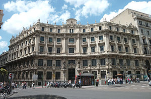
The former headquarters of Banco Central Hispano is located in Madrid, Spain. It was declared Bien de Interés Cultural in 1999.

Lhardy
Distance: Approx. 101 meters
Latitude and longitude: 40.41666667,-3.70138889
Lhardy is a restaurant located at Madrid in Spain, which was opened in 1839 by Emilio Huguenin Lhardy. It was said to have introduced French haute cuisine to Madrid. It has a deli and takeaway service on the ground floor and a formal restaurant on the second floor.

Madrid
Capital and largest city of Spain
Distance: Approx. 82 meters
Latitude and longitude: 40.41694444,-3.70333333
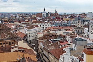
Madrid ( mə-DRID; Spanish: [maˈðɾið] ) is the capital and most populous municipality of Spain. It has almost 3.4 million inhabitants and a metropolitan area population of approximately 7 million. It is the second-largest city in the European Union (EU), and its monocentric metropolitan area is the second-largest in the EU. The municipality covers 604.3 km2 (233.3 sq mi) geographical area.

Sol (Madrid Metro)
Madrid Metro station
Distance: Approx. 96 meters
Latitude and longitude: 40.4167635,-3.7036371
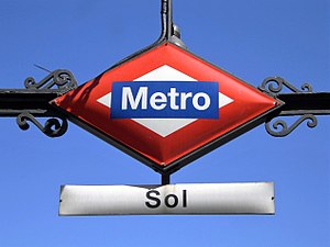
Sol [ˈsol] is a station on Line 1, Line 2 and Line 3 of the Madrid Metro. It is located in Zone A and is the most central station on the Metro, located at the Puerta del Sol square. Because of its location, it is one of the busiest stations of the Madrid Metro.

National Defence Council (Spain)
Short-lived governing council of Republican Spain in the last year of the Civil War (1939)
Distance: Approx. 107 meters
Latitude and longitude: 40.417281,-3.701827
The National Defence Council (Spanish: Consejo Nacional de Defensa) was the governing body in Republican Spain at the end of the Spanish Civil War (1936–1939). The council seized power with Colonel Segismundo Casado's coup on 5 March 1939 when it was clear that the Republicans had lost the war. The leaders hoped to negotiate an end to hostilities with the rebel forces led by General Francisco Franco.

Statue of the Bear and the Strawberry Tree
Public sculpture in Madrid
Distance: Approx. 57 meters
Latitude and longitude: 40.417,-3.7024
The Statue of the Bear and the Strawberry Tree (in Spanish “El Oso y el Madroño”) is a sculpture from the second half of the 20th century, situated in the Spanish city of Madrid. It represents the coat of arms of Madrid and is found on the east side of the Puerta del Sol, between Calle de Alcalá and Carrera de San Jerónimo, in the historical centre of the capital.

Iglesia del Buen Suceso
Distance: Approx. 40 meters
Latitude and longitude: 40.41685833,-3.70263333
The Iglesia de Nuestra Señora del Buen Suceso, commonly known as Iglesia del Buen Suceso was a church of Madrid that delimited the eastern part of the Puerta del Sol (Madrid). The church comes from a remodeling of the Hospital Real de la Corte (Royal Hospital of the Court) (built in 1483). Was doing functions of church and hospital since 1590.

Sol (Madrid)
Neighborhood in Madrid, Madrid, Spain
Distance: Approx. 114 meters
Latitude and longitude: 40.41666667,-3.70388889
Sol is an administrative neighborhood (barrio) of Madrid belonging to the district of Centro. It has a total area of around 44.5 hectares (less than 0.1% out of the total municipal area). Hugely affected by the impact of tourism, by 2018 it had over 2 tourists per 1 permanent dweller.

Royal House of the Post Office
Building in Madrid, Spain
Distance: Approx. 106 meters
Latitude and longitude: 40.4164,-3.7038
The Royal House of the Post Office (Spanish: Real Casa de Correos) is an eighteenth century building in Puerta del Sol, Madrid. It was built for the postal service, but currently serves as the office of the President of the Community of Madrid, the head of the regional government of the Autonomous Community of Madrid. This should not be confused with the City Council of Madrid, which is housed in another former post office, the Cybele Palace.
Weather in this IP's area
overcast clouds
16 Celsius
15 Celsius
15 Celsius
17 Celsius
1019 hPa
70 %
1019 hPa
942 hPa
10000 meters
4.63 m/s
90 degree
100 %
08:01:23
17:57:47