Country:
Region:
City:
Latitude and Longitude:
Time Zone:
Postal Code:
IP information under different IP Channel
ip-api
Country
Region
City
ASN
Time Zone
ISP
Blacklist
Proxy
Latitude
Longitude
Postal
Route
Luminati
Country
Region
pv
City
vitoriagasteiz
ASN
Time Zone
Europe/Madrid
ISP
Euskaltel S.A.
Latitude
Longitude
Postal
IPinfo
Country
Region
City
ASN
Time Zone
ISP
Blacklist
Proxy
Latitude
Longitude
Postal
Route
db-ip
Country
Region
City
ASN
Time Zone
ISP
Blacklist
Proxy
Latitude
Longitude
Postal
Route
ipdata
Country
Region
City
ASN
Time Zone
ISP
Blacklist
Proxy
Latitude
Longitude
Postal
Route
Popular places and events near this IP address
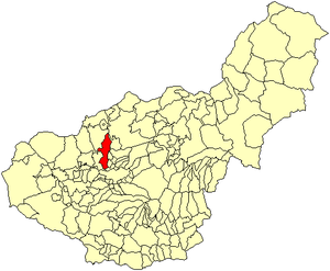
Albolote
City in Granada, Spain
Distance: Approx. 3215 meters
Latitude and longitude: 37.23055556,-3.65694444
Albolote is a city located in the province of Granada, Spain. It is one of the thirty-four entities which together form Granada's Metropolitan Area. It is formed by several populations: El Aire, El Chaparral, and Parque del Cubillas y Pretel.
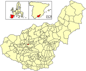
Maracena
City in Granada, Spain
Distance: Approx. 858 meters
Latitude and longitude: 37.2,-3.63333333
Maracena is a municipality located in the province of Granada, Spain. According to the 2005 census (INE), the city has a population of 18819 inhabitants. It is located in the central part of the Vega de Granada, being one of the fifty-two entities that make up the metropolitan area of Granada.It borders the municipalities of Peligros, Pulianas, Granada, Atarfe and Albolote.
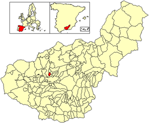
Peligros
City in Granada, Spain
Distance: Approx. 2868 meters
Latitude and longitude: 37.23333333,-3.63333333
Peligros is a municipality located in the province of Granada, Spain. According to the 2013 census (INE), the city has a population of 11,126 inhabitants. It is located next to Pulianas, Maracena, Albolote, Calicasas and Güevejar.

Pulianas
City in Granada, Spain
Distance: Approx. 3257 meters
Latitude and longitude: 37.21666667,-3.6
Pulianas is a municipality located in the province of Granada, Spain. According to the 2005 census (INE), the city has a population of 4842 inhabitants.
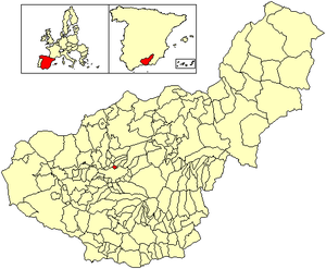
Jun, Granada
Place in Andalusia, Spain
Distance: Approx. 3257 meters
Latitude and longitude: 37.21666667,-3.6
Jun is a Spanish locality and township situated in the north-centre part of la Vega de Granada, in the province of Granada, autonomous community of Andalucía. It limits with the municipalities of Pulianas, Granada, Alfacar and Víznar. The municipality of Iundenia is one of the fifty two entities which make up the Metropolitan Area of Granada, and it is formed by Jun, Baltodano, and two streets of Pulianas: c/ Alhambra and c/ Generalife.

Vega de Granada
Comarca in Andalusia, Spain
Distance: Approx. 3094 meters
Latitude and longitude: 37.1875,-3.61083333
The Vega de Granada is a comarca (county, but with no administrative role) in the province of Granada, southeastern Spain. The name refers to the plain near the city of Granada. According to the 2007 census (INE), the comarca had a population of 500,121 inhabitants, which is over half the overall population of the province.
Andalusian School of Public Health
Public institution
Distance: Approx. 4113 meters
Latitude and longitude: 37.19017,-3.59403
The Andalusian School of Public Health (Spanish language acronym: EASP) is a public institution which provides training, consultancy and research services for the healthcare sector. It is located in Granada (Spain), on the University campus. It is a state-owned enterprise, promoted by the Andalusian government.
Club Recreativo Granada
Spanish football club
Distance: Approx. 3260 meters
Latitude and longitude: 37.208856,-3.598192
Club Recreativo Granada is a Spanish football team based in Granada, in the autonomous community of Andalusia. Founded in 1947, it is the reserve team of Granada CF and currently plays in Segunda Federación – Group 4, holding home games at Estadio Miguel Prieto, with a capacity for 2,500 spectators. Unlike the English League, reserve teams in Spain play in the same football pyramid as their senior team, rather than a separate league.

Granada (wine)
Spanish Denominación de Origen Protegida for wines in the province of Granada, Andalusia, Spain
Distance: Approx. 4073 meters
Latitude and longitude: 37.18333333,-3.60055556
Granada is a Spanish Denominación de Origen Protegida (DOP) for wines in the province of Granada, Andalusia, Spain, extending over 168 different municipalities. There is also sub-zone known as "Contraviesa-Alpujarras", covering another 13 municipalities in the Alpujarras mountains. Granada achieved Vino de Calidad status in 2009, and Denominación de Origen status in 2018.
Ciudad Deportiva del Granada CF
Distance: Approx. 3097 meters
Latitude and longitude: 37.20805556,-3.6
The Ciudad Deportiva del Granada CF, is the training ground of the Spanish football club Granada CF, located in Granada, Spain. It occupies an area of 75,535 m2. The 1st phase of the training centre occupying an area of 47,833m², was completed earlier in 2015.
Monteluz
Locality in Granada, Spain
Distance: Approx. 2868 meters
Latitude and longitude: 37.23333333,-3.63333333
Monteluz is a locality belonging to the municipality of Peligros in the province of Granada, community of Andalusia, Spain. It is placed in the central part of the region of the Vega of Granada. Near this locality are Albolote's Cores, Cortijo del Aire and El Chaparral.
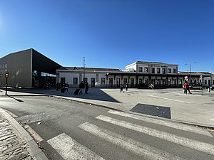
Granada railway station
Main railway station of Granada
Distance: Approx. 3540 meters
Latitude and longitude: 37.1837,-3.6086
Granada railway station is the main railway station of the Spanish city of Granada, Andalusia. The building dates back to the 1874, but the facilities have been modernised over the years, most notably to accommodate AVE high-speed trains.
Weather in this IP's area
clear sky
21 Celsius
20 Celsius
19 Celsius
22 Celsius
1015 hPa
55 %
1015 hPa
940 hPa
10000 meters
2.57 m/s
40 degree
07:53:58
18:04:39