Country:
Region:
City:
Latitude and Longitude:
Time Zone:
Postal Code:
IP information under different IP Channel
ip-api
Country
Region
City
ASN
Time Zone
ISP
Blacklist
Proxy
Latitude
Longitude
Postal
Route
Luminati
Country
Region
pv
City
vitoriagasteiz
ASN
Time Zone
Europe/Madrid
ISP
Euskaltel S.A.
Latitude
Longitude
Postal
IPinfo
Country
Region
City
ASN
Time Zone
ISP
Blacklist
Proxy
Latitude
Longitude
Postal
Route
db-ip
Country
Region
City
ASN
Time Zone
ISP
Blacklist
Proxy
Latitude
Longitude
Postal
Route
ipdata
Country
Region
City
ASN
Time Zone
ISP
Blacklist
Proxy
Latitude
Longitude
Postal
Route
Popular places and events near this IP address

Móstoles
Municipality in Community of Madrid, Spain
Distance: Approx. 1237 meters
Latitude and longitude: 40.33333333,-3.86666667
Móstoles (Spanish: [ˈmostoles] ) is a municipality of Spain located in the Community of Madrid. With over 200,000 inhabitants, it is the region's second most populated municipality after Madrid. Móstoles was a small town for a long time, but expanded rapidly in the second half of the 20th century.

Estadio Municipal de Santo Domingo
Distance: Approx. 2775 meters
Latitude and longitude: 40.33888889,-3.84055556
The Estadio Municipal de Santo Domingo is a football stadium located in Alcorcón, Community of Madrid, Spain. It is currently the home ground of AD Alcorcón. Owned and operated by the municipality, its first match dates from 19 May 1999, with the celebration of a friendly fixture with Real Madrid.
Estadio El Soto
Distance: Approx. 2521 meters
Latitude and longitude: 40.32581,-3.8943
Estadio El Soto is a stadium in Móstoles, Madrid, Spain. It is currently used for football matches and is the home stadium of CD Móstoles URJC. The stadium holds 14,000 spectators.
Hermitage of Nuestra Señora de los Santos
Hermitage in Móstoles, Spain
Distance: Approx. 187 meters
Latitude and longitude: 40.322453,-3.862768
The Hermitage of Nuestra Señora de los Santos (Spanish: Ermita de Nuestra Señora de los Santos) is a hermitage located in Móstoles, Spain. The building is baroque in style. The exterior shows some mudéjar influence.

Manuela Malasaña (Madrid Metro)
Madrid Metro station
Distance: Approx. 1479 meters
Latitude and longitude: 40.3090301,-3.8640212
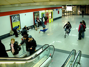
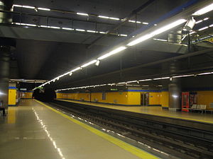
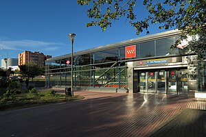
Manuela Malasaña [maˈnwe.la ma.laˈsa.ɲa] is a station on Line 12 of the Madrid Metro, named for the nearby school IES Manuela Malasaña, which is named for the Spanish heroine Manuela Malasaña (1791–1808). It is located in fare Zone B2.
Hospital de Móstoles (Madrid Metro)
Madrid Metro station
Distance: Approx. 1048 meters
Latitude and longitude: 40.3165265,-3.874709
Hospital de Móstoles ([ospiˈtal de ˈmostoles], "Móstoles Hospital") is a station on Line 12 of the Madrid Metro. It is located in fare Zone B2.

Pradillo (Madrid Metro)
Madrid Metro station
Distance: Approx. 69 meters
Latitude and longitude: 40.3216815,-3.8648885
Pradillo [pɾaˈðiʝo] is a station on Line 12 of the Madrid Metro, located near the Plaza del Pradillo ("Meadow Square") in Móstoles. It is located in fare Zone B2.

Móstoles Central (Madrid Metro)
Madrid Metro station
Distance: Approx. 727 meters
Latitude and longitude: 40.3287197,-3.8633785
Móstoles Central ([ˈmostoles θenˈtɾal], "Central Móstoles") is a station on Line 12 of the Madrid Metro. It is located in fare Zone B2. The station offers connection to Cercanías Madrid via Móstoles railway station.
Universidad Rey Juan Carlos (Madrid Metro)
Madrid Metro station
Distance: Approx. 1553 meters
Latitude and longitude: 40.3351225,-3.8721822
Universidad Rey Juan Carlos [uniβeɾsiˈðað ˈrej ˈxwaŋ ˈkaɾlos] is a station on Line 12 of the Madrid Metro, serving the Móstoles campus of King Juan Carlos University. It is located in fare Zone B2.
Parque Oeste (Madrid Metro)
Madrid Metro station
Distance: Approx. 2942 meters
Latitude and longitude: 40.3458961,-3.849337
Parque Oeste ([ˈpaɾke oˈeste], "West Park") is a station on Line 12 of the Madrid Metro, located west of the King Juan Carlos University's Alcorcón Campus. It is located in fare Zone B1.

Móstoles-El Soto railway station
Railway station in Móstoles, Spain
Distance: Approx. 1755 meters
Latitude and longitude: 40.331,-3.8822
Móstoles-El Soto, is one of two railway stations serving the town of Móstoles in the Community of Madrid, Spain. It is situated on the Madrid-Móstoles-El Soto railway and is owned by Adif. The station currently serves as the western terminus of one of Madrid's commuter lines (Cercanías Madrid line C-5).

Hospital Universitario Rey Juan Carlos
Hospital in Community of Madrid, Spain
Distance: Approx. 1915 meters
Latitude and longitude: 40.33881,-3.87131
The Hospital Universitario Rey Juan Carlos is a general hospital in Móstoles, Spain, part of the Servicio Madrileño de Salud (SERMAS) network. Inaugurated on 21 March 2012, it is the second hospital in the municipality of Móstoles, after the Hospital Universitario de Móstoles. The management was allocated to Capio, a private company; this was a cause of protests at the time of the opening.
Weather in this IP's area
overcast clouds
14 Celsius
14 Celsius
14 Celsius
15 Celsius
1021 hPa
78 %
1021 hPa
944 hPa
10000 meters
4.63 m/s
80 degree
100 %
08:01:49
17:58:39


