Country:
Region:
City:
Latitude and Longitude:
Time Zone:
Postal Code:
IP information under different IP Channel
ip-api
Country
Region
City
ASN
Time Zone
ISP
Blacklist
Proxy
Latitude
Longitude
Postal
Route
Luminati
Country
Region
pv
City
vitoriagasteiz
ASN
Time Zone
Europe/Madrid
ISP
Euskaltel S.A.
Latitude
Longitude
Postal
IPinfo
Country
Region
City
ASN
Time Zone
ISP
Blacklist
Proxy
Latitude
Longitude
Postal
Route
db-ip
Country
Region
City
ASN
Time Zone
ISP
Blacklist
Proxy
Latitude
Longitude
Postal
Route
ipdata
Country
Region
City
ASN
Time Zone
ISP
Blacklist
Proxy
Latitude
Longitude
Postal
Route
Popular places and events near this IP address

Palencia
Municipality in Castile and León, Spain
Distance: Approx. 1107 meters
Latitude and longitude: 42.01666667,-4.53333333
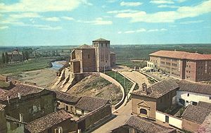
Palencia (Spanish pronunciation: [paˈlenθja] ) is a city of Spain located in the autonomous community of Castile and León. It is the capital and most populated municipality of the province of Palencia. Located in the northwest of the Iberian Peninsula, in the northern half of the Inner Plateau, the city lies on the left bank of the Carrión river.

Estadio Nueva Balastera
Distance: Approx. 701 meters
Latitude and longitude: 42.01173889,-4.51613611
Estadio Nueva Balastera is a football stadium in Palencia, Spain. It is the home ground of CF Palencia. The stadium holds 8,100 and was built in 2006, replacing the old La Balastera, built in 1943.

Venta de Baños
Municipality in Castile and León, Spain
Distance: Approx. 8710 meters
Latitude and longitude: 41.93333333,-4.5
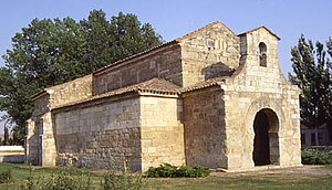
Venta de Baños is a small town and municipality of about 6,400 inhabitants located in the Cerrato district of the province of Palencia, part of the autonomous community of Castile and León in central Spain. It lies some 10 km south of the provincial capital, Palencia. Noteworthy monuments include the medieval Church of San Juan Bautista (St John the Baptist) which is believed to be Visigothic.

Fuentes de Valdepero
Municipality in Castile and León, Spain
Distance: Approx. 6667 meters
Latitude and longitude: 42.06666667,-4.5
Fuentes de Valdepero is a municipality located in the province of Palencia, Castile and León, Spain. It has a population of 429.

Grijota
Municipality in Castile and León, Spain
Distance: Approx. 6659 meters
Latitude and longitude: 42.05,-4.58333333
Grijota is a municipality located in the province of Palencia, Castile and León, Spain. According to the 2019 census (INE), the municipality has a population of 2,319 inhabitants. It is 7 km away from the capital of the province, Palencia, and 57 km from the city of Valladolid, capital of the region of Castile and León.

Husillos
Municipality in Castile and León, Spain
Distance: Approx. 8242 meters
Latitude and longitude: 42.08333333,-4.51666667
Husillos is a municipality located in the province of Palencia, Castile and León, Spain. According to the 2004 census (INE), the municipality had a population of 208 inhabitants.

Magaz de Pisuerga
Municipality in Castile and León, Spain
Distance: Approx. 9351 meters
Latitude and longitude: 41.9833,-4.41667
Magaz de Pisuerga is a municipality located in the province of Palencia, Castile and León, Spain. According to the 2004 census (INE), the municipality has a population of 755 inhabitants.

Villalobón
Municipality in Castile and León, Spain
Distance: Approx. 3316 meters
Latitude and longitude: 42.03333333,-4.5
Villalobón is a municipality located in the province of Palencia, Castile and León, Spain. According to the 2004 census (INE), the municipality has a population of 608 inhabitants.
Villamuriel de Cerrato
Municipality in Castile and León, Spain
Distance: Approx. 6652 meters
Latitude and longitude: 41.95,-4.51666667
Villamuriel de Cerrato is a municipality located in the province of Palencia, Castile and León, Spain. According to the 2004 census (INE), the municipality had a population of 5,304 inhabitants. Fr Adolfo Nicolás, Superior General of the Society of Jesus (2008-2016), was born in Villamuriel de Cerrato in 1936.

Palencia Cathedral
Distance: Approx. 1081 meters
Latitude and longitude: 42.01111111,-4.53694444
The Cathedral Basilica of Saint Antoninus (Spanish: Catedral-Basílica de San Antolín) is a Roman Catholic church located in Palencia, Spain. It is dedicated to Saint Antoninus of Pamiers.

Hospital de la Herrada
Hospital in Palencia, Spain
Distance: Approx. 298 meters
Latitude and longitude: 42.009193,-4.527641
The Hospital de la Herrada, also Hospital de Santa María de la Herrada was a hospital and college in the town of Carrión de los Condes, Palencia, Spain, established in 1209 by Gonzalo Rodríguez Girón, a Palencia tycoon who became steward of the king, to provide assistance to pilgrims on the Way of St James and other travelers. The hospital and Giron appear to have had considerable power in the medieval period. Three years after its founding, Girón made a provision to the Bishop Tello Téllez and his council, with estates and belongings such as the churches of Cordovilla, mills, orchards, fields and vineyards of Villanueva del Rebollar, Cardeñosa de Volpejera, Revenga de Campos, Villasabariego de Ucieza, Villaturde and Boedo de Castrejón.

Cristo del Otero
Sculpture
Distance: Approx. 2143 meters
Latitude and longitude: 42.02833333,-4.52944444
The Cristo del Otero (Christ of the Knoll) is a large sculpture and symbol of the city of Palencia in Spain, located on a knoll (otero) on the outskirts of the city. Another name, much less popular, is the Monument to the Sacred Heart of Jesus. The sculpture was designed by Victorio Macho, and it is also the location of his tomb.
Weather in this IP's area
overcast clouds
13 Celsius
13 Celsius
13 Celsius
15 Celsius
1019 hPa
75 %
1019 hPa
934 hPa
10000 meters
2.68 m/s
3.58 m/s
45 degree
100 %
08:08:29
17:57:15
