5.159.132.124 - IP Lookup: Free IP Address Lookup, Postal Code Lookup, IP Location Lookup, IP ASN, Public IP
Country:
Region:
City:
Location:
Time Zone:
Postal Code:
ISP:
ASN:
language:
User-Agent:
Proxy IP:
Blacklist:
IP information under different IP Channel
ip-api
Country
Region
City
ASN
Time Zone
ISP
Blacklist
Proxy
Latitude
Longitude
Postal
Route
db-ip
Country
Region
City
ASN
Time Zone
ISP
Blacklist
Proxy
Latitude
Longitude
Postal
Route
IPinfo
Country
Region
City
ASN
Time Zone
ISP
Blacklist
Proxy
Latitude
Longitude
Postal
Route
IP2Location
5.159.132.124Country
Region
navarra, comunidad foral de
City
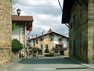
iturmendi
Time Zone
ISP
Language
User-Agent
Latitude
Longitude
Postal
ipdata
Country
Region
City
ASN
Time Zone
ISP
Blacklist
Proxy
Latitude
Longitude
Postal
Route
Popular places and events near this IP address

Arbizu
Place in Navarra, Spain
Distance: Approx. 7564 meters
Latitude and longitude: 42.91666667,-2.03333333
Arbizu is a village and municipality in the province and autonomous community of Navarre, northern Spain, neighbouring Etxarri-Aranatz. Its traditional "fiesta" falls on June 24, St. John's day, and is noted for the feast held in the main square.

Alsasua – Altsasu
Municipality in Navarre, Spain
Distance: Approx. 4145 meters
Latitude and longitude: 42.89527778,-2.16888889
Alsasua (in Spanish, Altsasu in Basque; official name: Altsasu/Alsasua) is a town located in the autonomous community of Navarre, northern Spain. Its population in 2017 was 7,419. The Battle of Alsasua took place here in 1834.
Bakaiku
Distance: Approx. 1384 meters
Latitude and longitude: 42.8925,-2.102
Bakaiku is a town and municipality located in the province and autonomous community of Navarre, northern Spain. It has 359 inhabitants and is an average 515 m above mean sea level.

Ergoiena
Town in Navarra, Spain
Distance: Approx. 7895 meters
Latitude and longitude: 42.8753,-2.02389
Ergoiena is a municipality located in the province and autonomous community of Navarre, northern Spain. The Basque municipality numbers three villages, Lizarraga, Unanu and Dorrao. It bounds with the range Urbasa on the west and south, and with Andia on the east.

Etxarri-Aranatz
Place in Navarra, Spain
Distance: Approx. 4613 meters
Latitude and longitude: 42.91111111,-2.07
Etxarri-Aranatz (Spanish: Echarri-Aranaz) is a town and municipality located in the province and autonomous community of Navarre, northern Spain. Etxarri-Aranatz was founded in 1312. During the First Carlist War, it was occupied and fortified by Liberal troops.

Iturmendi
Municipality in Navarre, Spain
Distance: Approx. 748 meters
Latitude and longitude: 42.88333333,-2.11666667
Iturmendi is a town and municipality located in the province and autonomous community of Navarre, northern Spain.

Lakuntza
Distance: Approx. 8770 meters
Latitude and longitude: 42.923,-2.021
Lakuntza (Spanish: Lacunza) is a town and municipality located in the autonomous community of Navarra, in northern Spain.
Olazti/Olazagutía
Municipality in Navarre, Spain
Distance: Approx. 6331 meters
Latitude and longitude: 42.8778,-2.19444
Olazti/Olazagutía is a town and municipality located in the province and autonomous community of Navarre, northern Spain.

Urdiain
Municipality of Spain
Distance: Approx. 1407 meters
Latitude and longitude: 42.88333333,-2.13333333
Urdiain is a town and municipality located in the province of Navarre, in the autonomous community of Navarre, in the North of Spain. The town of Urdiain has a population of under 700.

Fuentestrún
Municipality in Castile and León, Spain
Distance: Approx. 3469 meters
Latitude and longitude: 42.87444444,-2.08166667
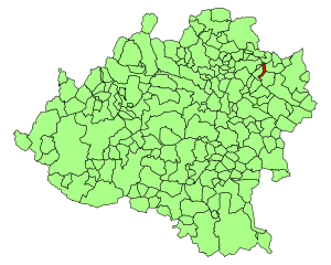
Fuentestrún is a municipality located in the province of Soria, Castile and León, Spain. According to the 2004 census (INE), the municipality had a population of 78 inhabitants.
Battle of Alsasua
Battle of the First Carlist War
Distance: Approx. 4146 meters
Latitude and longitude: 42.8953,-2.1689
The Battle of Alsasua, also known as the Battle of Altsasu or la Acción de la Venta de Alsasua (in Spanish "action of the inn at Alsasua"), occurred on April 22, 1834 in Navarre, Spain, during the First Carlist War. Carlist general Tomás de Zumalacárregui attacked a convoy led by the Liberal general Vicente Genaro de Quesada traveling from Vitoria-Gasteiz to Pamplona at the town of Alsasua. The Liberals suffered many casualties and Zumalacárregui took many prisoners, as well as half a million reals.

Urbasa
Mountain range of western Navarre, Spain
Distance: Approx. 6914 meters
Latitude and longitude: 42.83833333,-2.16583333
The Urbasa Range (Urbasa mendilerroa in Basque and Sierra de Urbasa in Spanish) is a mountain range of western Navarre, Spain, part of the Basque Mountains. Its highest point is the 1,183-metre-high Baiza. Urbasa is a karstic range where numerous nummulites fossils have been found.
Weather in this IP's area
clear sky
0 Celsius
-4 Celsius
0 Celsius
0 Celsius
1029 hPa
92 %
1029 hPa
933 hPa
10000 meters
3.2 m/s
4.25 m/s
344 degree
6 %

