5.150.68.35 - IP Lookup: Free IP Address Lookup, Postal Code Lookup, IP Location Lookup, IP ASN, Public IP
Country:
 Great Britain
Region:
City:
Location:
Time Zone:
Postal Code:
ISP:
ASN:
language:
User-Agent:
Proxy IP:
Blacklist:
IP information under different IP Channel
ip-api
Country
Region
City
ASN
Time Zone
ISP
Blacklist
Proxy
Latitude
Longitude
Postal
Route
db-ip
Country
Region
City
ASN
Time Zone
ISP
Blacklist
Proxy
Latitude
Longitude
Postal
Route
IPinfo
Country
Region
City
ASN
Time Zone
ISP
Blacklist
Proxy
Latitude
Longitude
Postal
Route
IP2Location
5.150.68.35Country
gbRegion
england
City
sydenham
Time Zone
Europe/London
ISP
Language
User-Agent
Latitude
Longitude
Postal
ipdata
Country
Region
City
ASN
Time Zone
ISP
Blacklist
Proxy
Latitude
Longitude
Postal
Route
Popular places and events near this IP address

Sydenham, London
Human settlement in England
Distance: Approx. 89 meters
Latitude and longitude: 51.4254,-0.0544
Sydenham () is a district of south-east London, England, which is shared between the London boroughs of Lewisham, Bromley and Southwark. Prior to the creation of the County of London in 1889, Sydenham was located in Kent, bordering Surrey. Historically, the area was very affluent, with the Crystal Palace being relocated to Sydenham Hill in 1854.

Sydenham railway station (London)
National rail station in London, England
Distance: Approx. 89 meters
Latitude and longitude: 51.4254,-0.0544
Sydenham is an interchange station between the Windrush line of the London Overground and National Rail services operated by Southern, located in Sydenham in the London Borough of Lewisham. Originally opened in 1839, the station is located on the former Croydon Canal, which is now a branch of the Brighton Main Line, often known as the Sydenham Corridor. The station is 6 miles 32 chains (6.40 miles, 10.30 km) down the line from London Bridge.

Penge East railway station
National Rail station in London, England
Distance: Approx. 792 meters
Latitude and longitude: 51.4191,-0.0537
Penge East railway station is on the Chatham Main Line in England, serving part of the Penge and Sydenham areas in the London Borough of Bromley, south London. It is 7 miles 15 chains (11.6 km) down the line from London Victoria and is situated between Sydenham Hill and Kent House. The station and all trains that call are operated by Southeastern, as part of the Bromley South Metro service.

Sydenham High School
Private day school in Sydenham, London
Distance: Approx. 596 meters
Latitude and longitude: 51.4273,-0.0629
Sydenham High School is a private day school for 4- to 18-year-old girls located in London, England. Sydenham High School was founded by the Girls’ Public Day School Trust in 1887. Since then, the original school roll of 20 pupils has grown to 724 girls.
Forest Hill School
Community school in Forest Hill, London Borough of Lewisham, England
Distance: Approx. 782 meters
Latitude and longitude: 51.4318,-0.0477
Forest Hill School is a boys' secondary school and sixth form located in Forest Hill, in the London Borough of Lewisham. The school is in federation with the girls' secondary, Sydenham School, which is nearby. In 2005 the school was given Performing Arts status for its Drama, Dance, Music and Art courses and currently has a silver artsmark from the English Arts Council.

Lewisham West and Penge (UK Parliament constituency)
Parliamentary constituency in the United Kingdom, 2010–2024
Distance: Approx. 526 meters
Latitude and longitude: 51.43,-0.05
Lewisham West and Penge was a constituency in Greater London created in 2010 and represented in the House of Commons of the UK Parliament. The seat was abolished for the 2024 general election and replaced by parts of three other constituencies.
Kirkdale School
Former school in Sydenham, London, England
Distance: Approx. 422 meters
Latitude and longitude: 51.429,-0.0586
Kirkdale School (1964 - 1980s) was a small, independent free school located at 186 Kirkdale, Sydenham, London, England. During the entirety of the school's existence it was run as a parent/teacher co-operative. Kirkdale is one of several free schools to have been established in the United Kingdom in the twentieth century.

St Christopher's Hospice
Hospice in London Borough of Bromley, England
Distance: Approx. 589 meters
Latitude and longitude: 51.421608,-0.058717
St. Christopher's Hospice is a hospice in south London, England, established in 1967 by Cicely Saunders, whose work is considered the basis of modern hospice philosophy.

Crystal Palace Park Cricket Ground
Distance: Approx. 877 meters
Latitude and longitude: 51.421,-0.064
Crystal Palace Park Cricket Ground was a cricket ground in Crystal Palace in south-east London. It was located in Crystal Palace Park in the shadow of The Crystal Palace. The ground was established on 3 June 1857 and used for first-class cricket between 1864 and 1906.
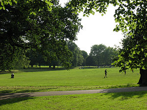
Mayow Park
Distance: Approx. 548 meters
Latitude and longitude: 51.42986,-0.049214
Mayow Park, formerly known as Sydenham Recreation Ground, is a municipal park in London Borough of Lewisham. Located on Mayow Road in Sydenham, south east London, it is the borough's oldest park and its second oldest public open space after Blackheath. The park has a Green Flag Award.

Dacres Wood
Distance: Approx. 633 meters
Latitude and longitude: 51.4317,-0.0522
Dacres Wood is a small local nature reserve in Forest Hill in the London Borough of Lewisham. It is owned and managed by Lewisham Council. The site is a remnant of the former Croydon Canal, which later became the garden of a Victorian house.
Walter Cobb (department store)
Former department store in London
Distance: Approx. 185 meters
Latitude and longitude: 51.4275,-0.05617
Walter Cobb was a department store located in Sydenham in South London. It opened in 1860 and closed in 1981.
Weather in this IP's area
clear sky
3 Celsius
3 Celsius
1 Celsius
4 Celsius
1043 hPa
87 %
1043 hPa
1036 hPa
10000 meters
1.03 m/s