5.145.153.55 - IP Lookup: Free IP Address Lookup, Postal Code Lookup, IP Location Lookup, IP ASN, Public IP
Country:
 Norway
Region:
City:
Location:
Time Zone:
Postal Code:
ISP:
ASN:
language:
User-Agent:
Proxy IP:
Blacklist:
IP information under different IP Channel
ip-api
Country
Region
City
ASN
Time Zone
ISP
Blacklist
Proxy
Latitude
Longitude
Postal
Route
db-ip
Country
Region
City
ASN
Time Zone
ISP
Blacklist
Proxy
Latitude
Longitude
Postal
Route
IPinfo
Country
Region
City
ASN
Time Zone
ISP
Blacklist
Proxy
Latitude
Longitude
Postal
Route
IP2Location
5.145.153.55Country
noRegion
viken
City
kolbotn
Time Zone
Europe/Oslo
ISP
Language
User-Agent
Latitude
Longitude
Postal
ipdata
Country
Region
City
ASN
Time Zone
ISP
Blacklist
Proxy
Latitude
Longitude
Postal
Route
Popular places and events near this IP address

Oppegård
Municipality in Akershus, Norway
Distance: Approx. 2156 meters
Latitude and longitude: 59.7925,10.79027778
Oppegård is an area in Nordre Follo, Akershus, Norway. Oppegård was a municipality in the county Akershus. It is part of the traditional region of Follo.

Søndre Nordstrand
Borough in Norway
Distance: Approx. 2229 meters
Latitude and longitude: 59.8299,10.7934
Søndre Nordstrand (Southern Nordstrand) is a borough of the city of Oslo, Norway. It is the southernmost borough of Oslo, bordering Nordstrand. As of 2020 it has 39,066 inhabitants and the highest rate of immigrant population at 56%.

Bjørndal
Distance: Approx. 2525 meters
Latitude and longitude: 59.82545,10.8381
Bjørndal is a suburb of Oslo, Norway, part of the borough of Søndre Nordstrand. Its population is estimated to be about 9,900 residents. Bjørndal has two primary schools, respectively named "Bjørndal skole" and "Seterbråten skole", a middle school named "Bjørnholt Ungdomsskole" and a high school named "Bjørnholt videregående skole".

Kolbotn
Town in Østlandet, Norway
Distance: Approx. 231 meters
Latitude and longitude: 59.811199,10.80004167
Kolbotn is an urban area in Norway's Nordre Follo municipality in Akershus county. Kolbotn is in the centre of the traditional district, Oppegård. The population is about 6,000.

Kolbotn Station
Railway station in Nordre Follo, Norway
Distance: Approx. 179 meters
Latitude and longitude: 59.81083333,10.80083333
Kolbotn is a railway station located at Kolbotn in Oppegård, Norway. Located 12 km from Oslo S on the Østfold Line, it is served by commuter trains operated by Vy. As part of the new high-speed the Follo Line between Oslo and Ski, was previously considered as an intermediate station.
Rosenholm Station
Railway station in Oslo, Norway
Distance: Approx. 1460 meters
Latitude and longitude: 59.82333333,10.79777778
Rosenholm Station (Norwegian: Rosenholm holdeplass) is a railway station on the Østfold Line located in the Holmlia neighborhood in the Søndre Nordstrand borough of Oslo, Norway. Situated 11.35 kilometers (7.05 mi) from Oslo Central Station (Oslo S), it features two side platforms. Rosenholm is served by the L2 line of the Oslo Commuter Rail.
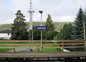
Solbråtan Station
Railway station in Nordre Follo, Norway
Distance: Approx. 1087 meters
Latitude and longitude: 59.80083333,10.80416667
Solbråtan Station (Norwegian: Solbråtan stasjon) is a railway station at Solbråtan in Oppegård, Norway. Located on the Østfold Line, it is served by the Oslo Commuter Rail line L2 operated by Vy with two hourly services. The station was opened in 1939.

Sofiemyr
Village in Østlandet, Norway
Distance: Approx. 1663 meters
Latitude and longitude: 59.79722222,10.81722222
Sofiemyr is a village in Nordre Follo, Akershus, Norway. The Well Spa is located in the village.
Trollåsen
Village in Østlandet, Norway
Distance: Approx. 1906 meters
Latitude and longitude: 59.8216,10.7779
Trollåsen is a village in Nordre Follo, Akershus, Norway.

Tårnåsen
Village in Østlandet, Norway
Distance: Approx. 872 meters
Latitude and longitude: 59.8154,10.8163
Tårnåsen is a village in Nordre Follo, Akershus, Norway.
Hvitebjørn
Distance: Approx. 2280 meters
Latitude and longitude: 59.8139,10.7638
Hvitebjørn (Hvitebjørn gård) is a historical farm near the village of Svartskog in Nordre Follo, Akershus, Norway.

The Well Spa
Spa in Sofiemyr
Distance: Approx. 2248 meters
Latitude and longitude: 59.7921,10.8201
The Well is an adult-only spa and wellness center at Kolbotn in Oppegård municipality in Akershus county, Norway. Situated 13 kilometers south of downtown Oslo, the center opened in December 2015 with 160 employees. Construction began in January 2014.
Weather in this IP's area
few clouds
0 Celsius
0 Celsius
-2 Celsius
0 Celsius
1042 hPa
61 %
1042 hPa
1021 hPa
10000 meters
1.24 m/s
1.76 m/s
21 degree
12 %