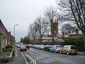
Country:
Region:
City:
Latitude and Longitude:
Time Zone:
Postal Code:
IP information under different IP Channel
ip-api
Country
Region
City
ASN
Time Zone
ISP
Blacklist
Proxy
Latitude
Longitude
Postal
Route
Luminati
Country
Region
eng
City
carlisle
ASN
Time Zone
Europe/London
ISP
Grain Communications Limited
Latitude
Longitude
Postal
IPinfo
Country
Region
City
ASN
Time Zone
ISP
Blacklist
Proxy
Latitude
Longitude
Postal
Route
db-ip
Country
Region
City
ASN
Time Zone
ISP
Blacklist
Proxy
Latitude
Longitude
Postal
Route
ipdata
Country
Region
City
ASN
Time Zone
ISP
Blacklist
Proxy
Latitude
Longitude
Postal
Route
Popular places and events near this IP address

BBC Radio Cumbria
Radio station in Carlisle, England
Distance: Approx. 1078 meters
Latitude and longitude: 54.8958,-2.9408
BBC Radio Cumbria is the BBC's local radio station serving the county of Cumbria. It broadcasts on FM, AM, DAB, digital TV and via BBC Sounds from studios in Carlisle. According to RAJAR, the station has a weekly audience of 85,000 listeners and a 8.4% share as of December 2023.

Carlisle Castle
Castle in Cumbria, England
Distance: Approx. 906 meters
Latitude and longitude: 54.89726,-2.941936
Carlisle Castle is a stone keep medieval fortress located in the city of Carlisle near the ruins of Hadrian's Wall. First built during the reign of William II in 1092 and rebuilt in stone under Henry I in 1122, the castle is over 930 years old and has been the scene of many episodes in British history. This Castle played an extremely important part in the wars between England and Scotland (the Wars of Scottish Independence).
Stanwix
District of Carlisle, Cumbria, England
Distance: Approx. 907 meters
Latitude and longitude: 54.9,-2.93333333
Stanwix is a district of Carlisle, Cumbria in North West England. The ward population (called Stanwix Urban) had a population taken at the 2011 census of 5,934. It is located on the north side of River Eden, across from Carlisle city centre.

River Caldew
River in Cumbria, England
Distance: Approx. 280 meters
Latitude and longitude: 54.9028,-2.9436
The River Caldew is a river running through Cumbria in England. The river rises high up on the northern flanks of Skiddaw, in the Northern Fells area of the English Lake District, and flows in a northerly direction until it joins the River Eden on the north side of the city of Carlisle. The Cumbria Way follows most of the course of the river, from its early stages in the Skiddaw Forest to Carrock Fell and again from Caldbeck through to the centre of Carlisle.

Siege of Carlisle (1644)
Siege of Carlisle during the First English Civil War
Distance: Approx. 906 meters
Latitude and longitude: 54.89726,-2.941936
The siege of Carlisle occurred during the First English Civil War when the allied forces of the Scottish Covenanters and the English Parliamentarians besieged Carlisle Castle which was held at the time by the English Royalist forces loyal to King Charles I. The siege took place in Carlisle, Cumbria from October 1644 to 25 June 1645.

Austin Friars
Private day school in Carlisle, Cumbria, United Kingdom
Distance: Approx. 353 meters
Latitude and longitude: 54.908,-2.947
Austin Friars is a coeducational private day school located in Carlisle, England. The Senior School provides secondary education for 350 boys and girls aged 11–18. There are 150 children aged 4–11 in the Junior School and the Nursery has places for 16 children aged 3–4.
Belah
Suburb of Carlisle in the City of Carlisle district, in the county of Cumbria, England
Distance: Approx. 700 meters
Latitude and longitude: 54.9,-2.95
Belah is a suburb of Carlisle in the City of Carlisle district, in the county of Cumbria, England.

Petriana
Roman fort in Cumbria, England
Distance: Approx. 138 meters
Latitude and longitude: 54.905,-2.942
Uxelodunum (with the alternative Roman name of Petriana and the modern name of Stanwix Fort) was a Roman fort with associated civilian settlement (vicus) in modern-day Carlisle, Cumbria, England. It was the largest fort on Hadrian's Wall and is now buried beneath the suburb of Stanwix.

Edenside
Cricket ground in England
Distance: Approx. 566 meters
Latitude and longitude: 54.90095833,-2.93949444
Edenside is a cricket ground in Carlisle, Cumbria. The ground is the primary home ground of Cumbria County Cricket Club. The first recorded match on the ground was in 1850, when Carlisle played an All-England Eleven.

Etterby
Human settlement in England
Distance: Approx. 723 meters
Latitude and longitude: 54.907,-2.955
Etterby is a former village in Cumbria, England. It is now a northwestern suburb of Carlisle, on the northern side of the River Eden. The Redfern Inn (1939–1940) was designed by the architect Harry Redfern in the New Model Inn style.

Milecastle 66
Distance: Approx. 394 meters
Latitude and longitude: 54.902135,-2.941333
Milecastle 66 (Stanwix Bank) was a milecastle on Hadrian's Wall (grid reference NY39735678).

Carlisle Civic Centre
Municipal building in Carlisle, Cumbria, England
Distance: Approx. 1056 meters
Latitude and longitude: 54.8975,-2.9347
Carlisle Civic Centre is a municipal building in the Rickergate, Carlisle, England. It was the headquarters of Carlisle City Council.
Weather in this IP's area
overcast clouds
11 Celsius
10 Celsius
10 Celsius
11 Celsius
1028 hPa
84 %
1028 hPa
1026 hPa
10000 meters
1.09 m/s
1.32 m/s
72 degree
98 %
07:19:49
16:30:48