Country:
Region:
City:
Latitude and Longitude:
Time Zone:
Postal Code:
IP information under different IP Channel
ip-api
Country
Region
City
ASN
Time Zone
ISP
Blacklist
Proxy
Latitude
Longitude
Postal
Route
Luminati
Country
Region
ba
City
baku
ASN
Time Zone
Asia/Baku
ISP
Azertelecom LLC
Latitude
Longitude
Postal
IPinfo
Country
Region
City
ASN
Time Zone
ISP
Blacklist
Proxy
Latitude
Longitude
Postal
Route
db-ip
Country
Region
City
ASN
Time Zone
ISP
Blacklist
Proxy
Latitude
Longitude
Postal
Route
ipdata
Country
Region
City
ASN
Time Zone
ISP
Blacklist
Proxy
Latitude
Longitude
Postal
Route
Popular places and events near this IP address

Battle of Baku
1918 battle between Ottoman–Azerbaijani forces and Bolshevik–Dashnak forces
Distance: Approx. 4305 meters
Latitude and longitude: 40.45,49.78333333
The Battle of Baku (Azerbaijani: Bakı döyüşü, Turkish: Bakü Muharebesi, Russian: Битва за Баку) took place in August and September 1918 between the Ottoman–Azerbaijani coalition forces led by Nuri Pasha and Bolshevik–ARF Baku Soviet forces, later succeeded by the British–Armenian–White Russian forces led by Lionel Dunsterville and saw Soviet Russia briefly re-enter the war. The battle took place during World War I, was a conclusive part of the Caucasus Campaign, but a beginning of the Armenian–Azerbaijani War.

Xırdalan
City & Municipality in Absheron, Azerbaijan
Distance: Approx. 4116 meters
Latitude and longitude: 40.44861111,49.75638889
Xırdalan (Khyrdalan) is a city, municipality and the capital of the Absheron District of Azerbaijan. It has a population of 95,200. Khyrdalan is home of country's biggest brewery Baltika Baku, previously known as Khyrdalan .
Hökməli
Municipality in Absheron, Azerbaijan
Distance: Approx. 3371 meters
Latitude and longitude: 40.43111111,49.73722222
Hökməli (also, Hokmaly and Hökmely) is a village and municipality in the Absheron Rayon of Azerbaijan. It has a population of 4,463.
Sulutəpə
Place in Baku, Azerbaijan
Distance: Approx. 2283 meters
Latitude and longitude: 40.43333333,49.76666667
Sulutepe (Azerbaijani: Sulutəpə, also spelled Sulu Tepe) is a settlement in Baku, Azerbaijan. The settlement forms part of the municipality of Bilajary in Binagadi raion. It is an unofficial township built up in the 1980s by rural migrants and refugees from Nagorno-Karabakh.
Hocasan
Municipality in Baku, Azerbaijan
Distance: Approx. 238 meters
Latitude and longitude: 40.41222222,49.77166667
Khojasan (Azerbaijani: Xocəsən also, Gadzhi-Gasan, Khodzhagasan, Khodzhasan, and Khodzhi-Gasan) is a settlement and municipality in Baku, Azerbaijan. It has a population of 5,100. Here is situated Khojasan Football Federation.

Bilajary
Municipality in Baku, Azerbaijan
Distance: Approx. 3898 meters
Latitude and longitude: 40.43138889,49.80805556
Bilajary (Azerbaijani: Biləcəri) is a settlement and municipality in Baku, Azerbaijan. It has a population of 45,008. The municipality consists of the settlements of Bilajary and Sulutepe.

Baku International Bus Terminal
Bus station in Baku, Azerbaijan
Distance: Approx. 2949 meters
Latitude and longitude: 40.4281,49.7975
Baku International Bus Terminal is a bus terminal located in Baku, Azerbaijan. The foundation stone for the complex was laid in 2004, and construction work was carried out by local firm "Baku 21st century". Baku International Bus Terminal was opened officially on 12 February 2009.

Avtovağzal (Baku Metro)
Baku Metro Station
Distance: Approx. 2388 meters
Latitude and longitude: 40.42130013,49.79493098
Avtovağzal is a Baku Metro station. It was opened on 19 April 2016, connecting the Baku International Bus Terminal to the Baku Metro network.
National Center of Oncology (Azerbaijan)
Distance: Approx. 3277 meters
Latitude and longitude: 40.400893,49.804297
The Azerbaijan National Center of Oncology (Azerbaijani: Milli Onkologiya Mərkəzi) is a scientific research institution that investigates oncological diseases and specializes in oncologic treatment. The National Center of Oncology has been led by Jamil Aliyev since 1990.

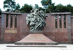
January 20 (monument)
Distance: Approx. 3375 meters
Latitude and longitude: 40.40374,49.80695
January 20 (Azerbaijani: 20 Yanvar) is a monument complex located in the city of Baku, Azerbaijan. İt was built in memory of the victims of January 20, 1990. The monument was erected on the territory of the Yasamal district, near the "January 20" ring road.

8 Noyabr (Baku Metro)
Baku Metro Station
Distance: Approx. 4653 meters
Latitude and longitude: 40.401111,49.821667
8 November (Azerbaijani: 8 Noyabr) is a station on the third (purple) line of the Baku Metro. The station was named to commemorate Victory Day of Azerbaijan.

Jafar Jabbarli Monument
Monument in Jafar Jabbarli square, Baku, Azerbaijan
Distance: Approx. 2995 meters
Latitude and longitude: 40.4,49.8
Jafar Jabbarli Monument (Azerbaijani: Cəfər Cabbarlının heykəli) is a monument to the Azerbaijani poet and dramatist Jafar Jabbarli (1899–1934), located on Jafar Jabbarli Square in the capital of Azerbaijan, Baku, not far from the entrance to the 28 May metro station. The monument was made of pink granite by the sculptor Mir-Ali Mir-Gasimov. It was installed in 1982.
Weather in this IP's area
broken clouds
13 Celsius
12 Celsius
13 Celsius
13 Celsius
1019 hPa
71 %
1019 hPa
1016 hPa
10000 meters
17.41 m/s
19.15 m/s
355 degree
74 %
07:13:08
17:35:46