46.71.124.174 - IP Lookup: Free IP Address Lookup, Postal Code Lookup, IP Location Lookup, IP ASN, Public IP
Country:
 Armenia
Region:
City:
Location:
Time Zone:
Postal Code:
ISP:
ASN:
language:
User-Agent:
Proxy IP:
Blacklist:
IP information under different IP Channel
ip-api
Country
Region
City
ASN
Time Zone
ISP
Blacklist
Proxy
Latitude
Longitude
Postal
Route
db-ip
Country
Region
City
ASN
Time Zone
ISP
Blacklist
Proxy
Latitude
Longitude
Postal
Route
IPinfo
Country
Region
City
ASN
Time Zone
ISP
Blacklist
Proxy
Latitude
Longitude
Postal
Route
IP2Location
46.71.124.174Country
amRegion
syunik'
City
khndzoresk
Time Zone
Asia/Yerevan
ISP
Language
User-Agent
Latitude
Longitude
Postal
ipdata
Country
Region
City
ASN
Time Zone
ISP
Blacklist
Proxy
Latitude
Longitude
Postal
Route
Popular places and events near this IP address
Karahunj
Place in Syunik, Armenia
Distance: Approx. 7337 meters
Latitude and longitude: 39.47916667,46.35888889
Karahunj (Armenian: Քարահունջ) is a village in the Goris Municipality of the Syunik Province in Armenia.

Tegh
Place in Syunik, Armenia
Distance: Approx. 6005 meters
Latitude and longitude: 39.55472222,46.47583333
Tegh (Armenian: Տեղ) is a village and the center of the Tegh Municipality of the Syunik Province in Armenia. Tegh is the last village on the Goris-Stepanakert Highway before passing the border with Azerbaijan. Of significance in the village, are the dozens of visible caves present near Tegh.

Aravus
Place in Syunik, Armenia
Distance: Approx. 6359 meters
Latitude and longitude: 39.56277778,46.46722222
Aravus (Armenian: Արավուս) is a village in the Tegh Municipality of the Syunik Province in Armenia.
Aygedzor, northern Syunik
Place in Syunik, Armenia
Distance: Approx. 5704 meters
Latitude and longitude: 39.46277778,46.41527778
Aygedzor (Armenian: Այգեձոր; formerly, Mugandzhug, Magandzhug, Magandzh, Maghanjugh, and Mughanjugh) is an abandoned town in the Syunik Province of Armenia.
Hartashen, Syunik
Place in Syunik, Armenia
Distance: Approx. 3143 meters
Latitude and longitude: 39.48583333,46.41972222
Hartashen (Armenian: Հարթաշեն) is a village in the Goris Municipality of the Syunik Province in Armenia.

Karashen
Place in Syunik, Armenia
Distance: Approx. 3754 meters
Latitude and longitude: 39.54,46.40805556
Karashen (Armenian: Քարաշեն) is a village in the Tegh Municipality of the Syunik Province in Armenia.

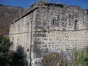
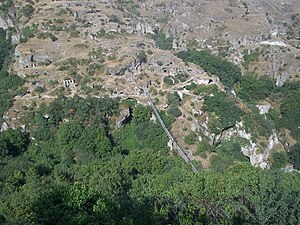
Khndzoresk
Place in Syunik, Armenia
Distance: Approx. 70 meters
Latitude and longitude: 39.51222222,46.43361111
Khndzoresk (Armenian: Խնձորեսկ, pronounced [χəndzɔˈɾɛsk]) is a village in the Goris Municipality of the Syunik Province in Armenia. The village is located to the east of the Goris-Stepanakert highway, on the steep slopes of Khor Dzor (Deep Gorge), which the village is named after, according to tradition. Crossing the bridge at the entrance of the village, the road continues towards the towns of Lachin and Stepanakert.
Nerkin Khndzoresk
Place in Syunik, Armenia
Distance: Approx. 5480 meters
Latitude and longitude: 39.50611111,46.49611111
Nerkin Khndzoresk (Armenian: Ներքին Խնձորեսկ) is a village in the Goris Municipality of the Syunik Province in southeastern Armenia. Nerkin Khndzoresk is located close to the border, and is located 21 km from Goris of the Stepanakert highway. The village lies 7 km from the Khndzoresk village connected by farm fields and one dirt road.
Cicimli, Lachin
Place in Lachin, Azerbaijan
Distance: Approx. 7179 meters
Latitude and longitude: 39.51194444,46.51638889
Cicimli (Jijimli) is a village in the Lachin District of Azerbaijan.

Goris State University
Distance: Approx. 7516 meters
Latitude and longitude: 39.5175,46.34555556
Goris State University (GorSU) (Armenian: Գորիսի պետական համալսարան) is a university in Goris, Syunik Province, Armenia. With 4 faculties, it is the largest university in Syunik Province. It provides degrees in Philology, History and Geography, Pedagogy, Biology and Chemistry, and Physics and Mathematics.

Melik Ajdar Mausoleum
Ancient mausoleum in Lachin District, Azerbaijan
Distance: Approx. 7179 meters
Latitude and longitude: 39.51194444,46.51638889
Melik Ajdar Mausoleum or Jijimli Mausoleum is a mausoleum located in the high mountainous terrain of the Jijimli village of the Lachin District of Azerbaijan. Some sources date the construction of the mausoleum to the fourteenth century, whereas others suggest an earlier period, namely the eleventh to twelfth centuries.
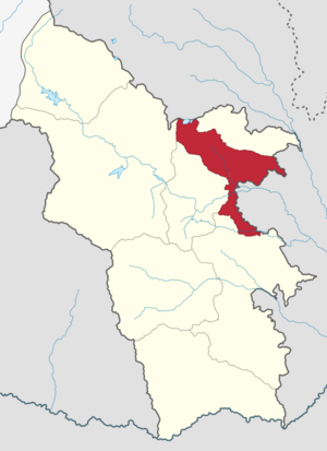
Goris Municipality
Urban Community in Syunik, Armenia
Distance: Approx. 7240 meters
Latitude and longitude: 39.5,46.35
Goris Municipality, referred to as Goris Community (Armenian: Գորիս Համայնք Goris Hamaynk), is an urban community and administrative subdivision of Syunik Province of Armenia, at the south of the country. Consisted of a group of settlements, its administrative centre is the town of Goris.
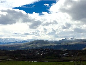
Weather in this IP's area
overcast clouds
1 Celsius
-2 Celsius
1 Celsius
1 Celsius
1021 hPa
61 %
1021 hPa
874 hPa
10000 meters
2.36 m/s
2.53 m/s
145 degree
100 %