Country:
 Germany
Region:
City:
Latitude and Longitude:
Time Zone:
Postal Code:
IP information under different IP Channel
ip-api
Country
Region
City
ASN
Time Zone
ISP
Blacklist
Proxy
Latitude
Longitude
Postal
Route
IPinfo
Country
Region
City
ASN
Time Zone
ISP
Blacklist
Proxy
Latitude
Longitude
Postal
Route
MaxMind
Country
Region
City
ASN
Time Zone
ISP
Blacklist
Proxy
Latitude
Longitude
Postal
Route
Luminati
Country
DERegion
hh
City
hamburg
ASN
Time Zone
Europe/Berlin
ISP
wilhelm.tel GmbH
Latitude
Longitude
Postal
db-ip
Country
Region
City
ASN
Time Zone
ISP
Blacklist
Proxy
Latitude
Longitude
Postal
Route
ipdata
Country
Region
City
ASN
Time Zone
ISP
Blacklist
Proxy
Latitude
Longitude
Postal
Route
Popular places and events near this IP address

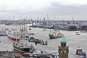
Hamburg Metropolitan Region
Place in Germany
Distance: Approx. 1525 meters
Latitude and longitude: 53.5,10
The Hamburg Metropolitan Region (German: Metropolregion Hamburg) is a metropolitan region centred around the city of Hamburg in northern Germany, consisting of eight districts (Landkreise) in the federal state of Lower Saxony, six districts (Kreise) in the state of Schleswig-Holstein and two districts in the state of Mecklenburg-Vorpommern along with the city-state of Hamburg itself. It covers an area of roughly 26,000 square kilometres (10,000 sq mi) and is home to more than 5.1 million inhabitants.

Wilhelmsburg, Hamburg
Quarter of Hamburg in Germany
Distance: Approx. 2441 meters
Latitude and longitude: 53.495,10.01111111
Wilhelmsburg () (Low German: Willemsborg) is a quarter (Stadtteil) of Hamburg, Germany within the borough (Bezirk) of Hamburg-Mitte. It is situated on several islands between the Northern and Southern branches of the Elbe river (Norderelbe and Süderelbe), together with the other quarters of Steinwerder, Veddel and Kleiner Grasbrook. The latter almost exclusively consists of facilities of the port of Hamburg.

Dessauer Ufer
Subcamp of the Neuengamme concentration camp in Nazi Germany (1944–1945)
Distance: Approx. 2605 meters
Latitude and longitude: 53.52638889,10.01166667
Dessauer Ufer was a subcamp of the Neuengamme concentration camp in Nazi Germany, located inside the Port of Hamburg on the Kleiner Grasbrook in Veddel. It was in operation from July 1944 to April 1945. Inmates were mostly used for forced labour at rubble clearing and building in the Hamburg port area.

Veddel station
Rapid transit station in Germany
Distance: Approx. 2354 meters
Latitude and longitude: 53.52166667,10.01333333
Veddel (BallinStadt) is a rapid transit station on the Harburg S-Bahn line and served by the trains of Hamburg S-Bahn. The railway station is located in the Veddel, Borough of Hamburg-Mitte, Hamburg, Germany. The station is managed by DB Station&Service, a subsidiary of the German railway company Deutsche Bahn AG. The station is listed as a Halt point (Haltepunkt), a passenger stop situated on an open stretch of line, and lacking specific signals.

Wilhelmsburg station
Railway station in Hamburg, Germany
Distance: Approx. 1950 meters
Latitude and longitude: 53.49888889,10.00694444
Wilhelmsburg station is a rapid transit station on the Harburg S-Bahn line and is served by trains on the Hamburg S-Bahn network. The railway station is located in the quarter Wilhelmsburg in the Hamburg-Mitte borough of the Free and Hanseatic City of Hamburg, Germany. Wilhelmsburg station is listed as a Bf (Bahnhof) (rail station), a place where trains may start, end or change directions, and that has at least one set of points.

Kleiner Grasbrook
Quarter of Hamburg in Germany
Distance: Approx. 2458 meters
Latitude and longitude: 53.53111111,9.99361111
Kleiner Grasbrook (pronounced [ˈklaɪnɐ ˈɡʁaːsbʁoːk] ) is a quarter (Stadtteil) of Hamburg, Germany within the borough (Bezirk) of Hamburg-Mitte. It is situated on the eponymous island between the Northern and Southern branches of the Elbe river (Norderelbe and Süderelbe), together with the other quarters of Steinwerder, Veddel and Wilhelmsburg. It almost exclusively consists of facilities of the port of Hamburg.

Süderelbe
River in Germany
Distance: Approx. 2859 meters
Latitude and longitude: 53.5021,9.9427
The Süderelbe (German: ['zyːdɐˌʔɛlbə] ) (Southern Elbe) is the biggest anabranch of the Unterelbe river in the area which is now the Port of Hamburg, Germany. Its natural flow path was redirected through the Köhlbrand.

BallinStadt
Museum in Hamburg, Germany
Distance: Approx. 2494 meters
Latitude and longitude: 53.52055556,10.01694444
BallinStadt (German pronunciation: [baːliːnʃtat]) is the name given to a memorial park and former emigration station in the Port of Hamburg, Germany. From the 1850s to the early 1930s the ground's emigration halls were last homestead for some five million emigrants from various parts of Europe, waiting for their departure to the Americas. The BallinStadt museum was opened in 2007 and named after Albert Ballin (1857–1918), then director General of the Hamburg America Line.

German Port Museum
Museum in Germany
Distance: Approx. 1975 meters
Latitude and longitude: 53.52508,9.99907
The German Port Museum (Deutsches Hafenmuseum) is a nautical museum in Hamburg. The German Federal Parliament's budget committee approved initial funding of €94 million to rebuild it.

Edel-optics.de Arena
Distance: Approx. 2000 meters
Latitude and longitude: 53.4956,10.0024
The Edel-optics.de Arena (known until May 2017 as Inselparkhalle) is a multi-function sports facility in the Wilhelmsburg district of Hamburg with a sports hall and a swimming pool. The hall is the home venue of the first division basketball team Hamburg Towers.

MS Bleichen
Museum ship in the port of Hamburg, Germany
Distance: Approx. 2388 meters
Latitude and longitude: 53.52937,9.998661
MS Bleichen is a museum ship in the port of Hamburg, which has its berth in the Hansa port on Bremer Kai in front of Shed 50. The ship, built in 1958, is a breakbulk cargo carrier of its time and is located in front of the listed general cargo storage shed used by the port museum.
Hamburg Maritime Foundation
German maritime foundation
Distance: Approx. 2401 meters
Latitude and longitude: 53.5302,9.99568
The Hamburg Maritim Foundation (Stiftung Hamburg Maritim) is a legally responsible foundation based in Hamburg, Germany and was founded in 2001.
Weather in this IP's area
moderate rain
11 Celsius
10 Celsius
10 Celsius
11 Celsius
1013 hPa
94 %
1013 hPa
1012 hPa
9000 meters
2.57 m/s
70 degree
100 %
07:54:51
18:14:46