46.57.99.33 - IP Lookup: Free IP Address Lookup, Postal Code Lookup, IP Location Lookup, IP ASN, Public IP
Country:
Region:
City:
Location:
Time Zone:
Postal Code:
IP information under different IP Channel
ip-api
Country
Region
City
ASN
Time Zone
ISP
Blacklist
Proxy
Latitude
Longitude
Postal
Route
Luminati
Country
Region
9
City
vienna
ASN
Time Zone
Europe/Vienna
ISP
Hutchison Drei Austria GmbH
Latitude
Longitude
Postal
IPinfo
Country
Region
City
ASN
Time Zone
ISP
Blacklist
Proxy
Latitude
Longitude
Postal
Route
IP2Location
46.57.99.33Country
Region
niederosterreich
City
maria enzersdorf
Time Zone
Europe/Vienna
ISP
Language
User-Agent
Latitude
Longitude
Postal
db-ip
Country
Region
City
ASN
Time Zone
ISP
Blacklist
Proxy
Latitude
Longitude
Postal
Route
ipdata
Country
Region
City
ASN
Time Zone
ISP
Blacklist
Proxy
Latitude
Longitude
Postal
Route
Popular places and events near this IP address
Mödling
City in Lower Austria near Vienna
Distance: Approx. 2268 meters
Latitude and longitude: 48.08333333,16.26666667
Mödling (German pronunciation: [ˈmøːdlɪŋ] ) is the capital of the Austrian district of the same name located approximately 15 km south of Vienna. Mödling lies in Lower Austria's industrial zone (Industrieviertel). The Mödlingbach, a brook which rises in the Vienna Woods, flows through the town.
Liechtenstein Castle (Maria Enzersdorf)
Castle in Lower Austria
Distance: Approx. 1346 meters
Latitude and longitude: 48.0925,16.27
Liechtenstein Castle (German: Burg Liechtenstein) is a castle near Maria Enzersdorf in Lower Austria, bordering Vienna. It is on the edge of the Wienerwald (Vienna Woods). Liechtenstein (German for "bright stone") Castle is the eponymous ancestral seat and place of origin of the House of Liechtenstein, the ruling family of the Principality of Liechtenstein.

Datenpol Arena
Distance: Approx. 2000 meters
Latitude and longitude: 48.0975,16.31083333
The Datenpol Arena (formerly motion_invest Arena, BSFZ-Arena, Bundesstadion Südstadt) is a multi-use stadium in Maria Enzersdorf - Südstadt, Austria (Johann Steinböck-Straße). It is currently used mostly for football matches and is the home ground of VfB Admira Wacker Mödling. The stadium holds 10,600.

Brunn am Gebirge
Municipality in Lower Austria, Austria
Distance: Approx. 64 meters
Latitude and longitude: 48.1,16.28333333
Brunn am Gebirge (Central Bavarian: Brunn aum Gebiage) is a town in the district of Mödling in the Austrian state of Lower Austria. As of the end of 2022, the population was recorded at 12,218.
Maria Enzersdorf
Municipality in Lower Austria, Austria
Distance: Approx. 64 meters
Latitude and longitude: 48.1,16.28333333
Maria Enzersdorf (Central Bavarian: Maria Enzasduaf) is a small city in the district of Mödling in the Austrian state of Lower Austria. There are several castles and ruins in the forests surrounding Maria Enzersdorf, including Schloss Liechtenstein, Liechtenstein Castle and the Schwarzer Turm (Black Tower) in the surrounding forest and Schloss Hunyadi in the town itself.

Perchtoldsdorf
Municipality in Lower Austria, Austria
Distance: Approx. 2267 meters
Latitude and longitude: 48.11666667,16.26666667
Perchtoldsdorf (German: [ˈpɛʁçtɔlt͡sdɔʁf] ; colloquially Petersdorf) is a market town in the Mödling District, in the Austrian state of Lower Austria. It is known chiefly for its winemaking.

Badner Bahn
Distance: Approx. 2283 meters
Latitude and longitude: 48.0994,16.3149
The Badner Bahn or Wiener Lokalbahn is a tram-train service in the metropolitan area of Vienna. It runs for 30.4 kilometres (18.9 mi) between Vienna and Baden, and is operated by the Wiener Lokalbahnen Aktiengesellschaft. The entire Badner Bahn is part of the Verkehrsverbund Ost-Region and is one of the most important passenger services owned by WLB. In 2013, 35,000 passengers per day used the service.

Seegrotte
Distance: Approx. 2535 meters
Latitude and longitude: 48.08583333,16.2575
The Seegrotte, near Hinterbrühl, Austria, is a cave system with a large grotto located under a former gypsum mine. It was closed in 1912 after the mine flooded with 20 million litres of water. It became a tourist attraction after 1930 and has been one ever since, with the exception of World War II. The lake is 60 meters below ground, the water surface is 6200 m² and pumps are used to keep the water level down.

Mödling railway station
Railway station in Lower Austria
Distance: Approx. 1808 meters
Latitude and longitude: 48.08558333,16.29538889
Mödling is a train station in Mödling, Austria. It is served by Vienna S-Bahn lines S1 and S2 and regional trains.

Thonetschlössl
Distance: Approx. 1506 meters
Latitude and longitude: 48.0867,16.2879
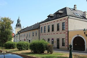
Thonetschlössl in Mödling, Austria is a symmetric building with three floors. The building's architecture is mainly influenced by the Late-Baroque style. Currently the Thonetschlössl houses the local museum of Mödling.
Brunn-Maria Enzersdorf railway station
Railway station in Lower Austria
Distance: Approx. 654 meters
Latitude and longitude: 48.10527778,16.28805556
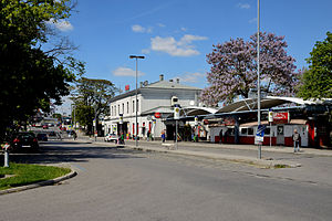
Brunn-Maria Enzersdorf is a railway station serving the town of Brunn am Gebirge in Lower Austria.

Schloss Liechtenstein (Maria Enzersdorf)
Neoclassical palace in Maria Enzersdorf, near Vienna, Austria
Distance: Approx. 1271 meters
Latitude and longitude: 48.092,16.272
The Liechtenstein Palace (German: Schloss Liechtenstein) is a neoclassical palace near Maria Enzersdorf (and Mödling) in Lower Austria, bordering Vienna. It is on the edge of the Vienna Woods (German: Wienerwald). It stands opposite south of Liechtenstein Castle, the ancestral seat of and place of origin of the House of Liechtenstein, the ruling family of the Principality of Liechtenstein.
Weather in this IP's area
few clouds
-0 Celsius
-7 Celsius
-1 Celsius
0 Celsius
1036 hPa
67 %
1036 hPa
1002 hPa
10000 meters
8.49 m/s
17.43 m/s
6 degree
18 %


