46.57.87.184 - IP Lookup: Free IP Address Lookup, Postal Code Lookup, IP Location Lookup, IP ASN, Public IP
Country:
Region:
City:
Location:
Time Zone:
Postal Code:
IP information under different IP Channel
ip-api
Country
Region
City
ASN
Time Zone
ISP
Blacklist
Proxy
Latitude
Longitude
Postal
Route
Luminati
Country
Region
9
City
vienna
ASN
Time Zone
Europe/Vienna
ISP
Hutchison Drei Austria GmbH
Latitude
Longitude
Postal
IPinfo
Country
Region
City
ASN
Time Zone
ISP
Blacklist
Proxy
Latitude
Longitude
Postal
Route
IP2Location
46.57.87.184Country
Region
niederosterreich
City
traismauer
Time Zone
Europe/Vienna
ISP
Language
User-Agent
Latitude
Longitude
Postal
db-ip
Country
Region
City
ASN
Time Zone
ISP
Blacklist
Proxy
Latitude
Longitude
Postal
Route
ipdata
Country
Region
City
ASN
Time Zone
ISP
Blacklist
Proxy
Latitude
Longitude
Postal
Route
Popular places and events near this IP address

Lower Austria
State of Austria
Distance: Approx. 2229 meters
Latitude and longitude: 48.33333333,15.75
Lower Austria (German: Niederösterreich pronounced [ˈniːdɐˌ(ʔ)øːstɐraɪç] , abbreviated LA or NÖ; Bavarian: Niedaöstareich; Slovak: Dolné Rakúsko [ˈdɔlnɛː ˈrakuːskɔ]; Czech: Dolní Rakousy [ˈdolɲiː ˈrakousɪ]) is one of the nine states of Austria, located in the northeastern corner of the country. Major cities are Amstetten, Krems an der Donau, Wiener Neustadt and Sankt Pölten, which has been the capital of Lower Austria since 1986, replacing Vienna, which became a separate state in 1921. With a land area of 19,186 km2 (7,408 sq mi) and a population of 1.7 million people, Lower Austria is the largest and second-most-populous state in Austria (after Vienna).
Gemeinlebarn
Distance: Approx. 5273 meters
Latitude and longitude: 48.33333333,15.8
Gemeinlebarn is an Austrian village in the community of Traismauer in the district of Sankt Pölten-Land, Lower Austria. Its population is about 1000 inhabitants. Its Old High German name is Lewary and so most of the native "Gemeinlebarner" (citizen of Gemeinlebarn in German) call it Lewing.

Schönbühel-Aggsbach
Municipality in Lower Austria, Austria
Distance: Approx. 7421 meters
Latitude and longitude: 48.28333333,15.73333333
Schönbühel-Aggsbach is a town in the district of Melk in the Austrian state of Lower Austria.
Inzersdorf-Getzersdorf
Municipality in Lower Austria, Austria
Distance: Approx. 6171 meters
Latitude and longitude: 48.31666667,15.66666667
Inzersdorf-Getzersdorf is a town in the district of Sankt Pölten-Land in the Austrian state of Lower Austria.

Nußdorf ob der Traisen
Municipality in Lower Austria, Austria
Distance: Approx. 2858 meters
Latitude and longitude: 48.35333333,15.695
Nußdorf ob der Traisen is a municipality in the district of Sankt Pölten-Land in Lower Austria, Austria.
Statzendorf
Municipality in Lower Austria, Austria
Distance: Approx. 8285 meters
Latitude and longitude: 48.30805556,15.64083333
Statzendorf is a municipality in the district of Sankt Pölten-Land in Lower Austria, Austria.
Traismauer
Municipality in Lower Austria, Austria
Distance: Approx. 824 meters
Latitude and longitude: 48.35,15.74444444
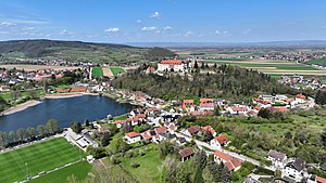
Traismauer is a municipality in the district of Sankt Pölten-Land in Lower Austria, Austria. It was established by the Romans, probably on a location of prior settlements. Some Roman buildings survive to this day.
Grafenwörth
Municipality in Lower Austria, Austria
Distance: Approx. 7143 meters
Latitude and longitude: 48.40666667,15.77861111
Grafenwörth is a municipality in the district of Tulln in the Austrian state of Lower Austria.
Sitzenberg-Reidling
Municipality in Lower Austria, Austria
Distance: Approx. 6799 meters
Latitude and longitude: 48.32,15.81333333
Sitzenberg-Reidling is a municipality in the district of Tulln in the Austrian state of Lower Austria.
Herzogenburg Monastery
Distance: Approx. 7605 meters
Latitude and longitude: 48.286389,15.695833
Herzogenburg Monastery (German: Stift Herzogenburg) is an Augustinian monastery located in Herzogenburg in Lower Austria. Founded in 1112 by Augustinian Canons, the monastery was refurbished in the Baroque style in 1714 by Jakob Prandtauer, Johann Bernhard Fischer von Erlach, and Josef Munggenast.
Krems (Lower Austria)
River in Lower Austria, Austria
Distance: Approx. 6035 meters
Latitude and longitude: 48.3838,15.7971
The Krems is a river in Waldviertel in northern Lower Austria. Its drainage basin is 366 km2 (141 sq mi). There are actually two rivers: the so-called "Große Krems" (Greater Krems), denoting either the whole river system or the main tributary only, and the smaller one called "Kleine Krems" (Lesser Krems).
Schloss Walpersdorf
Distance: Approx. 5783 meters
Latitude and longitude: 48.3131,15.6783
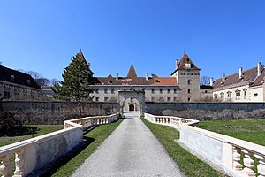
Schloss Walpersdorf is a castle in Lower Austria, Austria. Schloss Walpersdorf is 249 metres (817 ft) above sea level.
Weather in this IP's area
clear sky
-1 Celsius
-4 Celsius
-2 Celsius
1 Celsius
1038 hPa
98 %
1038 hPa
1014 hPa
10000 meters
1.92 m/s
2.11 m/s
268 degree
8 %


