46.57.105.8 - IP Lookup: Free IP Address Lookup, Postal Code Lookup, IP Location Lookup, IP ASN, Public IP
Country:
Region:
City:
Location:
Time Zone:
Postal Code:
IP information under different IP Channel
ip-api
Country
Region
City
ASN
Time Zone
ISP
Blacklist
Proxy
Latitude
Longitude
Postal
Route
Luminati
Country
Region
9
City
vienna
ASN
Time Zone
Europe/Vienna
ISP
Hutchison Drei Austria GmbH
Latitude
Longitude
Postal
IPinfo
Country
Region
City
ASN
Time Zone
ISP
Blacklist
Proxy
Latitude
Longitude
Postal
Route
IP2Location
46.57.105.8Country
Region
steiermark
City
sankt johann in der haide
Time Zone
Europe/Vienna
ISP
Language
User-Agent
Latitude
Longitude
Postal
db-ip
Country
Region
City
ASN
Time Zone
ISP
Blacklist
Proxy
Latitude
Longitude
Postal
Route
ipdata
Country
Region
City
ASN
Time Zone
ISP
Blacklist
Proxy
Latitude
Longitude
Postal
Route
Popular places and events near this IP address

Hartberg District
District in Styria, Austria
Distance: Approx. 6315 meters
Latitude and longitude: 47.3,15.949
Bezirk Hartberg is a former district of the state of Styria in Austria. Hartberg merged with the district of Fürstenfeld to form the new district Hartberg-Fürstenfeld on January 1, 2013.

Hartberg
Municipality in Styria, Austria
Distance: Approx. 3850 meters
Latitude and longitude: 47.28055556,15.97
Hartberg (Austrian German: [ˈhartbɛrɡ]) is a city in Styria, Austria and the district seat of Hartberg-Fürstenfeld District. As of January 1st 2024, it has a population of 6,713 in an area of 21.58 km2. About 68 km up the A2 Autobahn is the large Styrian capital of Graz.

Markt Allhau
Municipality in Burgenland, Austria
Distance: Approx. 5363 meters
Latitude and longitude: 47.28333333,16.08333333
Markt Allhau (Croatian: Oljhava) is a town in the district of Oberwart in the Austrian state of Burgenland.

Buch-Geiseldorf
Former municipality in Styria, Austria
Distance: Approx. 3939 meters
Latitude and longitude: 47.23555556,15.99194444
Buch-Geiseldorf is a former municipality in the district of Hartberg in Styria, Austria. It was united with Sankt Magdalena am Lemberg on January 1, 2013, to form the new municipality Buch-St. Magdalena in Hartberg-Fürstenfeld District.

Greinbach
Municipality in Styria, Austria
Distance: Approx. 5233 meters
Latitude and longitude: 47.30305556,15.97277778
Greinbach is a municipality in the district of Hartberg-Fürstenfeld in Styria, Austria.

Hartberg Umgebung
Municipality in Styria, Austria
Distance: Approx. 4435 meters
Latitude and longitude: 47.2725,15.95861111
Hartberg Umgebung is a municipality in the district of Hartberg-Fürstenfeld in Styria, Austria.

Rohr bei Hartberg
Municipality in Styria, Austria
Distance: Approx. 4229 meters
Latitude and longitude: 47.2375,16.0525
Rohr bei Hartberg is a municipality in the district of Hartberg-Fürstenfeld in Styria, Austria.

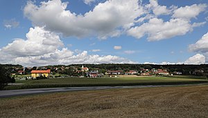
Sankt Johann in der Haide
Municipality in Styria, Austria
Distance: Approx. 1715 meters
Latitude and longitude: 47.28111111,16.02472222
Sankt Johann in der Haide is a municipality in the district of Hartberg-Fürstenfeld in Styria, Austria.

Sankt Magdalena am Lemberg
Former municipality in Styria, Austria
Distance: Approx. 4842 meters
Latitude and longitude: 47.22388889,16.02805556
Sankt Magdalena am Lemberg is a former municipality in the district of Hartberg in Styria, Austria. It was united with Buch-Geiseldorf on 1 January 2013 to form the new municipality Buch-St. Magdalena in Hartberg-Fürstenfeld District.
Hartberg-Fürstenfeld District
District in Styria, Austria
Distance: Approx. 6254 meters
Latitude and longitude: 47.3,15.95
Hartberg-Fürstenfeld (German: [ˈhartbɛrɡ ˈfʏrstn̩fɛld]) is a district in Styria, Austria. It came into effect on 1 January 2013 by merging the districts of Hartberg and Fürstenfeld.

Buch-Sankt Magdalena
Municipality in Styria, Austria
Distance: Approx. 4489 meters
Latitude and longitude: 47.22638889,16.015
Buch-Sankt Magdalena is a municipality in the district of Hartberg-Fürstenfeld in Styria, Austria. It was formed on 1 January 2013 by the merger of the former municipalities Sankt Magdalena am Lemberg and Buch-Geiseldorf.

Stadion Hartberg
Football stadium
Distance: Approx. 3354 meters
Latitude and longitude: 47.281192,15.977769
Stadion Hartberg, known as Profertil Arena Hartberg since 2014 for sponsorship reasons, is a football stadium in Hartberg, Austria. It is the home ground of TSV Hartberg, who compete in the Austrian Bundesliga. It was opened in 1946 and has a capacity of 5,024.
Weather in this IP's area
clear sky
0 Celsius
-2 Celsius
-1 Celsius
0 Celsius
1036 hPa
53 %
1036 hPa
986 hPa
10000 meters
1.82 m/s
1.85 m/s
328 degree