Country:
 Portugal
Region:
City:
Latitude and Longitude:
Time Zone:
Postal Code:
IP information under different IP Channel
ip-api
Country
Region
City
ASN
Time Zone
ISP
Blacklist
Proxy
Latitude
Longitude
Postal
Route
Luminati
Country
PTRegion
03
City
celoricodebasto
ASN
Time Zone
Europe/Lisbon
ISP
Servicos De Comunicacoes E Multimedia S.A.
Latitude
Longitude
Postal
IPinfo
Country
Region
City
ASN
Time Zone
ISP
Blacklist
Proxy
Latitude
Longitude
Postal
Route
db-ip
Country
Region
City
ASN
Time Zone
ISP
Blacklist
Proxy
Latitude
Longitude
Postal
Route
ipdata
Country
Region
City
ASN
Time Zone
ISP
Blacklist
Proxy
Latitude
Longitude
Postal
Route
Popular places and events near this IP address

Lisbon
Capital and largest city of Portugal
Distance: Approx. 617 meters
Latitude and longitude: 38.72527778,-9.15
Lisbon ( LIZ-bən; Portuguese: Lisboa [liʒˈβoɐ] ) is the capital and largest city of Portugal, with an estimated population of 567,131 as of 2023 within its administrative limits and 2,961,177 within the metropolis. Lisbon is mainland Europe's westernmost capital city (second overall after Reykjavik) and the only one along the Atlantic coast, the others (Reykjavik and Dublin) being on islands. The city lies in the western portion of the Iberian Peninsula, on the northern shore of the River Tagus.

Marquis of Pombal (title)
Distance: Approx. 624 meters
Latitude and longitude: 38.7253,-9.15024
Count of Oeiras (Portuguese: Conde de Oeiras) was a Portuguese title of nobility created by a royal decree, dated July 15, 1759, by King Joseph I of Portugal, and granted to Sebastião José de Carvalho e Melo, Chief Minister of the Portuguese government. Later, Joseph issued a royal decree dated September 16, 1769, in which he elevated the Count of Oeiras to the dignity of a marquisate as the Marquis of Pombal (Portuguese: Marquês de Pombal).

Marquis of Pombal Square
Roundabout in Lisbon, Portugal
Distance: Approx. 617 meters
Latitude and longitude: 38.72527778,-9.15
The Marquis of Pombal Square (Portuguese: Praça do Marquês de Pombal) is an important roundabout in the city of Lisbon, Portugal. It is located between the Avenida da Liberdade (Liberty Avenue) and the Eduardo VII Park in the former parish of Coração de Jesus and in the quarter of Santo António. The square is the radiating point for various important avenues: Liberdade, Duque de Loulé and Fontes Pereira de Melo, as well as the streets Braamcamp and Joaquim António de Aguiar.

Edward VII Park
Park in Lisbon, Portugal
Distance: Approx. 548 meters
Latitude and longitude: 38.728333,-9.152778
Edward VII Park (Portuguese: Parque Eduardo VII) is a public park in Lisbon, Portugal. The park occupies an area of 26 hectares (64 acres) to the north of Avenida da Liberdade and Marquis of Pombal Square in Lisbon's city center. The park is named for King Edward VII of the United Kingdom, who visited Portugal in 1903 to strengthen relations between the two countries and reaffirm the Anglo-Portuguese Alliance.
Institute for Nature Conservation and Forests
Distance: Approx. 616 meters
Latitude and longitude: 38.7358304,-9.1471787
The Institute for Nature Conservation and Forests (Portuguese: Instituto da Conservação da Natureza e das Florestas, I.P.), ICNF, is the responsible governmental body for the nature and forest policies, including the management of Protected Areas and State managed national, municipal and communal forests of mainland Portugal.
São Sebastião da Pedreira
Civil parish in Lisbon, Portugal
Distance: Approx. 264 meters
Latitude and longitude: 38.73,-9.15
São Sebastião da Pedreira (English: Saint Sebastian of the Quarry) was a Portuguese parish (freguesia) in the municipality of Lisbon. With the 2012 Administrative Reform, the former São Sebastião da Pedreira parish merged with the Nossa Senhora de Fátima parish into a new parish named Avenidas Novas.

Camões Secondary School
Secondary School in Lisbon, Portugal
Distance: Approx. 313 meters
Latitude and longitude: 38.73022222,-9.14338889
The Secondary School Luís de Camões (Portuguese: Escola Secundária Luís de Camões) is a secondary school located in the civil parish of Arroios, in the municipality and Portuguese capital of Lisbon, classified as a Monumento de Interesse Público (Monument of Public Interest) in 2012. Founded in 1902 and named after Portuguese poet Luís de Camões, it is one of the largest and most prestigious secondary schools in Lisbon, known for the many important Portuguese public figures who have attended it, including novelist António Lobo Antunes, current UN Secretary-General António Guterres and former President of the European Commission José Manuel Barroso.

Casa-Museu Dr. Anastácio Gonçalves
Residence/Museum in Lisbon, Portugal
Distance: Approx. 259 meters
Latitude and longitude: 38.73258333,-9.14641667
The Museum-Residence of Dr. Anastácio Gonçalves (Portuguese: Casa-Museu Dr. Anastácio Gonçalves) is a former residential home built in the Art Nouveau style that has been converted into a museum of nineteenth-century Portuguese painting and of Art Nouveau art and artifacts.

Saldanha Station
Metro station in Lisbon, Portugal
Distance: Approx. 544 meters
Latitude and longitude: 38.735,-9.14527778
Saldanha is an interchange station in central Lisbon, where the Red and Yellow Lines of the Lisbon Metro connect.
Parque Station
Metro station in Lisbon, Portugal
Distance: Approx. 301 meters
Latitude and longitude: 38.72944444,-9.15027778
Parque station is part of the Blue Line of the Lisbon Metro.

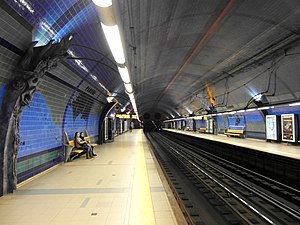
Picoas Station
Metro station in Lisbon, Portugal
Distance: Approx. 90 meters
Latitude and longitude: 38.73111111,-9.14694444
Picoas station is part of the Yellow Line of the Lisbon Metro, located on the north side of the city centre on Avenida Fontes Pereira de Melo.

Maternidade Alfredo da Costa
Hospital in Lisbon, Portugal
Distance: Approx. 234 meters
Latitude and longitude: 38.7324,-9.1471
Maternidade Alfredo da Costa (Portuguese pronunciation: [mɐtɨɾniˈðaðɨ alˈfɾeðu ðɐ ˈkɔʃtɐ], "Alfredo da Costa Maternity Hospital") is a public Central Hospital serving the Greater Lisbon area as part of the Central Lisbon University Hospital Centre (CHULC), a state-owned enterprise. Established in 1932 as a specialised maternity hospital, Alfredo da Costa Maternity Hospital was created to replace the old and increasingly inadequate Enfermaria de Santa Bárbara (Saint Barbara Ward), in Saint Joseph's Hospital, then the only maternity ward in the city. It evolved into a national reference centre in the field of obstetrics and gynaecology, social assistance and scientific research; it remains one of the largest maternity hospitals in the country (3,673 childbirths in 2017).
Weather in this IP's area
light rain
15 Celsius
14 Celsius
14 Celsius
16 Celsius
1016 hPa
80 %
1016 hPa
1007 hPa
10000 meters
3.09 m/s
60 degree
20 %
07:21:33
17:21:58