Country:
Region:
City:
Latitude and Longitude:
Time Zone:
Postal Code:
IP information under different IP Channel
ip-api
Country
Region
City
ASN
Time Zone
ISP
Blacklist
Proxy
Latitude
Longitude
Postal
Route
Luminati
Country
Region
03
City
celoricodebasto
ASN
Time Zone
Europe/Lisbon
ISP
Servicos De Comunicacoes E Multimedia S.A.
Latitude
Longitude
Postal
IPinfo
Country
Region
City
ASN
Time Zone
ISP
Blacklist
Proxy
Latitude
Longitude
Postal
Route
db-ip
Country
Region
City
ASN
Time Zone
ISP
Blacklist
Proxy
Latitude
Longitude
Postal
Route
ipdata
Country
Region
City
ASN
Time Zone
ISP
Blacklist
Proxy
Latitude
Longitude
Postal
Route
Popular places and events near this IP address

Vasco da Gama Bridge
Bridge in Lisbon, Portugal
Distance: Approx. 8598 meters
Latitude and longitude: 38.762,-9.043
The Vasco da Gama Bridge (Portuguese: Ponte Vasco da Gama) is a cable-stayed bridge flanked by viaducts that spans the Tagus River in Parque das Nações in Lisbon, the capital of Portugal. It is the second longest bridge in Europe, after the Crimean Bridge, and the longest one in the European Union. It was built to alleviate the congestion on Lisbon's 25 de Abril Bridge, and eliminate the need for traffic between the country's northern and southern regions to pass through the capital city.

Alcochete
Municipality in Setúbal, Portugal
Distance: Approx. 4861 meters
Latitude and longitude: 38.75,-8.96666667
Alcochete (Portuguese pronunciation: [alkuˈʃetɨ] ) is a municipality in Portugal. The population in 2011 was 17,569, in an area of 128.36 km². The municipality is composed of three parishes and is located in Setúbal District.

Moita
Municipality in Setúbal District, Portugal
Distance: Approx. 6365 meters
Latitude and longitude: 38.65,-8.98333333
Moita (pronounced [ˈmojtɐ] ) is a municipality in the district of Setúbal in Portugal. The population in 2011 was 66,029, in an area of 55.26 km2. The municipality is part of the Greater Lisbon Area, with a demographic rate of 1.194,9/km2 in 2011, growing from 533,2/km2 in 1960.

Montijo, Portugal
Municipality in Lisbon, Portugal
Distance: Approx. 6926 meters
Latitude and longitude: 38.68333333,-8.9
Montijo (Portuguese pronunciation: [mõˈtiʒu] ) is a city and municipality in Setúbal District in Portugal. Its name was Aldeia Galega do Ribatejo or simply Aldeia Galega until 1930. The population in 2021 was 55,732, in an area of 348.62 km2.

Sarilhos Pequenos
Civil parish in Lisbon, Portugal
Distance: Approx. 2873 meters
Latitude and longitude: 38.68166667,-8.98194444
Sarilhos Pequenos is town on the south margin of the Tagus River, near Lisbon, Portugal. Once a civil parish in the municipality of Moita, in the district of Setúbal, it merged in 2013 into the new parish of Gaio-Rosário e Sarilhos Pequenos. With an area of approximately 3.79 square kilometres (1.46 sq mi), the population of Sarilhos Pequenos was 1150 in 2011 (census data).

Alhos Vedros
Civil parish in Lisbon, Portugal
Distance: Approx. 7345 meters
Latitude and longitude: 38.653,-9.023
Alhos Vedros (pronounced [ˈaʎuʒ ˈvɛðɾuʃ]) is a town and a parish in the municipality of Moita, in Portugal. The population in 2011 was 15,050, in an area of 17.91 km2.
Baixa da Banheira e Vale da Amoreira
Civil parish in Lisbon, Portugal
Distance: Approx. 8076 meters
Latitude and longitude: 38.66,-9.045
Baixa da Banheira e Vale da Amoreira is a civil parish in the municipality of Moita, Portugal. It was formed in 2013 by the merger of the former parishes Baixa da Banheira and Vale da Amoreira. The population in 2011 was 30,949, in an area of 6.42 km2.

Montijo (parish)
Civil parish in Lisbon, Portugal
Distance: Approx. 974 meters
Latitude and longitude: 38.7,-8.96666667
Montijo is a former civil parish in the municipality of Montijo, central Portugal. In 2013, the parish merged into the new parish Montijo e Afonsoeiro. The population in 2021 was 55,732, in an area of 27.25 square kilometres (10.52 sq mi) km2.
Igreja de São João Baptista (Alcochete)
Distance: Approx. 5427 meters
Latitude and longitude: 38.7548362,-8.9639896
Igreja de São João Baptista is a church in Portugal. It is classified as a National Monument.

Montijo Air Base
Distance: Approx. 5391 meters
Latitude and longitude: 38.70388889,-9.03583333
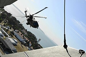
Montijo Air Base (Portuguese: Base Aérea do Montijo) (ICAO: LPMT) - officially known as Air Base No. 6 (Base Aérea n.º 6) or BA6 - is a military air base located in Montijo, Portugal. The base is home to three transport squadrons and one helicopter search and rescue squadron and provides logistic support to the Portuguese Navy's helicopters based there.
Gaio-Rosário e Sarilhos Pequenos
Civil parish in Lisbon, Portugal
Distance: Approx. 4674 meters
Latitude and longitude: 38.67,-9
Gaio-Rosário e Sarilhos Pequenos is a civil parish in the municipality of Moita, Portugal. It was formed in 2013 by the merger of the former parishes of Gaio-Rosário and Sarilhos Pequenos, respectively. The population in 2011 was 2,377, in an area of 14.12 km2.
Montijo e Afonsoeiro
Civil parish in Lisbon, Portugal
Distance: Approx. 213 meters
Latitude and longitude: 38.705,-8.975
Montijo e Afonsoeiro is a civil parish in the municipality of Montijo, Portugal. It was formed in 2013 by the merger of the former parishes Montijo and Afonsoeiro. The population in 2011 was 37,111, in an area of 31.46 km2.
Weather in this IP's area
light rain
15 Celsius
15 Celsius
14 Celsius
16 Celsius
1016 hPa
84 %
1016 hPa
1015 hPa
10000 meters
3.09 m/s
8.75 m/s
60 degree
20 %
07:20:48
17:21:20