Country:
 Portugal
Region:
City:
Latitude and Longitude:
Time Zone:
Postal Code:
IP information under different IP Channel
ip-api
Country
Region
City
ASN
Time Zone
ISP
Blacklist
Proxy
Latitude
Longitude
Postal
Route
Luminati
Country
PTASN
Time Zone
Europe/Lisbon
ISP
Servicos De Comunicacoes E Multimedia S.A.
Latitude
Longitude
Postal
IPinfo
Country
Region
City
ASN
Time Zone
ISP
Blacklist
Proxy
Latitude
Longitude
Postal
Route
db-ip
Country
Region
City
ASN
Time Zone
ISP
Blacklist
Proxy
Latitude
Longitude
Postal
Route
ipdata
Country
Region
City
ASN
Time Zone
ISP
Blacklist
Proxy
Latitude
Longitude
Postal
Route
Popular places and events near this IP address

Castanheira de Pera
Municipality in Centro, Portugal
Distance: Approx. 960 meters
Latitude and longitude: 40,-8.21666667
Castanheira de Pera (Portuguese pronunciation: [kɐʃtɐˈɲɐjɾɐ ðɨ ˈpeɾɐ] ), often erroneously written Castanheira de Pêra, is a municipality in the district of Leiria in Portugal. The population in 2011 was 3,191, in an area of 66.77 km². The present Mayor is Fernando José Pires Lopes, elected by the Socialist Party.

June 2017 Portugal wildfires
Four deadly fires in Leiria, Portugal
Distance: Approx. 7091 meters
Latitude and longitude: 39.94944444,-8.24555556
A series of four initial deadly wildfires erupted across central Portugal in the afternoon of 17 June 2017 within minutes of each other, resulting in at least 66 deaths and 204 injured people. The majority of deaths took place in the Pedrógão Grande municipality, when a fire swept across a road filled with evacuees escaping in their cars. Portuguese officials dispatched more than 1,700 firefighters nationwide to combat the blazes and Prime Minister António Costa declared three days of national mourning.
Nodeirinho
Village in Leiria, Portugal
Distance: Approx. 8862 meters
Latitude and longitude: 39.93,-8.23583333
Nodeirinho is a Portuguese village, located in the civil parish of Graça, municipality of Pedrógão Grande. Located between the towns of Avelar and Pedrógão Grande to the north of the IC8 road, it was heavily affected by the 2017 Portugal wildfires.
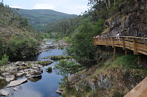
Paiva River
River in northern Portugal
Distance: Approx. 5835 meters
Latitude and longitude: 40.05,-8.25
The Paiva River (Portuguese pronunciation: [ˈpajˈvɐ]) is a river that rises in the Sierra de Leomil, more specifically in the parish of Pêra Velha, Aldeia de Nacomba e Ariz - belonging to the municipality of Moimenta da Beira - and flows into the Douro, in Castelo de Paiva, flowing through the parish of Fornos on the left bank. On the right bank, it flows through the parish of Souselo, Cinfães. It is classified as a Site of Community Importance in the Natura 2000 Network.
Weather in this IP's area
broken clouds
14 Celsius
13 Celsius
14 Celsius
14 Celsius
1018 hPa
71 %
1018 hPa
961 hPa
10000 meters
2.12 m/s
3.26 m/s
88 degree
69 %
07:20:47
17:15:15