Country:
Region:
City:
Latitude and Longitude:
Time Zone:
Postal Code:
IP information under different IP Channel
ip-api
Country
Region
City
ASN
Time Zone
ISP
Blacklist
Proxy
Latitude
Longitude
Postal
Route
Luminati
Country
Region
15
City
palmela
ASN
Time Zone
Europe/Lisbon
ISP
Servicos De Comunicacoes E Multimedia S.A.
Latitude
Longitude
Postal
IPinfo
Country
Region
City
ASN
Time Zone
ISP
Blacklist
Proxy
Latitude
Longitude
Postal
Route
db-ip
Country
Region
City
ASN
Time Zone
ISP
Blacklist
Proxy
Latitude
Longitude
Postal
Route
ipdata
Country
Region
City
ASN
Time Zone
ISP
Blacklist
Proxy
Latitude
Longitude
Postal
Route
Popular places and events near this IP address

Setúbal District
District of Portugal
Distance: Approx. 4939 meters
Latitude and longitude: 38.52430556,-8.89261111
The District of Setúbal (Portuguese: Distrito de Setúbal [sɨˈtuβal] ) is a district located in the south-west of Portugal. It is named for its capital, the city of Setúbal.

Setúbal
Municipality in Lisbon, Portugal
Distance: Approx. 4939 meters
Latitude and longitude: 38.52430556,-8.89261111
Setúbal ( sə-TOO-bəl, US also -bahl, European Portuguese: [sɨˈtuβal] ; Proto-Celtic: *Caetobrix) is a city and a municipality in Portugal. The population of the entire municipality in 2014 was 118,166, occupying an area of 230.33 km2 (88.9 sq mi). The city itself had 89,303 inhabitants in 2001.

Palmela
Municipality in Lisbon Region, Portugal
Distance: Approx. 537 meters
Latitude and longitude: 38.56666667,-8.9
Palmela (Portuguese pronunciation: [palˈmɛlɐ] ) is a town and municipality in Portugal. As of 2011, the population was 62,831, covering an area of 465.12 km². The municipality is located in the Lisboa Region and Setúbal District, about 25 km (16 mi) south of Lisbon.

Estádio do Bonfim
Stadium in Setúbal, Portugal
Distance: Approx. 4260 meters
Latitude and longitude: 38.531,-8.891
Estádio do Bonfim (Bonfim Stadium) is a multi-purpose stadium in Setúbal, Portugal. It is currently used primarily for football matches for Vitória F.C. The stadium was built in 1962 and was able to hold 18,694 spectators. Currently, holds 15,497 spectators.

Monastery of Jesus of Setúbal
Church in Lisbon, Portugal
Distance: Approx. 4696 meters
Latitude and longitude: 38.52614,-8.89484
The Monastery of Jesus (Portuguese: Mosteiro de Jesus) is a historical religious building in Setúbal, Portugal, which served a monastery of Poor Clare nuns. It is one of the first buildings in the Manueline style, the Portuguese version of late Gothic. The cloisters of the complex houses a museum of the monastery (Museu de Jesus).
Igreja de São Julião (Setúbal)
Distance: Approx. 4983 meters
Latitude and longitude: 38.5239,-8.8926
St. Julian's Church (Portuguese: Igreja de São Julião) is an 18th-century church located on the Praça de Bocage in Setúbal, Portugal. It is the main church (matriz) of the city classified as National Monument in 1910.

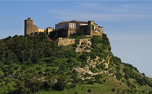
Castle of Palmela
Castle in Palmela, Setúbal, Portugal
Distance: Approx. 457 meters
Latitude and longitude: 38.56611111,-8.90111111
Castle of Palmela is a castle in Portugal. It is classified as a National Monument. The Castle of Palmela is located in the village, parish and county of the same name, district of Setúbal, in Portugal .
Igreja de Santiago de Palmela
Distance: Approx. 298 meters
Latitude and longitude: 38.5655916,-8.9035781
Igreja de Santiago de Palmela is a church in Portugal. It is classified as a National Monument. Construction first began in 1443, and the church was completed in 1482.

Artificial caves of Casal do Pardo
Prehistoric necropolis near Setúbal, Portugal
Distance: Approx. 2853 meters
Latitude and longitude: 38.56416667,-8.93861111
The four Artificial caves of Casal do Pardo (Portuguese: Grutas artificiais do Casal do Pardo), also known as the Caves of Quinta do Anjo, were neolithic tombs. They are situated in Palmela municipality in the Setúbal District, of Portugal, about 25 km (16 mi) south of the capital of Lisbon. These caves were classified as a National Monument of Portugal in 1934.

Castro of Chibanes
Chalcolithic and Roman site in Portugal
Distance: Approx. 1157 meters
Latitude and longitude: 38.56388889,-8.91861111
The Castro of Chibanes is located in the Arrábida Nature Park, on the Serra do Louro (Louro Hill), in the municipality of Palmela in the Setúbal District of Portugal, about 25 km (16 mi) south of the capital of Lisbon, which can be seen from the site. The Castro, or hill fort, is located at the top of the hill, naturally defended by a scarp to the south. It covers about one hectare and was first occupied in about 2900 BCE, during the Chalcolithic or Copper Age.
Azeda Lighthouse
Lighthouse in Setúbal, Portugal
Distance: Approx. 4014 meters
Latitude and longitude: 38.53861111,-8.87833333
The Azeda Lighthouse went into operation on 6 June 1940 at the Quinta da Azeda in Setúbal, in Setúbal District, Portugal. Initially the light was mounted in a hut on a hill but new housing construction made it difficult to see and in 1996 a 31-metre tall cylindrical tower was constructed. The lighthouse is situated about 3 kilometres inland.

Feu Guião Palace
Palace in Setúbal, Portugal
Distance: Approx. 4817 meters
Latitude and longitude: 38.52444444,-8.89944444
The Feu Guião Palace, Feu Guião Family Palace or Palace of the Adeantado, (Portuguese: Palácio Feu Guião), is an old mansion located in the Troino neighborhood, in the freguesia of São Julião, Nossa Senhora da Anunciada e Santa Maria da Graça, in Setúbal. It was built in the 18th century and restored from significant disrepair starting 2017.
Weather in this IP's area
overcast clouds
14 Celsius
14 Celsius
14 Celsius
16 Celsius
1016 hPa
85 %
1016 hPa
998 hPa
10000 meters
3.34 m/s
6.36 m/s
106 degree
100 %
07:20:13
17:21:23

