Country:
Region:
City:
Latitude and Longitude:
Time Zone:
Postal Code:
IP information under different IP Channel
ip-api
Country
Region
City
ASN
Time Zone
ISP
Blacklist
Proxy
Latitude
Longitude
Postal
Route
Luminati
Country
ASN
Time Zone
Europe/Lisbon
ISP
Servicos De Comunicacoes E Multimedia S.A.
Latitude
Longitude
Postal
IPinfo
Country
Region
City
ASN
Time Zone
ISP
Blacklist
Proxy
Latitude
Longitude
Postal
Route
db-ip
Country
Region
City
ASN
Time Zone
ISP
Blacklist
Proxy
Latitude
Longitude
Postal
Route
ipdata
Country
Region
City
ASN
Time Zone
ISP
Blacklist
Proxy
Latitude
Longitude
Postal
Route
Popular places and events near this IP address

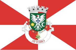
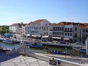
Aveiro, Portugal
Municipality in Centro, Portugal
Distance: Approx. 1278 meters
Latitude and longitude: 40.63333333,-8.65
Aveiro (pronounced [aˈvɐjɾu] ) is a city and a municipality in Portugal. In 2021, the population was 80,880, in an area of 197.58 square kilometres (76.29 sq mi): it is the second most populous city in the Centro Region of Portugal (after Coimbra). Along with the neighbouring city of Ílhavo, Aveiro is part of an urban agglomeration that includes 120,000 inhabitants, making it one of the most important populated regions by density in the North Region, and primary centre of the Intermunicipal Community of Aveiro and Baixo Vouga.
Esgueira
Civil parish in Centro, Portugal
Distance: Approx. 1410 meters
Latitude and longitude: 40.646,-8.629
Esgueira is an urban civil parish in the municipality (concelho) of Aveiro, in continental Portugal. The population in 2011 was 13,431, in an area of 17.15 km2 (6.62 sq mi).
University of Aveiro
Public polytechnic university in Aveiro, Portugal
Distance: Approx. 1857 meters
Latitude and longitude: 40.6303,-8.6575
The University of Aveiro (Portuguese: Universidade de Aveiro) is a public university, in addition to providing polytechnic education, located in the Portuguese city of Aveiro. Founded in 1973, it has a student population of approximately 12,500, distributed among 58 graduate, 40 Masters of Science and 25 PhD programs, distributed by departments and autonomous sections, with specialized faculties. It is a Research & Development university, with research departments developing programmes in fundamental and applied mathematics, physics, chemistry, telecommunications, robotics, bioinformatics, sea sciences, materials, design, business administration and industrial engineering.

Região de Aveiro
Intermunicipal community in Centro, Portugal
Distance: Approx. 2063 meters
Latitude and longitude: 40.63,-8.63
The Comunidade Intermunicipal da Região de Aveiro (Intermunicipal Aveiro Region) is an administrative division in Portugal. It was created in October 2008, replacing the previously existing Greater Metropolitan Area of Aveiro. Since January 2015, Região de Aveiro is also a NUTS3 subregion of Centro Region, that covers the same area as the intermunicipal community.

Aveiro District
District of Portugal
Distance: Approx. 790 meters
Latitude and longitude: 40.64111111,-8.65388889
Aveiro District (Portuguese: Distrito de Aveiro, pronounced [aˈvɐjɾu] ) is located in the central coastal region of Portugal. The capital of the district is the city of Aveiro, which also serves as the seat of Aveiro Municipality. Aveiro District is bordered by the Porto District to the north, the Viseu District to the east, the Coimbra District to the south, and the Atlantic Ocean to the west.

Baixo Vouga
Distance: Approx. 3244 meters
Latitude and longitude: 40.61666667,-8.63333333
Baixo Vouga (Portuguese pronunciation: [ˌbajʃu ˈvoɣɐ]) is a former Portuguese subregion integrated in the Centro Region. It was abolished at the January 2015 NUTS 3 revision. It was centered on the city of Aveiro.

Roman Catholic Diocese of Aveiro
Diocese of the Catholic Church
Distance: Approx. 656 meters
Latitude and longitude: 40.6397,-8.6504
The Diocese of Aveiro (Latin: Dioecesis Aveirensis) is a Latin Church diocese of the Catholic Church in Portugal. It has existed since 1938 when the historical dioceses of Coimbra, Porto, and Viseu were combined. It is a suffragan of the archdiocese of Braga.

Estádio Mário Duarte
Football stadium in Aveiro, Portugal
Distance: Approx. 1636 meters
Latitude and longitude: 40.63,-8.65
Estádio Mário Duarte was a football stadium in Aveiro, Portugal. It was used as the stadium of S.C. Beira-Mar matches. The capacity of the stadium was 12,000 spectators.
Santa Joana (parish)
Civil parish in Centro, Portugal
Distance: Approx. 2627 meters
Latitude and longitude: 40.632,-8.619
Santa Joana is a civil parish in Aveiro Municipality, Aveiro District, Portugal. The population in 2011 was 8,094, in an area of 5.85 km2.

Cathedral of Aveiro
Distance: Approx. 648 meters
Latitude and longitude: 40.63972222,-8.65027778
The Cathedral of Aveiro (Portuguese: Sé de Aveiro), also known as the Church of St. Dominic (Portuguese: Igreja de São Domingos), is a Roman Catholic cathedral in Aveiro, Portugal. It is the seat of the Diocese of Aveiro and built in Portuguese Baroque.

Church of São João Evangelista (Aveiro)
Church in Centro, Portugal
Distance: Approx. 942 meters
Latitude and longitude: 40.6383,-8.6534
A Church of São João Evangelista (Portuguese: Igreja de São João Evangelista), or Carmelite Church of Aveiro, is an 18th-century church in the Praça Marquês de Pombal, in the civil parish of Glória e Vera Cruz, in the Portuguese municipality of Aveiro. It was declared a national monument in 1910.
Glória e Vera Cruz
Civil parish in Centro, Portugal
Distance: Approx. 551 meters
Latitude and longitude: 40.6435,-8.65197222
Glória e Vera Cruz is a civil parish in the municipality of Aveiro, in the central Portuguese district of Aveiro. It was constituted in 2013, following the national administrative reform, through aggregation of the civil parishes of Glória and Vera Cruz, resulting a cumulative population of 18756 inhabitants dispersed through a total area of 45.32 square kilometres (17.50 sq mi).
Weather in this IP's area
broken clouds
14 Celsius
14 Celsius
14 Celsius
14 Celsius
1017 hPa
82 %
1017 hPa
1015 hPa
10000 meters
2.74 m/s
5.65 m/s
103 degree
59 %
07:24:04
17:15:27

