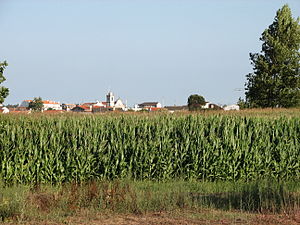
Country:
Region:
City:
Latitude and Longitude:
Time Zone:
Postal Code:
IP information under different IP Channel
ip-api
Country
Region
City
ASN
Time Zone
ISP
Blacklist
Proxy
Latitude
Longitude
Postal
Route
Luminati
Country
ASN
Time Zone
Europe/Lisbon
ISP
Servicos De Comunicacoes E Multimedia S.A.
Latitude
Longitude
Postal
IPinfo
Country
Region
City
ASN
Time Zone
ISP
Blacklist
Proxy
Latitude
Longitude
Postal
Route
db-ip
Country
Region
City
ASN
Time Zone
ISP
Blacklist
Proxy
Latitude
Longitude
Postal
Route
ipdata
Country
Region
City
ASN
Time Zone
ISP
Blacklist
Proxy
Latitude
Longitude
Postal
Route
Popular places and events near this IP address
Ovar
Municipality in Centro, Portugal
Distance: Approx. 1133 meters
Latitude and longitude: 40.86666667,-8.63333333
Ovar (Portuguese pronunciation: [ɔˈvaɾ] or [oˈvaɾ]) is a city and a municipality in Aveiro District, Baixo Vouga Subregion in Portugal. The population in 2011 was 55,398, in an area of 147.70 km2. It had 42,582 eligible voters (2006).
Souto (Santa Maria da Feira)
Civil parish in Norte, Portugal
Distance: Approx. 6313 meters
Latitude and longitude: 40.888,-8.561
Souto is a former civil parish in the municipality of Santa Maria da Feira, Portugal. In 2013, the parish merged into the new parish São Miguel do Souto e Mosteirô. It has a population of 4,835 inhabitants and a total area of 9.40 km2.
Espargo
Civil parish in Norte, Portugal
Distance: Approx. 8276 meters
Latitude and longitude: 40.923,-8.576
Espargo is a former civil parish in the municipality of Santa Maria da Feira, Portugal. In 2013, the parish merged into the new parish Santa Maria da Feira, Travanca, Sanfins e Espargo. It has a population of 1,309 inhabitants and a total area of 5.70 km2.
Mosteirô
Civil parish in Norte, Portugal
Distance: Approx. 9110 meters
Latitude and longitude: 40.899,-8.531
Mosteirô is a former civil parish in the municipality of Santa Maria da Feira, Portugal. In 2013, the parish merged into the new parish São Miguel do Souto e Mosteirô. It has a population of 2,043 inhabitants and a total area of 2.95 km2.
Travanca (Santa Maria da Feira)
Civil parish in Norte, Portugal
Distance: Approx. 7249 meters
Latitude and longitude: 40.911,-8.574
Travanca is a former civil parish in the municipality of Santa Maria da Feira, Portugal. In 2013, the parish merged into the new parish Santa Maria da Feira, Travanca, Sanfins e Espargo. It has a population of 2,201 inhabitants and a total area of 5.72 km2.

Castle of Santa Maria da Feira
Castle in Santa Maria da Feira, Aveiro, Portugal
Distance: Approx. 9814 meters
Latitude and longitude: 40.92100556,-8.54276389
The Castle of Santa Maria da Feira is a Portuguese castle in the municipality of Santa Maria da Feira, district of Aveiro. Emblematic of Portuguese medieval military architecture, the Castle of Santa Maria da Feira is one of the monuments that best reflects the diversity of defenses used during the Middle Ages, having been instrumental in the process of Reconquista and autonomy of the County of Portugal. It has been listed as a National monument since 1910.

Cortegaça, Ovar
Civil parish in Centro, Portugal
Distance: Approx. 9733 meters
Latitude and longitude: 40.946,-8.622
Cortegaça is a small village and a civil parish in the Ovar Municipality, Portugal. The population in 2011 was 3,837, in an area of 9.23 km2 (3.56 sq mi). It is a village dating back to the 9th and 10th centuries, associated with the repopulation of the lands of Santa Maria da Feira.

Ponte da Varela
Bridge in Aveiro District, Portugal
Distance: Approx. 8682 meters
Latitude and longitude: 40.78944444,-8.67277778
Ponte da Varela is a bridge in Aveiro District in Portugal. It was inaugurated on June 22, 1964, after a lengthy design phase. The bridge is constructed of concrete and steel, with the legs far enough apart to allow ships to pass beneath.
Avanca
Civil parish in Centro, Portugal
Distance: Approx. 7230 meters
Latitude and longitude: 40.807,-8.573
Avanca is a civil parish in the municipality of Estarreja, in the central subregion of Baixo Vouga. The population in 2011 was 6,189, in an area of 21.07 km2.
São Miguel do Souto e Mosteirô
Civil parish in Norte, Portugal
Distance: Approx. 7046 meters
Latitude and longitude: 40.888,-8.551
São Miguel do Souto e Mosteirô is a civil parish in the municipality of Santa Maria da Feira, Portugal. It was formed in 2013 by the merger of the former parishes Souto and Mosteirô. The population in 2011 was 6,734, in an area of 13.80 km2.
Pardilhó
Civil parish in Centro, Portugal
Distance: Approx. 6802 meters
Latitude and longitude: 40.7975,-8.62472222
Pardilhó is a village and a civil parish of the municipality of Estarreja, Portugal. The population in 2011 was 4,176, in an area of 15.7 km2.
Weather in this IP's area
scattered clouds
14 Celsius
14 Celsius
14 Celsius
17 Celsius
1017 hPa
68 %
1017 hPa
1015 hPa
10000 meters
2.48 m/s
3.12 m/s
82 degree
37 %
07:24:30
17:14:51

