Country:
Region:
City:
Latitude and Longitude:
Time Zone:
Postal Code:
IP information under different IP Channel
ip-api
Country
Region
City
ASN
Time Zone
ISP
Blacklist
Proxy
Latitude
Longitude
Postal
Route
Luminati
Country
ASN
Time Zone
Europe/Lisbon
ISP
Servicos De Comunicacoes E Multimedia S.A.
Latitude
Longitude
Postal
IPinfo
Country
Region
City
ASN
Time Zone
ISP
Blacklist
Proxy
Latitude
Longitude
Postal
Route
db-ip
Country
Region
City
ASN
Time Zone
ISP
Blacklist
Proxy
Latitude
Longitude
Postal
Route
ipdata
Country
Region
City
ASN
Time Zone
ISP
Blacklist
Proxy
Latitude
Longitude
Postal
Route
Popular places and events near this IP address

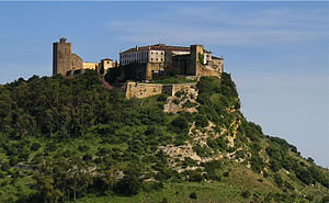
Reguengos de Monsaraz
Municipality in Alentejo, Portugal
Distance: Approx. 971 meters
Latitude and longitude: 38.41666667,-7.53333333
Reguengos de Monsaraz (European Portuguese pronunciation: [rɨˈɣẽɡuʒ ðɨ mõsɐˈɾaʃ] ) is a municipality in Évora District in Portugal. The population in 2011 was 10,828, in an area of 464.00 km2. The City of Reguengos de Monsaraz proper has a population of 7,308.
Castle of Degebe
Castle in Portugal
Distance: Approx. 2278 meters
Latitude and longitude: 38.41513889,-7.55761111
The Castle of Degebe (Portuguese: Castelo Velho do Debege) is a medieval castle located in the civil parish of Reguengos de Monsaraz, in the municipality of Reguengos de Monsaraz, Portuguese district of Évora.

Castle of Esporão
Castle in the district of Évora, Portugal
Distance: Approx. 3406 meters
Latitude and longitude: 38.3983639,-7.5534546
The Castle of Esporão (Portuguese: Castelo de Esporão) is a medieval castle in the civil parish of Reguengos de Monsaraz, municipality of Reguengos de Monsaraz, district of Évora. It is classified by IGESPAR as a Site of Public Interest.
Castle of Vidigueiras
Distance: Approx. 3940 meters
Latitude and longitude: 38.39389722,-7.51410833
The Castle of Vidigueiras is a signeurial residential estate in the civil parish of Reguengos de Monsaraz in the municipality of Reguengos de Monsaraz in the Portuguese sub-region of Baixo Alentejo. It is the only residential project completed by landscape architect Francisco Caldeira Cabral.

Rocha dos Namorados
Pagan site in Évora district, Portugal
Distance: Approx. 5632 meters
Latitude and longitude: 38.44513889,-7.47552778
The Rocha dos Namorados (Lovers’ Rock) is a large upright granite stone located in the parish of Corval, municipality of Reguengos de Monsaraz, in the Évora District of the Alentejo region of Portugal. It is sometimes considered to be a menhir or standing stone but there is no evidence of it having been placed at the site and it seems to be a natural outcrop, although it does have some dimpled, megalithic engravings, as well as a cross, which is believed to have been carved in order to Christianise what was an ancient ritual. It is considered a rare example of the veneration of stones associated with a secular, pagan fertility rite that has continued to the present.
Weather in this IP's area
light rain
13 Celsius
12 Celsius
13 Celsius
13 Celsius
1016 hPa
78 %
1016 hPa
989 hPa
10000 meters
1.57 m/s
1.82 m/s
91 degree
100 %
07:14:24
17:16:13