46.37.240.73 - IP Lookup: Free IP Address Lookup, Postal Code Lookup, IP Location Lookup, IP ASN, Public IP
Country:
Region:
City:
Location:
Time Zone:
Postal Code:
IP information under different IP Channel
ip-api
Country
Region
City
ASN
Time Zone
ISP
Blacklist
Proxy
Latitude
Longitude
Postal
Route
Luminati
Country
ASN
Time Zone
Europe/Rome
ISP
ip telecom srl
Latitude
Longitude
Postal
IPinfo
Country
Region
City
ASN
Time Zone
ISP
Blacklist
Proxy
Latitude
Longitude
Postal
Route
IP2Location
46.37.240.73Country
Region
marche
City
castel di lama
Time Zone
Europe/Rome
ISP
Language
User-Agent
Latitude
Longitude
Postal
db-ip
Country
Region
City
ASN
Time Zone
ISP
Blacklist
Proxy
Latitude
Longitude
Postal
Route
ipdata
Country
Region
City
ASN
Time Zone
ISP
Blacklist
Proxy
Latitude
Longitude
Postal
Route
Popular places and events near this IP address

Ancarano
Comune in Abruzzo, Italy
Distance: Approx. 3632 meters
Latitude and longitude: 42.83333333,13.73333333
Ancarano (Marchigiano: 'Ngarà) is a town and comune in Teramo province in the Abruzzo region of eastern Italy.
Sant'Egidio alla Vibrata
Comune in Abruzzo, Italy
Distance: Approx. 3454 meters
Latitude and longitude: 42.83333333,13.71666667
Sant'Egidio alla Vibrata (Abruzzo: Sand'llië) is a town and comune in the province of Teramo, in the Abruzzo region of central Italy, located in the Vibrata river valley.

Appignano del Tronto
Comune in Marche, Italy
Distance: Approx. 5850 meters
Latitude and longitude: 42.9,13.66666667
Appignano del Tronto is a comune (municipality) in the Province of Ascoli Piceno in the Italian region Marche, located about 80 kilometres (50 mi) south of Ancona and about 9 kilometres (6 mi) northeast of Ascoli Piceno. Appignano del Tronto borders the following municipalities: Ascoli Piceno, Castel di Lama, Castignano, Offida.

Castel di Lama
Comune in Marche, Italy
Distance: Approx. 1597 meters
Latitude and longitude: 42.86666667,13.7
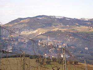
Castel di Lama is a comune (municipality) in the Province of Ascoli Piceno in the Italian region Marche, located about 80 kilometres (50 mi) south of Ancona and about 10 kilometres (6 mi) east of Ascoli Piceno. Castel di Lama borders the following municipalities: Appignano del Tronto, Ascoli Piceno, Castorano, Offida. The name comes from a mediaeval castle on the hill, which now houses the hotel Borgo Storico Seghetti Panichi.

Castorano
Comune in Marche, Italy
Distance: Approx. 4136 meters
Latitude and longitude: 42.9,13.73333333
Castorano is a comune (municipality) in the Province of Ascoli Piceno in the Italian region Marche, located about 80 kilometres (50 mi) south of Ancona and about 13 kilometres (8 mi) northeast of Ascoli Piceno. Castorano borders the following municipalities: Ascoli Piceno, Castel di Lama, Colli del Tronto, Monsampolo del Tronto, Offida, Spinetoli.
Colli del Tronto
Comune in Marche, Italy
Distance: Approx. 3281 meters
Latitude and longitude: 42.88333333,13.75
Colli del Tronto ("Tronto's hills") is a comune (municipality) in the Province of Ascoli Piceno in the Italian region Marche, located about 80 kilometres (50 mi) south of Ancona and about 14 kilometres (9 mi) northeast of Ascoli Piceno. As of 31 December 2004, it had a population of 3,290 and an area of 5.9 square kilometres (2.3 sq mi). Colli del Tronto borders the following municipalities: Ancarano, Ascoli Piceno, Castorano, Spinetoli.
Maltignano
Comune in Marche, Italy
Distance: Approx. 4528 meters
Latitude and longitude: 42.83333333,13.68333333
Maltignano is a comune (municipality) in the Province of Ascoli Piceno in the Italian region Marche, located about 90 kilometres (56 mi) south of Ancona and about 8 kilometres (5 mi) east of Ascoli Piceno. As of 31 December 2004, it had a population of 2,470 and an area of 8.2 square kilometres (3.2 sq mi).
Monsampolo del Tronto
Comune in Marche, Italy
Distance: Approx. 5637 meters
Latitude and longitude: 42.88333333,13.78333333
Monsampolo del Tronto is a comune (municipality) in the Province of Ascoli Piceno in the Italian region Marche, located about 80 kilometres (50 mi) south of Ancona and about 18 kilometres (11 mi) southwest of Ascoli Piceno. Monsampolo del Tronto borders the following municipalities: Acquaviva Picena, Castorano, Controguerra, Monteprandone, Offida, Spinetoli.

Spinetoli
Comune in Marche, Italy
Distance: Approx. 4407 meters
Latitude and longitude: 42.88333333,13.76666667
Spinetoli is a comune (municipality) in the Province of Ascoli Piceno in the Italian region Marche, located about 80 kilometres (50 mi) south of Ancona and about 15 kilometres (9 mi) east of Ascoli Piceno. As of 31 December 2004, it had a population of 6,351 and an area of 12.4 square kilometres (4.8 sq mi). Spinetoli borders the following municipalities: Ancarano, Castorano, Colli del Tronto, Controguerra, Monsampolo del Tronto, Offida.
Santa Reparata, Civitella del Tronto
Frazione in Abruzzo, Italy
Distance: Approx. 6437 meters
Latitude and longitude: 42.80861111,13.69805556
Santa Reparata (Civitella del Tronto) is a frazione in the Province of Teramo in the Abruzzo region of Italy.

Borgo Storico Seghetti Panichi
Distance: Approx. 300 meters
Latitude and longitude: 42.86694444,13.72
The Borgo Storico Seghetti Panichi near Ascoli Piceno in Marche region of central Italy comprises a 13th to 18th-century villa, a 19th-century romantic landscape by Ludwig Winter (one of the Grandi Giardini Italiani), a 16th-century chapel to St. Pancras and a farmstead which has been converted into a hotel.
Picchio Racing Cars
Distance: Approx. 1592 meters
Latitude and longitude: 42.8519509,13.729149
Picchio Racing Cars is a small Italian racing and road automobile manufacturer, based in the town of Ancarano, Teramo.
Weather in this IP's area
overcast clouds
6 Celsius
4 Celsius
5 Celsius
7 Celsius
1023 hPa
88 %
1023 hPa
1015 hPa
10000 meters
3.13 m/s
5.36 m/s
263 degree
100 %
