46.29.227.64 - IP Lookup: Free IP Address Lookup, Postal Code Lookup, IP Location Lookup, IP ASN, Public IP
Country:
Region:
City:
Location:
Time Zone:
Postal Code:
IP information under different IP Channel
ip-api
Country
Region
City
ASN
Time Zone
ISP
Blacklist
Proxy
Latitude
Longitude
Postal
Route
Luminati
Country
Region
20
City
rakovnik
ASN
Time Zone
Europe/Prague
ISP
ISP Alliance a.s.
Latitude
Longitude
Postal
IPinfo
Country
Region
City
ASN
Time Zone
ISP
Blacklist
Proxy
Latitude
Longitude
Postal
Route
IP2Location
46.29.227.64Country
Region
stredocesky kraj
City
rakovnik
Time Zone
Europe/Prague
ISP
Language
User-Agent
Latitude
Longitude
Postal
db-ip
Country
Region
City
ASN
Time Zone
ISP
Blacklist
Proxy
Latitude
Longitude
Postal
Route
ipdata
Country
Region
City
ASN
Time Zone
ISP
Blacklist
Proxy
Latitude
Longitude
Postal
Route
Popular places and events near this IP address

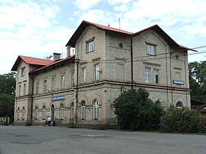
Rakovník
Town in the Czech Republic
Distance: Approx. 22 meters
Latitude and longitude: 50.10388889,13.73333333
Rakovník (Czech pronunciation: [ˈrakovɲiːk], German: Rakonitz) is a town in the Central Bohemian Region of the Czech Republic. It has about 16,000 inhabitants. The historic town centre is well preserved and is protected by law as an urban monument zone.

Senomaty
Market town in Central Bohemian, Czech Republic
Distance: Approx. 5709 meters
Latitude and longitude: 50.09833333,13.65388889
Senomaty is a market town in Rakovník District in the Central Bohemian Region of the Czech Republic. It has about 1,300 inhabitants.

Lubná (Rakovník District)
Municipality in Central Bohemian, Czech Republic
Distance: Approx. 3779 meters
Latitude and longitude: 50.07694444,13.70083333
Lubná is a municipality and village in Rakovník District in the Central Bohemian Region of the Czech Republic. It has about 1,100 inhabitants.
Lužná (Rakovník District)
Municipality in Central Bohemian, Czech Republic
Distance: Approx. 3446 meters
Latitude and longitude: 50.12388889,13.77
Lužná is a municipality and village in Rakovník District in the Central Bohemian Region of the Czech Republic. It has about 2,000 inhabitants.

Olešná (Rakovník District)
Municipality in Central Bohemian, Czech Republic
Distance: Approx. 3858 meters
Latitude and longitude: 50.12861111,13.69583333
Olešná is a municipality and village in Rakovník District in the Central Bohemian Region of the Czech Republic. It has about 600 inhabitants.

Lišany (Rakovník District)
Municipality in Central Bohemian, Czech Republic
Distance: Approx. 4914 meters
Latitude and longitude: 50.1475,13.74194444
Lišany is a municipality and village in Rakovník District in the Central Bohemian Region of the Czech Republic. It has about 700 inhabitants.

Pavlíkov
Market town in Central Bohemian, Czech Republic
Distance: Approx. 5302 meters
Latitude and longitude: 50.05611111,13.73638889
Pavlíkov is a market town in Rakovník District in the Central Bohemian Region of the Czech Republic. It has about 1,100 inhabitants.
Rakovník District
District in Central Bohemian, Czech Republic
Distance: Approx. 412 meters
Latitude and longitude: 50.1,13.73333333
Rakovník District (Czech: okres Rakovník) is a district in the Central Bohemian Region of the Czech Republic. Its capital is the town of Rakovník.

Hvozd (Rakovník District)
Municipality in Central Bohemian, Czech Republic
Distance: Approx. 6311 meters
Latitude and longitude: 50.05166667,13.69833333
Hvozd is a municipality and village in Rakovník District in the Central Bohemian Region of the Czech Republic. It has about 200 inhabitants.

Příčina
Municipality in Central Bohemian, Czech Republic
Distance: Approx. 6333 meters
Latitude and longitude: 50.06583333,13.66722222
Příčina is a municipality and village in Rakovník District in the Central Bohemian Region of the Czech Republic. It has about 200 inhabitants.

Senec (Rakovník District)
Municipality in Central Bohemian, Czech Republic
Distance: Approx. 4535 meters
Latitude and longitude: 50.06666667,13.70694444
Senec is a municipality and village in Rakovník District in the Central Bohemian Region of the Czech Republic. It has about 300 inhabitants.

České dráhy Museum
Railway museum in Lužná, Czech Republic
Distance: Approx. 5546 meters
Latitude and longitude: 50.14555556,13.77555556
The České dráhy Museum (Czech: Muzeum Českých drah) is a railway museum in Lužná in the Central Bohemian Region of the Czech Republic. it is operated by the České dráhy company. It is located close to the local railway station.
Weather in this IP's area
overcast clouds
1 Celsius
-3 Celsius
-0 Celsius
2 Celsius
1019 hPa
91 %
1019 hPa
979 hPa
10000 meters
4.78 m/s
10.11 m/s
295 degree
100 %

