46.255.173.26 - IP Lookup: Free IP Address Lookup, Postal Code Lookup, IP Location Lookup, IP ASN, Public IP
Country:
Region:
City:
Location:
Time Zone:
Postal Code:
IP information under different IP Channel
ip-api
Country
Region
City
ASN
Time Zone
ISP
Blacklist
Proxy
Latitude
Longitude
Postal
Route
Luminati
Country
Region
so
City
bellach
ASN
Time Zone
Europe/Zurich
ISP
Quickline AG
Latitude
Longitude
Postal
IPinfo
Country
Region
City
ASN
Time Zone
ISP
Blacklist
Proxy
Latitude
Longitude
Postal
Route
IP2Location
46.255.173.26Country
Region
bern
City
biel
Time Zone
Europe/Zurich
ISP
Language
User-Agent
Latitude
Longitude
Postal
db-ip
Country
Region
City
ASN
Time Zone
ISP
Blacklist
Proxy
Latitude
Longitude
Postal
Route
ipdata
Country
Region
City
ASN
Time Zone
ISP
Blacklist
Proxy
Latitude
Longitude
Postal
Route
Popular places and events near this IP address

Biel/Bienne
Municipality in Bern, Switzerland
Distance: Approx. 459 meters
Latitude and longitude: 47.13333333,7.25
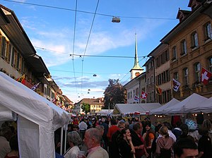
Biel/Bienne (official bilingual wording; German: Biel [biːl] ; French: Bienne [bjɛn]; locally Alemannic German: [ˈb̥iˑəu]; Italian: Bienna; Romansh: Bienna; Latin: Belna) is a bilingual city in the canton of Bern in Switzerland. With over 55,000 residents, it is the country's tenth-largest city by population. The Biel urban area has a population of around 100,000 inhabitants.

Biel District
District in Switzerland
Distance: Approx. 822 meters
Latitude and longitude: 47.1333,7.23333
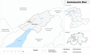
Biel/Bienne District is a constitutional district (Amtsbezirk) in the canton of Bern in Switzerland with its seat Biel/Bienne. It is bi-lingual (41% French and 59% German) and includes two municipalities in an area of 25 km2: From 1 January 2010, the district lost its administrative power while being replaced by the administrative district of Biel/Bienne. Since 2010, it remains a fully recognised district under the law and the Constitution (Art.3 al.2) of the canton of Bern.

Glycine (watch)
Swiss watch manufacturer
Distance: Approx. 1061 meters
Latitude and longitude: 47.141791,7.246484
Glycine Watch SA, or simply Glycine ( ), is a Swiss watchmaker founded in 1914 in Biel/Bienne (BE), Switzerland, where its manufacturing and headquarters remain today. In 1930, Glycine released the first mass-produced automatic watches, and in 1959, it developed vacuum-sealed cases, allowing for more durable and water-resistant timepieces. The Glycine Airman, the first watch capable of tracking two 24-hour time zones, has been used extensively in commercial and military aviation, as well as in spaceflights; notable examples include its use by United States Air Force pilots during the Vietnam War and astronaut Pete Conrad during the Gemini 5 and Gemini 11 spaceflights.

Nidau
Municipality in Bern, Switzerland
Distance: Approx. 459 meters
Latitude and longitude: 47.13333333,7.25
Nidau is a municipality in the Biel/Bienne administrative district in the canton of Bern in Switzerland.
Madretsch
Distance: Approx. 784 meters
Latitude and longitude: 47.13222222,7.25444444
Madretsch (formerly Mardrez) is a former commune in the Swiss canton of Bern. It is a suburb of Biel/Bienne, which it joined in 1920. Previously a rural suburb with some remaining farms and green areas, it has now become fully integrated as a city suburb, without any real local character any more.
Suze (river)
River in the Bernese Jura, Canton of Bern, Switzerland
Distance: Approx. 790 meters
Latitude and longitude: 47.1319,7.2337
The Suze (German: Schüss) is a river in the Bernese Jura, canton of Bern, Switzerland.
Biel/Bienne (administrative district)
Administrative District in Switzerland
Distance: Approx. 822 meters
Latitude and longitude: 47.13333333,7.23333333
Biel/Bienne District is an administrative district in the Canton of Bern, Switzerland. It is located along both shores of the northeastern half of Lake Biel and is part of the Seeland administrative region, and its capital is Biel/Bienne. It contains 19 municipalities with an area of 97.63 km2 (37.70 sq mi) and a population (as of December 2008) of 90,536, over half of which lives in the district's capital.
Seeland Region
Distance: Approx. 615 meters
Latitude and longitude: 47.137497,7.247238
Seeland Region is one of five administrative regions of the canton of Bern, with a population of 66,000 (as of 2005) in 62 municipalities (Biel-Bienne 19 and Seeland 43 municipalities).

Biel/Bienne railway station
Railway station in Biel/Bienne, Canton of Bern, Switzerland
Distance: Approx. 105 meters
Latitude and longitude: 47.132885,7.24291806
Biel/Bienne railway station (German: Bahnhof Biel; French: Gare de Bienne) serves the bilingual municipality of Biel/Bienne, in the canton of Bern, Switzerland. It is a major railway junction on the Swiss railways network. It lies on one of the two busiest major railway lines between the northeastern (St.

Bienne–Evilard Funicular
Funicular railway in canton of Bern, Switzerland
Distance: Approx. 1533 meters
Latitude and longitude: 47.14611111,7.24222222
The Bienne–Evilard Funicular (German:Leubringenbahn; French:Funiculaire Bienne–Evilard) is a funicular railway in the bilingual city of Biel/Bienne in the Swiss canton of Bern. The funicular links Biel/Bienne with Leubringen/Evilard in the Jura mountains above the town. The line is operated by Verkehrsbetriebe Biel/Transports publics biennois (short: VB/TPB) since 2014.

Trams in Biel/Bienne
Tramway network in Biel/Bienne, Switzerland
Distance: Approx. 42 meters
Latitude and longitude: 47.13222222,7.24361111
The Biel/Bienne tramway network (Alemannic German: Strassenbahnnetz Biel; French: Réseau tramway de Bienne) was part of the public transport network of the bilingual city of Biel/Bienne, in the canton of Bern, Switzerland, and its environs for more than 70 years. Opened in 1877, the network operated as a horsecar tramway (Rösslitram) until 1902, when it was electrified and converted from 1,435 mm (4 ft 8+1⁄2 in) standard gauge to 1,000 mm (3 ft 3+3⁄8 in) metre gauge. Initially, the operator was the Compagnie générale des tramways suisses (TS) of Geneva, a predecessor of today's Transports Publics Genevois (TPC).

City Church of Biel
Church in Canton of Bern, Switzerland
Distance: Approx. 1016 meters
Latitude and longitude: 47.14138889,7.24638889
The City Church of Biel (German: Stadtkirche Biel) is a Swiss Reformed church in Biel/Bienne, Switzerland. Built in the Gothic style, its construction started around 1451 and was mostly complete in 1470. The church is considered one of the most significant late-Gothic churches in Switzerland and is a Swiss Cultural Property of National Significance.
Weather in this IP's area
broken clouds
2 Celsius
-2 Celsius
-1 Celsius
5 Celsius
1024 hPa
92 %
1024 hPa
970 hPa
10000 meters
3 m/s
8.9 m/s
215 degree
71 %

