46.253.9.136 - IP Lookup: Free IP Address Lookup, Postal Code Lookup, IP Location Lookup, IP ASN, Public IP
Country:
 Bulgaria
Region:
City:
Location:
Time Zone:
Postal Code:
ISP:
ASN:
language:
User-Agent:
Proxy IP:
Blacklist:
IP information under different IP Channel
ip-api
Country
Region
City
ASN
Time Zone
ISP
Blacklist
Proxy
Latitude
Longitude
Postal
Route
db-ip
Country
Region
City
ASN
Time Zone
ISP
Blacklist
Proxy
Latitude
Longitude
Postal
Route
IPinfo
Country
Region
City
ASN
Time Zone
ISP
Blacklist
Proxy
Latitude
Longitude
Postal
Route
IP2Location
46.253.9.136Country
bgRegion
silistra
City
silistra
Time Zone
Europe/Sofia
ISP
Language
User-Agent
Latitude
Longitude
Postal
ipdata
Country
Region
City
ASN
Time Zone
ISP
Blacklist
Proxy
Latitude
Longitude
Postal
Route
Popular places and events near this IP address

Silistra
Town in Bulgaria
Distance: Approx. 494 meters
Latitude and longitude: 44.11722222,27.26055556
Silistra (Bulgarian: Силистра [siˈlistrɐ]; Turkish: Silistre; Romanian: Silistra or Dârstor) is a town in Northeastern Bulgaria. The town lies on the southern bank of the lower Danube river, and is also the part of the Romanian border where it stops following the Danube. Silistra is the administrative center of the Silistra Province and one of the important towns of the historical region of Dobruja.

Silistra Eyalet
Administrative division of the Ottoman Empire from 1593 to 1864
Distance: Approx. 5 meters
Latitude and longitude: 44.11666667,27.26666667
The Eyalet of Silistra or Silistria (Ottoman Turkish: ایالت سیلیستره; Eyālet-i Silistre), later known as Özü Eyalet (Ottoman Turkish: ایالت اوزی; Eyālet-i Özi) meaning Province of Ochakiv was an eyalet of the Ottoman Empire along the Black Sea littoral and south bank of the Danube River in southeastern Europe. The fortress of Akkerman was under the eyalet's jurisdiction. Its reported area in the 19th century was 71,140 square kilometres (27,469 sq mi).

Siege of Dorostolon
Byzantine military investment of the Kievan Rus in Dorostolon
Distance: Approx. 555 meters
Latitude and longitude: 44.11861111,27.26028056
The Battle of Dorostopol or Dorystolon was fought in 971 between the Byzantine Empire and forces of Kievan Rus'. The Byzantines, led by John I Tzimiskes, were victorious.

Ostrov, Constanța
Commune in Constanța, Romania
Distance: Approx. 7813 meters
Latitude and longitude: 44.10916667,27.36388889
Ostrov is a commune in Constanța County, Northern Dobruja, Romania.
Siege of Silistria (1854)
1854 battle of the Crimean War
Distance: Approx. 508 meters
Latitude and longitude: 44.11916944,27.26136111
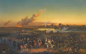
The siege of Silistria, or siege of Silistra, took place during the Crimean War, from 11 May to 23 June 1854, when Russian forces besieged the Ottoman fortress of Silistria (present-day Bulgaria). Sustained Ottoman resistance had allowed French and British troops to build up a significant army in nearby Varna. Under additional pressure from Austria, the Russian command, which was about to launch a final assault on the fortress town, was ordered to lift the siege and retreat from the area, thus ending the Danubian phase of the Crimean War.

Silistra Airfield
Airport in Bulgaria
Distance: Approx. 9766 meters
Latitude and longitude: 44.05497222,27.17991667
Polkovnik Lambrinovo Airport (IATA: SLS, ICAO: LBSS) was an Air Base located 5 nm southwest of Silistra, Silistra, Bulgaria. It closed down in December 1999.

Roman Tomb (Silistra)
Ancient Roman tomb in Bulgaria
Distance: Approx. 806 meters
Latitude and longitude: 44.110119,27.270892
The Roman Tomb of Silistra (Bulgarian: Римска гробница в Силистра, Rimska grobnitsa v Silistra) is an Ancient Roman burial tomb in the town of Silistra in northeastern Bulgaria. Dating to the mid-4th century AD, the Roman Tomb is the best-preserved architectural monument of the Ancient Roman city of Durostorum. The tomb is considered "one of the most investigated and most discussed monuments of the late antique art in Bulgaria" and the Balkans, owing in large part to the quality and extent of its interior frescoes.

Medjidi Tabia fortress
Fortress on the Danube, Bulgaria
Distance: Approx. 1800 meters
Latitude and longitude: 44.10222222,27.25666667
The Medjidi Tabia Fortress (Bulgarian: Меджиди табия) is a fortress from the 1840s and early 1850s. The fortress was built in the period 1841-1853 according to the plans of the German military engineer Helmut von Moltke who visited Silistra in 1837. In 1847 it was visited by Sultan Abdulmejid I, whose name is called — Majidi Tabia.

Siege of Silistra (1828)
1829 battle of the Russo-Turkish War (1828–1829)
Distance: Approx. 555 meters
Latitude and longitude: 44.11861111,27.26028056
The siege of Silistra (July 21 – November 8, 1828) was a siege during the Russo-Turkish War, 1828–1829.

Siege of Silistra (1773)
1773 siege during the Russo-Turkish war
Distance: Approx. 837 meters
Latitude and longitude: 44.10923806,27.26538111
The siege of Silistra, was a military siege undertaken by Russia between 18 and 29 June 1773 against the Ottoman city of Silistria. The siege was an important phase of the Russo-Turkish War (1768–1774), and resulted in an Ottoman victory.
Weather in this IP's area
clear sky
3 Celsius
0 Celsius
3 Celsius
3 Celsius
1032 hPa
48 %
1032 hPa
1023 hPa
10000 meters
2.35 m/s
2.26 m/s
14 degree
6 %