Country:
Region:
City:
Latitude and Longitude:
Time Zone:
Postal Code:
IP information under different IP Channel
ip-api
Country
Region
City
ASN
Time Zone
ISP
Blacklist
Proxy
Latitude
Longitude
Postal
Route
Luminati
Country
Region
pn
City
panevezys
ASN
Time Zone
Europe/Vilnius
ISP
UAB Cgates
Latitude
Longitude
Postal
IPinfo
Country
Region
City
ASN
Time Zone
ISP
Blacklist
Proxy
Latitude
Longitude
Postal
Route
db-ip
Country
Region
City
ASN
Time Zone
ISP
Blacklist
Proxy
Latitude
Longitude
Postal
Route
ipdata
Country
Region
City
ASN
Time Zone
ISP
Blacklist
Proxy
Latitude
Longitude
Postal
Route
Popular places and events near this IP address
Panevėžys County
County of Lithuania
Distance: Approx. 1238 meters
Latitude and longitude: 55.7375,24.37027778
Panevėžys County (Lithuanian: Panevėžio apskritis) is one of ten counties in Lithuania. It is in the north-east of the country, and its capital is Panevėžys. On 1 July 2010, the county administration was abolished, and since that date, Panevėžys County remains as the territorial and statistical unit.

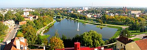
Panevėžys
City in Aukštaitija, Lithuania
Distance: Approx. 576 meters
Latitude and longitude: 55.73333333,24.35
Panevėžys (Lithuanian pronunciation: [pɐnʲɛvʲeːˈʑiːs] ) is the fifth-largest city in Lithuania and the eighth-most-populous city in the Baltic States. As of 2021, it occupies 50 square kilometres (19 sq mi) with 89,100 inhabitants. As defined by Eurostat the population of the Panevėžys functional urban area that stretches beyond the city limits is estimated at 124,412 (as of 2022).
Aukštaitija Stadium
Football stadium in Panevėžys, Lithuania
Distance: Approx. 559 meters
Latitude and longitude: 55.73916667,24.35944444
Aukštaitija Stadium is a multi-purpose stadium in Panevėžys, Lithuania. It is currently used mostly for football matches and is the home ground of FK Panevėžys and earlier of FK Ekranas Panevėžys. It is named Aukštaitija, one of the five regions of Lithuania.

Sports Palace Aukštaitija
Basketball arena in Lithuania
Distance: Approx. 400 meters
Latitude and longitude: 55.73888889,24.35694444
Sports Palace Aukštaitija is an indoor sporting arena located in Panevėžys, Lithuania. The capacity of the arena is 2,000 people.

Roman Catholic Diocese of Panevėžys
Roman Catholic diocese in Lithuania
Distance: Approx. 2431 meters
Latitude and longitude: 55.71666667,24.35
The Roman Catholic Diocese of Panevėžys (Latin: Panevezen(sis)) is a diocese located in the city of Panevėžys in the ecclesiastical province of Vilnius in Lithuania. It was established on April 4, 1926 from the Diocese of Samogitia. The Christ the King Cathedral is the Bishop's Cathedral of the diocese since the declaration of Pope Pius XI in 1926.

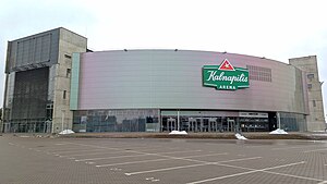
Kalnapilio Arena
Distance: Approx. 903 meters
Latitude and longitude: 55.73349,24.339266
Kalnapilis Arena, formerly Cido Arena, is the largest multifunctional arena in Panevėžys, Lithuania. It generally hosts track cycling events, as well as basketball games and concerts.

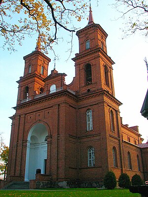
Panevėžys Cathedral
Distance: Approx. 1826 meters
Latitude and longitude: 55.72277778,24.35888889
The Cathedral of Christ the King (Lithuanian: Kristaus Karaliaus katedra) in Panevėžys, Lithuania, is a Roman Catholic cathedral, seat of the Roman Catholic Diocese of Panevėžys.
Juozas Balčikonis Gymnasium
School in Respublikos g. , Panevėžys, Lithuania
Distance: Approx. 752 meters
Latitude and longitude: 55.7329,24.3573
Juozas Balčikonis Gymnasium (Lithuanian: Juozo Balčikonio gimnazija) is a secondary state school located in Panevėžys, Lithuania. Teaching started in 1727, however, school reorganised to gymnasium in 1858, making it the oldest gymnasium type school in Lithuania. Juozo Balčikonio gimnazija is always one of the top-ranked institutions in the Lithuania for the high quality of its teaching, long lasting traditions and notable alumni.

Aukštaitija narrow gauge railway
Distance: Approx. 788 meters
Latitude and longitude: 55.745198,24.354678
The Aukštaitijos narrow gauge railway (Lithuanian Aukštaitijos siaurasis geležinkelis for Aukštaitija narrow gauge railway) is a 68.4 kilometres (42.5 mi) long tourist railway from Panevėžys to Rubikiai in Lithuania with a gauge of 750 mm (2 ft 5+1⁄2 in).
Church of the Holy Trinity, Panevėžys
Distance: Approx. 1412 meters
Latitude and longitude: 55.72656111,24.35821111
The Church of the Holy Trinity (Lithuanian: Švč. Trejybės bažnyčia) is a Roman Catholic church in Panevėžys, Lithuania. It was built in 1803 by the Piarists, along with a monastery and a college.

St. Peter and St. Paul's Church, Panevėžys
Distance: Approx. 1366 meters
Latitude and longitude: 55.73227222,24.36937778
The St. Peter and St. Paul's Church (Lithuanian: Šv.
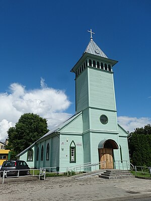
Evangelical Lutheran Church, Panevėžys
Lutheran church in Lithuania
Distance: Approx. 1751 meters
Latitude and longitude: 55.728325,24.37190278
The Panevėžys Evangelical Lutheran Church (Lithuanian: Panevėžio evangelikų liuteronų bažnyčia) is an Evangelical Lutheran church in Panevėžys, Lithuania. The current church was built in 1845–1850, however the Panevėžys Evangelical Lutheran Parish was founded in 1790–1795.
Weather in this IP's area
few clouds
-2 Celsius
-2 Celsius
-2 Celsius
-2 Celsius
1029 hPa
81 %
1029 hPa
1022 hPa
10000 meters
1.29 m/s
1.31 m/s
176 degree
14 %
07:54:22
16:19:39


