46.226.81.144 - IP Lookup: Free IP Address Lookup, Postal Code Lookup, IP Location Lookup, IP ASN, Public IP
Country:
 Germany
Region:
City:
Location:
Time Zone:
Postal Code:
ISP:
ASN:
language:
User-Agent:
Proxy IP:
Blacklist:
IP information under different IP Channel
ip-api
Country
Region
City
ASN
Time Zone
ISP
Blacklist
Proxy
Latitude
Longitude
Postal
Route
db-ip
Country
Region
City
ASN
Time Zone
ISP
Blacklist
Proxy
Latitude
Longitude
Postal
Route
IPinfo
Country
Region
City
ASN
Time Zone
ISP
Blacklist
Proxy
Latitude
Longitude
Postal
Route
IP2Location
46.226.81.144Country
deRegion
saarland
City
nalbacherbrucke
Time Zone
Europe/Berlin
ISP
Language
User-Agent
Latitude
Longitude
Postal
ipdata
Country
Region
City
ASN
Time Zone
ISP
Blacklist
Proxy
Latitude
Longitude
Postal
Route
Popular places and events near this IP address

Saarlouis (district)
District in Saarland, Germany
Distance: Approx. 4746 meters
Latitude and longitude: 49.33,6.75
Saarlouis (Sarrelouis in French) is a Kreis (district) in the middle of the Saarland, Germany. Neighboring districts are Merzig-Wadern, Sankt Wendel, Neunkirchen, Saarbrücken, and the French département Moselle.

Saarwellingen
Municipality in Saarland, Germany
Distance: Approx. 4076 meters
Latitude and longitude: 49.35,6.83333333
Saarwellingen (German pronunciation: [ˌzaːɐ̯ˈvɛlɪŋən], French: Sarrevailingue) is a municipality in the district of Saarlouis in Saarland, Germany. As of 2022 it has a population of 13,302.

Dillingen, Saarland
Town in Saarland, Germany
Distance: Approx. 4072 meters
Latitude and longitude: 49.35,6.73333333
Dillingen (also: Dillingen an der Saar) (French: Dillange) is a town in the district of Saarlouis, in Saarland. It has about 20,000 inhabitants and is divided into the three districts Dillingen-city center, Pachten and Diefflen. The city is located on the edge of the Saar-Hunsrück Nature Park at the mouth of the Prims in the Saar and is located about 10 km from the French border.

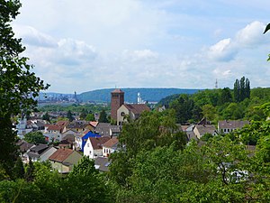
Nalbach
Municipality in Saarland, Germany
Distance: Approx. 1206 meters
Latitude and longitude: 49.36666667,6.76666667
Nalbach is a municipality in the district of Saarlouis, in Saarland, Germany. It is situated approximately 8 km northeast of Saarlouis, and 20 km northwest of Saarbrücken.

Territory of the Saar Basin
League of Nations Mandate in Weimar Republic (1920–35)
Distance: Approx. 4072 meters
Latitude and longitude: 49.38333333,6.83333333
The Territory of the Saar Basin (German: Saarbeckengebiet, Saarterritorium; French: Territoire du bassin de la Sarre) was a region occupied and governed by the United Kingdom and France from 1920 to 1935 under a League of Nations mandate. It had its own flag (adopted on 28 July 1920): a blue, white, and black horizontal tricolour. The blue and white stood for Bavaria, and white and black for Prussia, out of whose lands the Saar Territory was formed.
Saarlouis Body & Assembly
German car plant located in Saarlouis of Ford
Distance: Approx. 2553 meters
Latitude and longitude: 49.34722222,6.76472222
Ford Saarlouis Body & Assembly (SB&A) is a major car plant located on the western edge of Saarlouis in the German Saarland. It belongs to Ford-Werke GmbH, the German subsidiary of the American automaker Ford Motor Company.

Altes Schloss (Dillingen)
Distance: Approx. 3910 meters
Latitude and longitude: 49.35305556,6.73361111
Altes Schloss (Dillingen) is a castle and museum in Dillingen, Saarland, Germany. The Old castle, like many castles, was originally a medieval castle, probably of the 14th century. It is leased to the town, which uses it for cultural purposes, among other things.

Saarlouis Hauptbahnhof
Railway station in Saarlouis, Germany
Distance: Approx. 4949 meters
Latitude and longitude: 49.32782,6.750219
Saarlouis Hauptbahnhof is the only station in the town of Saarlouis in the German state of Saarland. It is on the Saar line between Trier and Saarbrucken in the district of Roden, about 1 km north of the city centre. It is classified by Deutsche Bahn as a category 3 station.

Dillingen (Saar) station
Railway station in Dillingen/Saar, Germany
Distance: Approx. 4673 meters
Latitude and longitude: 49.35263228,6.7225787
Dillingen (Saar) station is on the Saar Railway between Saarbrücken and Trier in the town of Dillingen in the German state of the Saarland. The station is classified by Deutsche Bahn as a category 4 station. A bus station is connected to the station.
Diefflen
Stadtteil of Dillingen/Saar in Saarland, Germany
Distance: Approx. 3047 meters
Latitude and longitude: 49.35,6.75
Diefflen (pronounced: Dieflen, in the local, Moselle-Franconian dialect Dejfeln) is a district of Dillingen/Saar in the district of Saarlouis (Saarland) and has about 4700 inhabitants. It is located on the lower Prims, a tributary of the Saar. Since its foundation in the High Middle Ages Diefflen was historically linked to the villages of the former "Hochgericht Nalbacher Tal".

Saardom
Distance: Approx. 4280 meters
Latitude and longitude: 49.35648,6.72639
The so-called Saardom (full name: "Ecclesia Parochialis Catholica Sacratissimi Sacramenti Dioecesis Treverensis", "Catholic Parish Church of the Blessed Sacrament in the Diocese of Trier") in Dillingen/Saar is one of the largest sacred buildings in Saarland. It is the parish church of the parish of St Sacrament. The parish belongs to the parish community of the Holy Sacrament, St John the Baptist in Dillingen, St Joseph and St Wendelin in Diefflen, St Maximin in Pachten, and St Mary consolation of the saddeneds (Consolatrix afflictorum) on the Pachtener Heide.

Fraulautern
Stadtteil of Saarlouis in Saarland, Germany
Distance: Approx. 4426 meters
Latitude and longitude: 49.32777778,6.77083333
Fraulautern is a district of Saarlouis in the Saarland region of Germany. In 1936, the village of Fraulautern was incorporated into the city of Saarlouis. It is also the source of the alternative name for Saarlouis, Saarlautern.
Weather in this IP's area
clear sky
-1 Celsius
-4 Celsius
-2 Celsius
-0 Celsius
1031 hPa
84 %
1031 hPa
994 hPa
10000 meters
2.46 m/s
8.75 m/s
64 degree
6 %