Country:
Region:
City:
Latitude and Longitude:
Time Zone:
Postal Code:
IP information under different IP Channel
ip-api
Country
Region
City
ASN
Time Zone
ISP
Blacklist
Proxy
Latitude
Longitude
Postal
Route
Luminati
Country
ASN
Time Zone
Europe/London
ISP
CSL (DualCom) Limited
Latitude
Longitude
Postal
IPinfo
Country
Region
City
ASN
Time Zone
ISP
Blacklist
Proxy
Latitude
Longitude
Postal
Route
db-ip
Country
Region
City
ASN
Time Zone
ISP
Blacklist
Proxy
Latitude
Longitude
Postal
Route
ipdata
Country
Region
City
ASN
Time Zone
ISP
Blacklist
Proxy
Latitude
Longitude
Postal
Route
Popular places and events near this IP address

Tripontium
Town in Roman Britain
Distance: Approx. 1909 meters
Latitude and longitude: 52.409152,-1.212683
Tripontium (Latin for "Place of three bridges") was a town in Roman Britain. It lay on the Roman road later called Watling Street (and known today as the A5) at a site now chiefly within the civil parish of Churchover in the English county of Warwickshire and partly in Leicestershire, some 3.4 miles north-east of Rugby and 3.1 miles south of Lutterworth.

Newton, Warwickshire
Human settlement in England
Distance: Approx. 1311 meters
Latitude and longitude: 52.397514,-1.22024
Newton is a small village in the civil parish of Newton and Biggin in the Rugby borough of Warwickshire, England. The civil parish population taken at the 2021 census was 1,273. Newton is about 3 miles (5 km) north east of Rugby, and is close to the A5 road which marks the border with Leicestershire and Northamptonshire, the three counties meet at Dow Bridge east of the village, where the A5 crosses the River Avon.

Cosford, Warwickshire
Hamlet and civil parish in England
Distance: Approx. 1945 meters
Latitude and longitude: 52.408,-1.265
Cosford is a small hamlet and civil parish in the Rugby borough of Warwickshire, England. it is located 2,1/2 miles north of Rugby, just west of the River Swift, a tributary of the River Avon, and slightly south of the M6 Motorway. It has been a civil parish since 1866.
Brownsover
Human settlement in England
Distance: Approx. 1590 meters
Latitude and longitude: 52.391792,-1.254702
Brownsover is a residential and commercial area of Rugby, Warwickshire in England, about 1+1⁄2 miles north of the town centre. The area is named after the original hamlet of Brownsover. Since 1960, the area has been subsumed by the expansion of Rugby, with the construction of a number of housing estates, industrial estates and retail parks.

Churchover
Human settlement in England
Distance: Approx. 2003 meters
Latitude and longitude: 52.419688,-1.242643
Churchover is a small village and civil parish in Warwickshire, England.

Brownsover Hall
Distance: Approx. 1525 meters
Latitude and longitude: 52.3935,-1.2559
Brownsover Hall is a 19th-century mansion house in the old village of Brownsover, Rugby, Warwickshire which has been converted for use as a hotel. It is a Grade II* listed building.
Coton House
Country house in Warwickshire, England
Distance: Approx. 969 meters
Latitude and longitude: 52.41055556,-1.23666667
Coton House is a late 18th-century country house at Churchover, near Rugby, Warwickshire in England. It is a Grade II* listed building.

Clifton Mill railway station
Former railway station in Warwickshire, England
Distance: Approx. 2175 meters
Latitude and longitude: 52.38284,-1.2311
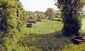
Clifton Mill railway station was a railway station serving Clifton-upon-Dunsmore in the English county of Warwickshire. It was opened on the Rugby and Stamford Railway in 1864.

St Michael and All Angels Church, Brownsover
Church in Warwickshire, England
Distance: Approx. 1540 meters
Latitude and longitude: 52.392,-1.254
St Michael and All Angels Church is a redundant Anglican church in the former village of Brownsover, which is now a suburb of the town of Rugby, Warwickshire, England. It is recorded in the National Heritage List for England as a designated Grade II* listed building, and is under the care of the Churches Conservation Trust.

Cave's Inn Pits
Distance: Approx. 2114 meters
Latitude and longitude: 52.41,-1.21
Cave's Inn Pits is a 5.8-hectare (14-acre) biological Site of Special Scientific Interest south-west of Shawell in Leicestershire. These disused gravel workings have some of the best neutral marsh in the county, with varied habitats also including scrub, species-rich grassland and shallow pools. There are diverse species of breeding birds.

Swift Valley Nature Reserve
Nature reserve in Rugby, Warwickshire, England
Distance: Approx. 1624 meters
Latitude and longitude: 52.394052,-1.25831
The Swift Valley Nature Reserve is a nature reserve at the Brownsover area of Rugby, Warwickshire on the northern outskirts of the town. It covers an area of 24 hectares (59 acres) and is named after the River Swift (a tributary of the River Avon) which it is adjacent to.
Rugby services
Motorway service station in Warwickshire, England
Distance: Approx. 859 meters
Latitude and longitude: 52.4081,-1.2457
Rugby services is a motorway service station operated by Moto Hospitality and situated at junction 1 of the M6 motorway in Warwickshire, England.
Weather in this IP's area
overcast clouds
9 Celsius
7 Celsius
8 Celsius
10 Celsius
1025 hPa
91 %
1025 hPa
1010 hPa
10000 meters
2.75 m/s
3.92 m/s
238 degree
99 %
07:26:59
16:12:28