Country:
Region:
City:
Latitude and Longitude:
Time Zone:
Postal Code:
IP information under different IP Channel
ip-api
Country
Region
City
ASN
Time Zone
ISP
Blacklist
Proxy
Latitude
Longitude
Postal
Route
Luminati
Country
Region
fl
City
almerestad
ASN
Time Zone
Europe/Amsterdam
ISP
Nextpertise B.V.
Latitude
Longitude
Postal
IPinfo
Country
Region
City
ASN
Time Zone
ISP
Blacklist
Proxy
Latitude
Longitude
Postal
Route
db-ip
Country
Region
City
ASN
Time Zone
ISP
Blacklist
Proxy
Latitude
Longitude
Postal
Route
ipdata
Country
Region
City
ASN
Time Zone
ISP
Blacklist
Proxy
Latitude
Longitude
Postal
Route
Popular places and events near this IP address

Delfshaven
Borough of Rotterdam, Netherlands
Distance: Approx. 596 meters
Latitude and longitude: 51.90722222,4.44833333
Delfshaven (Dutch pronunciation: [ˌdɛl(ə)fsˈɦaːvə(n)] ) is a borough of Rotterdam, Netherlands, on the right bank of river Nieuwe Maas. It was a separate municipality until 1886. The town of Delfshaven grew around the port of the city of Delft.

Coolhaven metro station
Metro station in Rotterdam, Netherlands
Distance: Approx. 826 meters
Latitude and longitude: 51.90972222,4.45805556
Coolhaven is an underground subway station in the Dutch city of Rotterdam. It is served by Rotterdam Metro lines A, B, and C. The station, with one island platform, opened on 10 May 1982 as the western terminus of the East-West Line (also formerly called Calandlijn). Coolhaven was the terminus until 1986, when the line was extended to Marconiplein.

Pilgrim Fathers Church
Distance: Approx. 415 meters
Latitude and longitude: 51.909,4.449
The Old or Pilgrim Fathers' Church (Dutch: Oude of Pelgrimvaderskerk Rotterdam-Delfshaven) is a church located in Rotterdam-Delfshaven, in the Netherlands.

Delfshaven metro station
Metro station in Rotterdam, the Netherlands
Distance: Approx. 293 meters
Latitude and longitude: 51.91,4.44555556
Delfshaven is an underground subway station in the Dutch city of Rotterdam, served by lines A, B, and C of the Rotterdam Metro. The station is part of the two station long extension of the East-West Line (or Caland line), and it opened on 25 April 1986. This extension connected the line's former terminus Coolhaven with the new Marconiplein station.
Marconiplein metro station
Metro station in Rotterdam, the Netherlands
Distance: Approx. 976 meters
Latitude and longitude: 51.9133,4.43275
Marconiplein is an underground subway station in the Dutch city of Rotterdam, and is part of Rotterdam Metro lines A, B, and C. The station is part of the two station long extension of the East-West Line (also formerly called Caland line) and opened on 25 April 1986. This extension connected the new Marconiplein and Delfshaven stations with the line's former terminus Coolhaven. Until 4 November 2002 Marconiplein station was the western terminus of the East-West Line.

Mevlana Mosque, Rotterdam
Mosque in Rotterdam, South Holland, Netherlands
Distance: Approx. 1035 meters
Latitude and longitude: 51.9212,4.4416
The Mevlana Mosque (Dutch: Mevlanamoskee; Turkish: Mevlana Camii) is a mosque in northwestern Rotterdam, Netherlands which serves mainly Turkish-Dutch Muslims. The mosque, named after Rumi, was built in 2001 and benefits from two minarets. The mosque was voted as Rotterdam's most attractive building in 2006.

Bospolder-Tussendijken
Neighborhood of Rotterdam, Netherlands
Distance: Approx. 563 meters
Latitude and longitude: 51.90861111,4.44166667
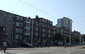
Bospolder-Tussendijken is a neighborhood of Rotterdam, Netherlands.
Nieuwe Westen
Neighborhood of Rotterdam in South Holland, Netherlands
Distance: Approx. 185 meters
Latitude and longitude: 51.91305556,4.44944444
Nieuwe Westen is a pre-war neighbourhood in the west of Rotterdam, located between the Heemraadssingel and the Delfshavense Schie in the Delfshaven district. Nieuwe Westen was built in the early twentieth century. As in the neighbouring Middelland district, Nieuwe Westen is a district of contrasts: completely renovated streets can be found within 100 metres of the stately Heemraadssingel and Mathenesserlaan.

Schiemond
Neighborhood of Rotterdam in South Holland, Netherlands
Distance: Approx. 1024 meters
Latitude and longitude: 51.90361111,4.44305556
Schiemond is a neighborhood of Rotterdam, Netherlands. Schiemond a postwar district in the west of the city with approximately 3,500 inhabitants. The district is bounded to the east by the port of Schiemond, in the south by the Nieuwe Maas, in the west by the port areas of IJselhaven and Pelgrimsstraat and Westzeedijk in the north.

Richard Visser
Dutch pastry chef
Distance: Approx. 751 meters
Latitude and longitude: 51.91744,4.45435
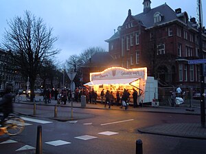
Richard Visser (1968/1969) is a Dutch pastry chef who runs a pastry stand (Dutch: Richard Visser's Gebakkraam) located on the corner of the Heemraadssingel and the Vierambachtsstraat in Rotterdam, which mainly sells oliebollen. In 2011 his oliebollen were named the best in the Netherlands by the Algemeen Dagblad national newspaper in their AD-Oliebollentest; this was his eighth win in nineteen years. He won again in 2013.

Museum Rotterdam
History museum in Rotterdam, Netherlands
Distance: Approx. 826 meters
Latitude and longitude: 51.90893,4.45745
The Museum Rotterdam, until 2011 called the Historical Museum Rotterdam, is a museum about the history of Rotterdam located at the Coolhaven.
Dutch Pinball Museum
Museum in Rotterdam, Netherlands
Distance: Approx. 502 meters
Latitude and longitude: 51.9082492,4.4493252
The Dutch Pinball Museum is a museum in Rotterdam, the Netherlands. The museum is home to more than 130 different pinball machines ranging from 1930 to today and also includes a rare toupie hollandaise table from the year 1853.
Weather in this IP's area
overcast clouds
5 Celsius
3 Celsius
5 Celsius
6 Celsius
1025 hPa
89 %
1025 hPa
1024 hPa
6000 meters
3.09 m/s
90 degree
100 %
07:49:55
17:02:06

