Country:
Region:
City:
Latitude and Longitude:
Time Zone:
Postal Code:
IP information under different IP Channel
ip-api
Country
Region
City
ASN
Time Zone
ISP
Blacklist
Proxy
Latitude
Longitude
Postal
Route
Luminati
Country
Region
sh
City
kaltenkirchen
ASN
Time Zone
Europe/Berlin
ISP
TNG Stadtnetz GmbH
Latitude
Longitude
Postal
IPinfo
Country
Region
City
ASN
Time Zone
ISP
Blacklist
Proxy
Latitude
Longitude
Postal
Route
db-ip
Country
Region
City
ASN
Time Zone
ISP
Blacklist
Proxy
Latitude
Longitude
Postal
Route
ipdata
Country
Region
City
ASN
Time Zone
ISP
Blacklist
Proxy
Latitude
Longitude
Postal
Route
Popular places and events near this IP address
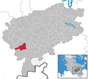
Kaltenkirchen
Town in Schleswig-Holstein, Germany
Distance: Approx. 1493 meters
Latitude and longitude: 53.83972222,9.96027778
Kaltenkirchen (nicknamed Kaki; Low German: Koldenkarken or Kolenkarken) is a town located 35 km north of Hamburg in Germany. It is part of the Segeberg district, in Schleswig-Holstein. It has about 20,000 inhabitants.
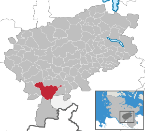
Henstedt-Ulzburg
Municipality in Schleswig-Holstein, Germany
Distance: Approx. 5546 meters
Latitude and longitude: 53.78333333,10
Henstedt-Ulzburg is a municipality in the district of Segeberg, in Schleswig-Holstein, Germany.
Auenland Südholstein
Distance: Approx. 975 meters
Latitude and longitude: 53.83333333,9.96666667
Auenland Südholstein is an Amt ("collective municipality") in the district of Segeberg, in Schleswig-Holstein, Germany. Its seat is in Nützen. Before 1 April 2022, the name of the Amt was Kaltenkirchen-Land, and its seat was in the town Kaltenkirchen.

Kisdorf
Municipality in Schleswig-Holstein, Germany
Distance: Approx. 3849 meters
Latitude and longitude: 53.81,10.00916667
Kisdorf is a municipality in the district of Segeberg, in Schleswig-Holstein, Germany. It is situated approximately 30 km north of Hamburg, and 15 km north of Norderstedt. Kisdorf is part of the Amt ("collective municipality") Kisdorf.

Winsen, Schleswig-Holstein
Municipality in Schleswig-Holstein, Germany
Distance: Approx. 3611 meters
Latitude and longitude: 53.83222222,10.01166667
Winsen (German pronunciation: [ˈvɪnzn̩] ) is a municipality in the district of Segeberg, in Schleswig-Holstein, Germany.

Kattendorf
Municipality in Schleswig-Holstein, Germany
Distance: Approx. 4870 meters
Latitude and longitude: 53.84388889,10.02555556
Kattendorf is a municipality in the district of Segeberg, in Schleswig-Holstein, Germany.
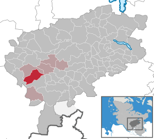
Nützen
Municipality in Schleswig-Holstein, Germany
Distance: Approx. 5227 meters
Latitude and longitude: 53.86666667,9.91666667
Nützen is a municipality in the district of Segeberg, in Schleswig-Holstein, Germany. Two areas, Kampen and Springhirsch, are within its jurisdiction.
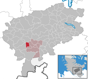
Oersdorf
Municipality in Schleswig-Holstein, Germany
Distance: Approx. 1858 meters
Latitude and longitude: 53.83333333,9.98333333
Oersdorf is a municipality in the district of Segeberg, in Schleswig-Holstein, Germany. It was founded in 1496.

Schmalfeld
Municipality in Schleswig-Holstein, Germany
Distance: Approx. 5972 meters
Latitude and longitude: 53.8775,9.98527778
Schmalfeld is a municipality in the district of Segeberg, in Schleswig-Holstein, Germany.
Kisdorf (Amt)
Distance: Approx. 4041 meters
Latitude and longitude: 53.817,10.017
Kisdorf is an Amt ("collective municipality") in the district of Segeberg, in Schleswig-Holstein, Germany. The seat of the Amt is in Kattendorf.
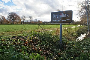
Krambek
River in Schleswig-Holstein, Germany
Distance: Approx. 4916 meters
Latitude and longitude: 53.785,9.98361111
Krambek is a small river of Schleswig-Holstein, Germany. It flows into the Pinnau in Henstedt-Ulzburg.
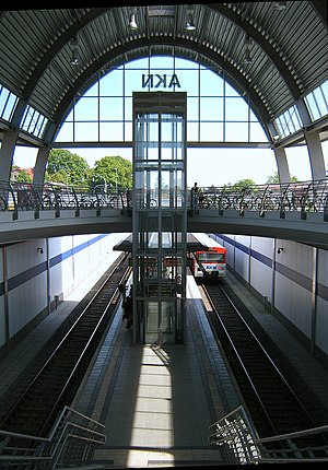
Kaltenkirchen station
Railway station in Germany
Distance: Approx. 1056 meters
Latitude and longitude: 53.83444444,9.96611111
Kaltenkirchen is a rapid transit station on the Hamburg-Altona–Neumünster railway line, located some 30 kilometres (19 miles) north of Hamburg, in the center of Kaltenkirchen, a town in the German state of Schleswig-Holstein.
Weather in this IP's area
light rain
5 Celsius
1 Celsius
4 Celsius
5 Celsius
1002 hPa
95 %
1002 hPa
999 hPa
10000 meters
5.78 m/s
11.13 m/s
284 degree
100 %
07:51:33
16:19:07