46.214.215.169 - IP Lookup: Free IP Address Lookup, Postal Code Lookup, IP Location Lookup, IP ASN, Public IP
Country:
Region:
City:
Location:
Time Zone:
Postal Code:
ISP:
ASN:
language:
User-Agent:
Proxy IP:
Blacklist:
IP information under different IP Channel
ip-api
Country
Region
City
ASN
Time Zone
ISP
Blacklist
Proxy
Latitude
Longitude
Postal
Route
db-ip
Country
Region
City
ASN
Time Zone
ISP
Blacklist
Proxy
Latitude
Longitude
Postal
Route
IPinfo
Country
Region
City
ASN
Time Zone
ISP
Blacklist
Proxy
Latitude
Longitude
Postal
Route
IP2Location
46.214.215.169Country
Region
salaj
City
zalau
Time Zone
Europe/Bucharest
ISP
Language
User-Agent
Latitude
Longitude
Postal
ipdata
Country
Region
City
ASN
Time Zone
ISP
Blacklist
Proxy
Latitude
Longitude
Postal
Route
Popular places and events near this IP address

Sălaj County
County of Romania
Distance: Approx. 0 meters
Latitude and longitude: 47.2,23.05
Sălaj County (Romanian pronunciation: [səˈlaʒ]; Hungarian: Szilágy megye) (also known as Land of Silvania, silva, -ae means "forest") is a county (județ) of Romania, located in the north-west of the country, in the historical regions of Crișana and Transylvania. It is bordered to the north by Satu Mare and Maramureș counties, to the west and south-west by Bihor County, and to the south-east by Cluj County. Zalău is the county seat, as well as its largest city.

Szilágy County
County of the Kingdom of Hungary
Distance: Approx. 1855 meters
Latitude and longitude: 47.18333333,23.05
Szilágy (Romanian: Sălaj) was an administrative county (comitatus) of the Kingdom of Hungary. Its territory is now in north-western Romania. The capital of the county was Zilah (present-day Zalău in Romania).

Zalău
Municipality in Sălaj, Romania
Distance: Approx. 1130 meters
Latitude and longitude: 47.19111111,23.05722222
Zalău (Romanian pronunciation: [zaˈləw], unofficial and former official name: Romanian: Zalău (Romanian pronunciation: [zalˈəw]; German: Zillenmarkt or Waltenberg, Hungarian: Zilah, Turkish: Zile) is the seat of Sălaj County, Romania. In 2021, its estimated population was 52,359.

Silvania National College
Public school in Zalău, Sălaj County, Romania
Distance: Approx. 2358 meters
Latitude and longitude: 47.17888889,23.0525
Silvania National College (Romanian: Colegiul Național Silvania, Hungarian: Silvania Főgimnázium) is a bilingual high school located at 1 Unirii Street, Zalău, Romania, with both Romanian and Hungarian language classes. In 2002 it had 949 students, of whom 747 participated in Romanian and 202 in Hungarian language education.
Tuhutum Monument
Obelisk in Zalău, Romania
Distance: Approx. 2004 meters
Latitude and longitude: 47.182042,23.051805
The Tuhutum Monument (Romanian: Monumentul Tuhutum; Hungarian: Tuhutum-emlékmű) was an obelisk in Zalău, Romania.

Zalău City Hall
Building in Zalău, Romania
Distance: Approx. 2458 meters
Latitude and longitude: 47.1782,23.0552
The Zalău City Hall (Romanian: Primăria Zalău) is a building in Zalău which was built in 1889.

Dormition of the Theotokos Church, Zalău
Distance: Approx. 2004 meters
Latitude and longitude: 47.182042,23.051805
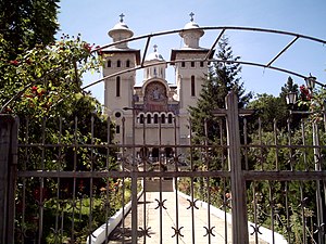
The Dormition of the Theotokos Church (Romanian: Biserica Adormirea Maicii Domnului) is a church in Zalău, Romania, built by the Greek-Catholic Church between 1930 and 1934.

Iuliu Maniu Square
Square in Zalău, Romania
Distance: Approx. 2407 meters
Latitude and longitude: 47.178673,23.05526
The Iuliu Maniu Square (Romanian: Piaţa Iuliu Maniu) is a major plaza in the Romanian city of Zalău. It was named successively Kossuth Square (Romanian: Piața Kossuth) and Freedom Square (Romanian: Piața Libertății). The square shelters the most important banks in the county: BCR and Generali.

Reformed Church, Zalău
Distance: Approx. 2004 meters
Latitude and longitude: 47.182042,23.051805
The Reformed Church (Romanian: Biserica Reformată; Hungarian: Református templom) is a church in Zalău, Romania, completed in 1907.

Zalău County Museum
Distance: Approx. 2004 meters
Latitude and longitude: 47.182042,23.051805
The County Museum of History and Art (Romanian: Muzeul Județean de Istorie și Artă) is a museum in Zalău, Romania, established in 1951. Archaeologists from the museum took part in excavations in the region. In 2015, a stone sarcophagus was discovered during restoration of a sacred area at Porolissum.
Zalău explosion
Distance: Approx. 1855 meters
Latitude and longitude: 47.18333333,23.05
The Zalău explosion occurred on September 14, 2007 in a block of flats in Zalău, Romania as the result of a gas leak. Two people died and fifteen were injured in the explosion. The structure was severely affected and the block of flats E24 was demolished in October 2007.
Monument to Endre Ady, Zalău
Monument in 1 Unirii Street, Zalău
Distance: Approx. 2408 meters
Latitude and longitude: 47.1786,23.0546
Monument to Endre Ady is a monument in Zalău, Romania. It was opened in front of Silvania National College, on November 22, 1957 (80 years after the birth of Endre Ady).
Weather in this IP's area
scattered clouds
1 Celsius
-0 Celsius
1 Celsius
1 Celsius
1035 hPa
77 %
1035 hPa
998 hPa
10000 meters
1.38 m/s
1.42 m/s
47 degree
26 %