46.214.194.59 - IP Lookup: Free IP Address Lookup, Postal Code Lookup, IP Location Lookup, IP ASN, Public IP
Country:
Region:
City:
Location:
Time Zone:
Postal Code:
IP information under different IP Channel
ip-api
Country
Region
City
ASN
Time Zone
ISP
Blacklist
Proxy
Latitude
Longitude
Postal
Route
Luminati
Country
Region
db
City
targoviste
ASN
Time Zone
Europe/Bucharest
ISP
Nextgen Communications Srl
Latitude
Longitude
Postal
IPinfo
Country
Region
City
ASN
Time Zone
ISP
Blacklist
Proxy
Latitude
Longitude
Postal
Route
IP2Location
46.214.194.59Country
Region
prahova
City
campina
Time Zone
Europe/Bucharest
ISP
Language
User-Agent
Latitude
Longitude
Postal
db-ip
Country
Region
City
ASN
Time Zone
ISP
Blacklist
Proxy
Latitude
Longitude
Postal
Route
ipdata
Country
Region
City
ASN
Time Zone
ISP
Blacklist
Proxy
Latitude
Longitude
Postal
Route
Popular places and events near this IP address

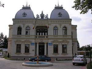
Câmpina
Municipality in Prahova, Romania
Distance: Approx. 577 meters
Latitude and longitude: 45.13,25.74
Câmpina (Romanian pronunciation: [ˈkɨmpina]) is a city in Prahova County, Romania, north of the county seat Ploiești, located on the main route between Wallachia and Transylvania. Its existence is first attested in a document of 1503. It is situated in the historical region of Muntenia.
Doftana prison
Distance: Approx. 3228 meters
Latitude and longitude: 45.13666667,25.77333333
Doftana was a Romanian prison, sometimes referred to as "the Romanian Bastille". Built in 1895 in connection with the nearby salt mines, from 1921 it began to be used to detain political prisoners, among them Gheorghe Gheorghiu-Dej, who was the Prime Minister of Romania (1952–1955), and the Chairman of the State Council of Romania (1961–1965), and Nicolae Ceaușescu, who was General Secretary of Romanian Communist Party (1965–1989), and the first President of Romania (1974–1989). The prison is situated close to the village with the same name, in the Telega commune of Prahova County.

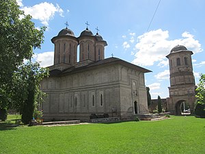
Brebu Monastery
Distance: Approx. 6691 meters
Latitude and longitude: 45.181885,25.767086
The Brebu Monastery in Romania is one of the most important architectural achievements of the rule of Matei Basarab and of Romanian art in the 17th century. Constructions began in 1640. The Romanian Orthodox monastery is located in the present-day locality of Brebu Mânăstirei, Prahova County, Romania.

Bănești, Prahova
Commune in Prahova, Romania
Distance: Approx. 3833 meters
Latitude and longitude: 45.1,25.76666667
Bănești is a commune in Prahova County, Muntenia, Romania. It is composed of two villages, Bănești and Urleta. The commune is situated at the northern edge of the Wallachian Plain, at an altitude of 395 m (1,296 ft), in the foothills of the Southern Carpathians.

Cornu, Prahova
Commune in Prahova, Romania
Distance: Approx. 4133 meters
Latitude and longitude: 45.15555556,25.70277778
Cornu is a commune in Prahova County, Muntenia, Romania. It is composed of three villages: Cornu de Jos, Cornu de Sus and Valea Oprii; the administrative centre is Cornu de Jos. The commune is located in the northwestern part of the county, next to the DN1 road that connects it to the county seat, Ploiești (39 km (24 mi) to the south) and to the capital, Bucharest (90 km (56 mi) to the south), and to Brașov (70 km (43 mi) to the north).

Telega, Prahova
Commune in Prahova, Romania
Distance: Approx. 3878 meters
Latitude and longitude: 45.13333333,25.78333333
Telega is a commune in Prahova County, Muntenia, Romania. It is composed of six villages: Boșilcești, Buștenari, Doftana, Melicești, Telega and Țonțești. The commune is located in the west-central part of the county, in the Sub Carpathian hills, 36 km (22 mi) northwest of the county seat, Ploiești.

Doftana (Prahova)
River in Prahova County, Romania
Distance: Approx. 3184 meters
Latitude and longitude: 45.0996,25.7499
The Doftana is a left tributary of the river Prahova in Romania. It discharges into the Prahova in Bănești near Câmpina. It flows through the villages Trăisteni, Teșila, Seciuri, Brebu Mânăstirei, Doftana and the city Câmpina.
Purcaru
River in Prahova County, Romania
Distance: Approx. 3519 meters
Latitude and longitude: 45.1462,25.7697
The Purcaru is a left tributary of the river Doftana in Romania. It flows into the Doftana in the village Doftana. Its length is 10 km (6.2 mi) and its basin size is 29 km2 (11 sq mi).

Iulia Hasdeu Castle
Castle in Romania
Distance: Approx. 1219 meters
Latitude and longitude: 45.13567,25.7272
The Iulia Hașdeu Castle is a folly built in the form of small castle by historian and politician Bogdan Petriceicu Hașdeu in the city of Câmpina, Romania. Work on it began in 1893, after Hasdeu's daughter, Iulia Hasdeu, died at the age of 19, an event that dramatically shook Hasdeu's life. He claimed that his late daughter provided the plans for building the castle during sessions of spiritism.
Câmpea
River in Prahova County, Romania
Distance: Approx. 2090 meters
Latitude and longitude: 45.136,25.7123
The Câmpea (also: Câmpina, Câmpinița) is a left tributary of the river Prahova in Romania. It flows into the Prahova near the city Câmpina. Its length is 14 km (8.7 mi) and its basin size is 30 km2 (12 sq mi).

Poiana Câmpina
Commune in Prahova, Romania
Distance: Approx. 3878 meters
Latitude and longitude: 45.13333333,25.78333333
Poiana Câmpina is a commune in Prahova County, Muntenia, Romania. It is composed of four villages: Bobolia, Pietrișu, Poiana Câmpina and Răgman. The commune is located in the western part of the county, 36 km (22 mi) northwest of the county seat, Ploiești.
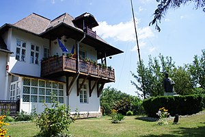
Nicolae Grigorescu Memorial Museum
Distance: Approx. 960 meters
Latitude and longitude: 45.13469636,25.73290959
The Nicolae Grigorescu Memorial Museum (Romanian: Muzeul Memorial Nicolae Grigorescu) is a museum located at 166 Carol I Boulevard, Câmpina, Romania. The house that hosts the museum was originally built in 1901–1904 for painter Nicolae Grigorescu, his wife and son. He designed the building himself in the local style: eight rooms on two floors, balconies on three sides and a shingle roof.
Weather in this IP's area
broken clouds
2 Celsius
2 Celsius
1 Celsius
4 Celsius
1030 hPa
82 %
1030 hPa
976 hPa
10000 meters
0.49 m/s
1.78 m/s
18 degree
70 %

