46.214.171.198 - IP Lookup: Free IP Address Lookup, Postal Code Lookup, IP Location Lookup, IP ASN, Public IP
Country:
Region:
City:
Location:
Time Zone:
Postal Code:
ISP:
ASN:
language:
User-Agent:
Proxy IP:
Blacklist:
IP information under different IP Channel
ip-api
Country
Region
City
ASN
Time Zone
ISP
Blacklist
Proxy
Latitude
Longitude
Postal
Route
db-ip
Country
Region
City
ASN
Time Zone
ISP
Blacklist
Proxy
Latitude
Longitude
Postal
Route
IPinfo
Country
Region
City
ASN
Time Zone
ISP
Blacklist
Proxy
Latitude
Longitude
Postal
Route
IP2Location
46.214.171.198Country
Region
caras-severin
City
bocsa
Time Zone
Europe/Bucharest
ISP
Language
User-Agent
Latitude
Longitude
Postal
ipdata
Country
Region
City
ASN
Time Zone
ISP
Blacklist
Proxy
Latitude
Longitude
Postal
Route
Popular places and events near this IP address

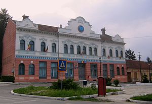
Bocșa
Town in Caraș-Severin, Romania
Distance: Approx. 191 meters
Latitude and longitude: 45.37472222,21.71055556
Bocșa (Romanian pronunciation: [ˈbokʃa] ; Hungarian: Boksánbánya; German: Deutsch-Bokschan, Neuwerk) is a town in Caraș-Severin County, in the Banat region of Romania, with a population of 12,949 in 2021.

Ocna de Fier
Commune in Caraș-Severin, Romania
Distance: Approx. 6309 meters
Latitude and longitude: 45.34194444,21.77638889
Ocna de Fier (Hungarian: Vaskő, German: Eisenstein) is a commune in Caraș-Severin County, in the Banat region of southwestern Romania. It is composed of a single village, Ocna de Fier.
Copăș
River in Caraș-Severin County, Romania
Distance: Approx. 3158 meters
Latitude and longitude: 45.3914,21.6781
The Copăș (also: Gârliște) or is a left tributary of the river Bârzava in Romania. It discharges into the Bârzava near Bocșa. Its length is 15 km (9.3 mi) and its basin size is 38 km2 (15 sq mi).
Moravița (upper Bârzava)
River in Caraș-Severin County, Romania
Distance: Approx. 1104 meters
Latitude and longitude: 45.3805,21.6995
The Moravița is a left tributary of the river Bârzava in Romania. It discharges into the Bârzava in Bocșa. Its length is 14 km (8.7 mi) and its basin size is 35 km2 (14 sq mi).
Vornic (river)
River in Caraș-Severin County, Romania
Distance: Approx. 7928 meters
Latitude and longitude: 45.433,21.6539
The Vornic is a right tributary of the river Bârzava in Romania. It flows into the Bârzava near Berzovia. Its length is 13 km (8.1 mi) and its basin size is 46 km2 (18 sq mi).

Berzovia
Commune in Caraș-Severin, Romania
Distance: Approx. 8934 meters
Latitude and longitude: 45.43333333,21.63333333
Berzovia (Hungarian: Zsidovin) is a commune in Caraș-Severin County, Banat, Romania with a population of 4,165 people. It is composed of three villages: Berzovia, Fizeș (Krassófűzes) and Gherteniș (Gertenyes). It is mentioned on the Tabula Peutingeriana as Berzobia.

Doclin
Commune in Caraș-Severin, Romania
Distance: Approx. 9383 meters
Latitude and longitude: 45.3,21.65
Doclin (Hungarian: Doklény) is a commune in Caraș-Severin County, western Romania with a population of 2.047 people. It is composed of three villages: Biniș (Bényes), Doclin and Tirol (Királykegye; German: Königsgnad).

Ramna, Caraș-Severin
Commune in Caraș-Severin, Romania
Distance: Approx. 6982 meters
Latitude and longitude: 45.43333333,21.68333333
Ramna (Hungarian: Rafna) is a commune in Caraș-Severin County, western Romania with a population of 1782 people. It is composed of three villages: Bărbosu (Barbos), Ramna, and Valeapai (Valéapáj).

Bersobis
Distance: Approx. 9268 meters
Latitude and longitude: 45.429085,21.621184
Bersobis was an ancient Dacian fortress conquered in Trajan's Dacian Wars with the Romans. It became a legionary fortress in the Roman province of Dacia in the 2nd century AD. It is located near the town of Berzovia, Romania. The legion Legio IV Flavia Felix built its legionary fortress and base here in about 108 AD which endured till 118/9.
Dacian fortress of Bocșa
Distance: Approx. 1316 meters
Latitude and longitude: 45.383041,21.718725
It was a Dacian fortified town.
Weather in this IP's area
few clouds
9 Celsius
8 Celsius
9 Celsius
9 Celsius
1012 hPa
62 %
1012 hPa
986 hPa
10000 meters
2.7 m/s
2.85 m/s
165 degree
18 %