Country:
 Iran
IranRegion:
City:
Latitude and Longitude:
Time Zone:
Postal Code:
IP information under different IP Channel
ip-api
Country
Region
City
ASN
Time Zone
ISP
Blacklist
Proxy
Latitude
Longitude
Postal
Route
IPinfo
Country
Region
City
ASN
Time Zone
ISP
Blacklist
Proxy
Latitude
Longitude
Postal
Route
MaxMind
Country
Region
City
ASN
Time Zone
ISP
Blacklist
Proxy
Latitude
Longitude
Postal
Route
Luminati
Country
IRASN
Time Zone
Asia/Tehran
ISP
Respina Networks & Beyond PJSC
Latitude
Longitude
Postal
db-ip
Country
Region
City
ASN
Time Zone
ISP
Blacklist
Proxy
Latitude
Longitude
Postal
Route
ipdata
Country
Region
City
ASN
Time Zone
ISP
Blacklist
Proxy
Latitude
Longitude
Postal
Route
Popular places and events near this IP address

Valiasr Street
Street in Tehran, Iran
Distance: Approx. 1337 meters
Latitude and longitude: 35.732826,51.411112
Valiasr Street (Persian: خیابان ولیعصر), formerly known as the Pahlavi Street (Persian: خیابان پهلوی), is a tree-lined street in Tehran, dividing the metropolis into western and eastern parts which were built in 1922 to 1927 respectively, considering the end of asphalt plan it ended in 1933. It is considered one of Tehran's main thoroughfares and commercial centers. It is also the longest street in the Middle East, and was reported as one of the longest in the world by former BBC (now Al Jazeera) journalist Rageh Omaar during the television documentary Welcome to Tehran.

Amir Abad
Neighbourhood in Tehran, Iran
Distance: Approx. 1528 meters
Latitude and longitude: 35.73694444,51.39416667
Amir Abad (Persian: امیرآباد) is a district in the city of Tehran, Iran. The main street of Amir Abad is called Kargar Avenue and is one of the longest streets of Tehran, extending from Southern Tehran's Rah Ahan Square to Northern Amir Abad. The Atomic Energy Organization of Iran is headquartered north of this district.
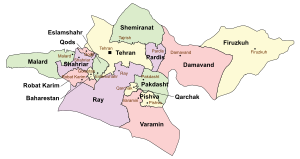
Tehran County
County in Tehran province, Iran
Distance: Approx. 973 meters
Latitude and longitude: 35.75,51.41666667
Tehran County (Persian: شهرستان تهران) is in Tehran province of Iran. Its capital is the city of Tehran. Greater Tehran is situated mostly in the county, the most populous in Iran.
Tehran International Tower
Residential in Tehran, Iran
Distance: Approx. 846 meters
Latitude and longitude: 35.7426808,51.3991446
Tehran International Tower (Persian: برج بینالمللی تهران) is a 56-story residential tower in Tehran, Iran. It is the tallest residential building in Iran, and the only one to meet the definition of a skyscraper. It is located north of Yusef Abad and Amir Abad districts, close to Kurdistan and Qasem Soleimani Expressway.

Iran Air Flight 291
1980 deadly plane crash in Tehran, Iran
Distance: Approx. 1469 meters
Latitude and longitude: 35.73333333,51.41666667
Iran Air Flight 291 was a flight from Mashad Airport to Tehran-Mehrabad Airport that crashed on 21 January 1980 during its approach to Tehran-Mehrabad runway 29 in foggy and snowy weather conditions, killing all 128 people on board. At the time, Iran Air Flight 291 was the deadliest aircraft disaster in Iranian history.

Fajr Interchange
Distance: Approx. 1301 meters
Latitude and longitude: 35.7498,51.4211
Fajr Interchange (Persian: تقاطع غیر هم سطح فجر) is an interchange in Tehran, Iran. It is between Hemmat and Modares Expressway.

A.S.P. Towers
Distance: Approx. 819 meters
Latitude and longitude: 35.74457,51.39914
A.S.P. Towers (also known as Kooy-e Nobonyad-e Vanak, Persian: ساختمانهای آ.اس.پ) are amongst the most well-known buildings in Tehran, Iran. They're located in the neighbourhood of Amir Abad and Yusef Abad in the corner of Kordestan and Hakim Highway. They were among the first residential high-rises in Iran and have housed some of the most well-known Iranian figures over the years, including Amir-Abbas Hoveyda, prime-minister under Mohammad Reza Pahlavi.
Export Development Bank of Iran
Iranian banking and financial services corporation
Distance: Approx. 1250 meters
Latitude and longitude: 35.735006,51.415398
Export Development Bank of Iran (EDBI) (Persian: بانک توسعه صادرات ايران, Bank Tuse'h-e Sadârat-e Iran) is Iran's export-import bank. The bank was incorporated as a policy bank, owned by the Iranian government, and provides financial and other conventional banking services to Iranian exporters and importers.

Abrisham Bridge
Bridge in Iran
Distance: Approx. 1171 meters
Latitude and longitude: 35.750992,51.418499
Abrisham Bridge (Persian: پل ابریشم, Pol-e Abrišam), literally the "Silk Bridge", is a cable-stayed bridge in Northern Tehran, Iran. It is located about 100 meters south of the Iran's Shipping Lines Tower, in the district of Abbas Abad. Extending in a north-south direction, it is intended solely for pedestrian traffic.
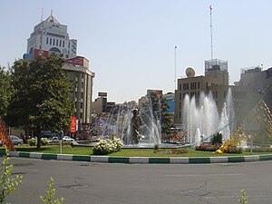
Arjantin Square
Distance: Approx. 1061 meters
Latitude and longitude: 35.73708333,51.41541667
Arjantin Square is a square in north central Tehran. The area around the square is home to embassies, businesses, Medical labs, hospitals and the Arjantin Beihaghi Bus Terminal, which is central Tehran's main national bus terminal.
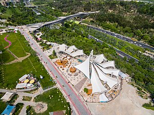
Ab-o-Atash Park
Park in Tehran, Iran
Distance: Approx. 1398 meters
Latitude and longitude: 35.75413028,51.41828028
Ab-o-Atash Park (Persian: پارکِ آب و آتش, Pārk-e Āb-o-Ātaš), literally the "Water-and-Fire Park", also known as the Ebrahim Park (Persian: پارکِ ابراهیم, Pārk-e Ebrāhim), is a park in northern Tehran, Iran. With an area over 24,000 square meters (260,000 sq ft), the park was opened on June 27, 2009 by the 55th Mayor of Tehran, Mohammad Baqer Galibaf.

Iranology Foundation
Institute of Historical Research on Iran
Distance: Approx. 1304 meters
Latitude and longitude: 35.7474679,51.3942016
The Iranology Foundation is a scientific and research institute in Iran and Iranian studies is the main field of its activities. The Foundation's studies and researches are all topics and issues related to various manifestations of Iranian culture and civilization. The institute was established in 1997 under the supervision of the Presidential Administration of Iran.
Weather in this IP's area
clear sky
19 Celsius
18 Celsius
19 Celsius
19 Celsius
1013 hPa
46 %
1013 hPa
863 hPa
10000 meters
1.54 m/s
05:50:53
18:04:43