46.19.49.6 - IP Lookup: Free IP Address Lookup, Postal Code Lookup, IP Location Lookup, IP ASN, Public IP
Country:
Region:
City:
Location:
Time Zone:
Postal Code:
ISP:
ASN:
language:
User-Agent:
Proxy IP:
Blacklist:
IP information under different IP Channel
ip-api
Country
Region
City
ASN
Time Zone
ISP
Blacklist
Proxy
Latitude
Longitude
Postal
Route
db-ip
Country
Region
City
ASN
Time Zone
ISP
Blacklist
Proxy
Latitude
Longitude
Postal
Route
IPinfo
Country
Region
City
ASN
Time Zone
ISP
Blacklist
Proxy
Latitude
Longitude
Postal
Route
IP2Location
46.19.49.6Country
Region
marche
City
fano
Time Zone
Europe/Rome
ISP
Language
User-Agent
Latitude
Longitude
Postal
ipdata
Country
Region
City
ASN
Time Zone
ISP
Blacklist
Proxy
Latitude
Longitude
Postal
Route
Popular places and events near this IP address

Fano
Comune in Marche, Italy
Distance: Approx. 2463 meters
Latitude and longitude: 43.8425,13.01361111
Fano (Italian: [ˈfaːno]) is a town and comune of the province of Pesaro and Urbino in the Marche region of Italy. It is a beach resort 12 kilometres (7 miles) southeast of Pesaro, located where the Via Flaminia reaches the Adriatic Sea. It is the third city in the region by population after Ancona and Pesaro.
Battle of the Metaurus
207 BC battle during the Second Punic War
Distance: Approx. 4235 meters
Latitude and longitude: 43.7824,13.0145
The Battle of the Metaurus was a pivotal battle in the Second Punic War between Rome and Carthage, fought in 207 BC near the Metauro River in Italy. The Carthaginians were led by Hasdrubal Barca, brother of Hannibal, who was to have brought siege equipment and reinforcements for Hannibal. The Roman armies were led by the consuls Marcus Livius, who was later nicknamed the Salinator, and Gaius Claudius Nero.

Metauro
River in Marche, Italy
Distance: Approx. 3551 meters
Latitude and longitude: 43.8292,13.0546
The Metauro is a river in the Marche region of central Italy. It rises in the Apennine Mountains and runs east for 110 kilometres (68 mi) or 121 kilometres (75 mi) if the Meta is included as its uppermost reach. The name of the river in Latin is Metaurus or Mataurus.
Battle of Fano
Battle during the Roman-Germanic wars (271)
Distance: Approx. 1486 meters
Latitude and longitude: 43.833333,13.016667
The Battle of Fano also known as the Battle of Fanum Fortunae was fought in 271 between the Roman and the Juthungian armies. The Romans led by Emperor Aurelian, were victorious.

San Costanzo
Comune in Marche, Italy
Distance: Approx. 7417 meters
Latitude and longitude: 43.76666667,13.06666667
San Costanzo is a comune (municipality) in the Province of Pesaro e Urbino in the Italian region Marche, located about 40 kilometres (25 mi) northwest of Ancona and about 20 kilometres (12 mi) southeast of Pesaro.
Art collection of Fondazione Cassa di Risparmio di Fano
Distance: Approx. 2681 meters
Latitude and longitude: 43.84416667,13.0175
The Quadreria della Fondazione Cassa di Risparmio di Fano (Gallery of the Foundation of Fano Saving Bank) houses a notable collection of Italian paintings from the 1600-1900s, collected over the last forty years by Cassa di Risparmio di Fano (which now transferred to the holding entity – the Fondazione). It is located in the Salone del Consiglio of the financial institution, formerly the Case dei Malatesti, in the city of Fano, Marche. The painting gallery is open to the public by pre-arranged guided tour.
Roman Catholic Diocese of Fano-Fossombrone-Cagli-Pergola
Roman Catholic diocese in Italy
Distance: Approx. 2645 meters
Latitude and longitude: 43.8435,13.0198
The Diocese of Fano-Fossombrone-Cagli-Pergola (Latin: Dioecesis Fanensis-Forosemproniensis-Calliensis-Pergulana) is a Latin diocese of the Catholic Church in Italy, created in 1986, when the historical Diocese of Fano was united to the Diocese of Cagli e Pergola and the Diocese of Fossombrone. It is a suffragan of the Archdiocese of Pesaro.

Arch of Augustus (Fano)
Distance: Approx. 2530 meters
Latitude and longitude: 43.84305556,13.01458333
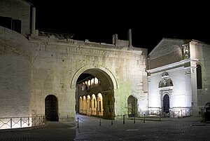
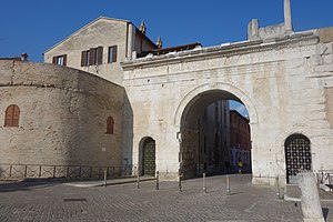
The Arch of Augustus in Fano (in the Province of Pesaro and Urbino) is a city gate in the form of a triumphal arch with three vaults. It is the entrance to the city by the via Flaminia, which became the inside of the wall of the decumanus maximus. It is one of the symbols of the city.
San Domenico, Fano
Distance: Approx. 2739 meters
Latitude and longitude: 43.8448,13.0165
San Domenico is a deconsecrated Roman Catholic church in the town of Fano, province of Pesaro and Urbino in the Marche, Italy. The deconsecrated church is now used to display the painting collection of the Fondazione Cassa di Risparmio di Fano. The church has been selected to display sacred works and altarpieces from the 16th and 17th centuries in an environment resembling their original placements.

Teatro della Fortuna
Music and theater venue
Distance: Approx. 2646 meters
Latitude and longitude: 43.843811,13.017811
The Teatro della Fortuna is a music and theater venue (opera house) in Fano, province of Pesaro and Urbino, region of Marche, Italy. The present building is, in general, the result of at least two nearly complete reconstructions. A palace built in 1299 at this site housed the Palazzo del Podestà of Fano.

Fano Cathedral
Cathedral in Marche, Italy
Distance: Approx. 2588 meters
Latitude and longitude: 43.8435,13.0157
Fano Cathedral (Italian: Basilica cattedrale di Santa Maria Assunta; Cattedrale di Fano; also called Santa Maria Maggiore) is the principal church of Fano, Marche, Italy. Originally the seat of the bishop of Fano, since 1986 it has been the episcopal seat of the Diocese of Fano-Fossombrone-Cagli-Pergola. In January 1953 Pope Pius XII elevated it to the rank of a basilica minor.
Weather in this IP's area
overcast clouds
13 Celsius
12 Celsius
13 Celsius
14 Celsius
1015 hPa
73 %
1015 hPa
1007 hPa
10000 meters
2.17 m/s
6.2 m/s
222 degree
97 %

