Country:
 Netherlands
Region:
City:
Latitude and Longitude:
Time Zone:
Postal Code:
IP information under different IP Channel
ip-api
Country
Region
City
ASN
Time Zone
ISP
Blacklist
Proxy
Latitude
Longitude
Postal
Route
IPinfo
Country
Region
City
ASN
Time Zone
ISP
Blacklist
Proxy
Latitude
Longitude
Postal
Route
MaxMind
Country
Region
City
ASN
Time Zone
ISP
Blacklist
Proxy
Latitude
Longitude
Postal
Route
Luminati
Country
NLASN
Time Zone
Europe/Amsterdam
ISP
Tilaa B.V.
Latitude
Longitude
Postal
db-ip
Country
Region
City
ASN
Time Zone
ISP
Blacklist
Proxy
Latitude
Longitude
Postal
Route
ipdata
Country
Region
City
ASN
Time Zone
ISP
Blacklist
Proxy
Latitude
Longitude
Postal
Route
Popular places and events near this IP address

Hortus Botanicus (Amsterdam)
Dutch botanical garden
Distance: Approx. 264 meters
Latitude and longitude: 52.3668,4.9079
Hortus Botanicus is a botanical garden in the Plantage district of Amsterdam, the Netherlands. It is one of the world's oldest botanical gardens.
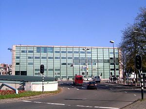
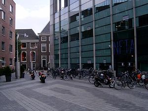
Netherlands Film Academy
Distance: Approx. 174 meters
Latitude and longitude: 52.36833333,4.90472222
The Netherlands Film Academy (Dutch: Nederlandse Filmacademie) (NFA) was founded in 1958. The academy is the only recognised institute in the Netherlands that offers training to prepare for the work in the various crew disciplines. Specialisation is possible in fiction directing, documentary directing, screenwriting, editing, producing, sounddesign, cinematography, production design, and interactive multimedia/visual effects.

Beit Ha'Chidush
Synagogue in Amsterdam, Netherlands
Distance: Approx. 174 meters
Latitude and longitude: 52.37027778,4.90527778
Beit Ha'Chidush (meaning House of Renewal in Hebrew), abbreviated as BHC is a Progressive Jewish congregation, located in Amsterdam, in the North Holland region of The Netherlands. The congregation was founded in 1995 by predominately expatriate Jews with secular and religious backgrounds who wanted to create a welcoming, inspiring and renewed Jewish congregation. Since 1997, the congregation has worshiped from the Uilenburg Synagogue, a synagogue located at Nieuwe Uilenburgerstraat 91, in Central Amsterdam.
Markenplein
Distance: Approx. 126 meters
Latitude and longitude: 52.3686,4.9053
Markenplein (Marken Square) is the name of a square in the centre of Amsterdam. Until 1970, it was called het oude Markenpleintje and before World War II it used to be a part of the Jewish district of Amsterdam. The name Markenplein symbolizes the bond between the new neighborhood and the old Jewish neighborhood.

Portuguese Synagogue (Amsterdam)
Orthodox synagogue in Amsterdam, Netherlands
Distance: Approx. 207 meters
Latitude and longitude: 52.3675,4.9054
The Portuguese Synagogue, also known as the Esnoga, or Snoge, is an Orthodox Jewish congregation and synagogue, located at Mr. Visserplein 3 in Central Amsterdam, Amsterdam, in the North Holland region of The Netherlands. The synagogue was completed in 1675.

Jodenbreestraat
Street in Amsterdam
Distance: Approx. 265 meters
Latitude and longitude: 52.36916667,4.90305556
The Jodenbreestraat ("Jewish Broad Street") is a street in the centre of Amsterdam, which connects the Sint Antoniesluis sluice gates to the Mr. Visserplein traffic circle. North of the sluice gates, the street continues on to Nieuwmarkt square as the Sint Antoniesbreestraat.
Rapenburg
Neighborhood in Amsterdam, Netherlands
Distance: Approx. 259 meters
Latitude and longitude: 52.37111111,4.90888889
Rapenburg is a neighbourhood in Amsterdam, Netherlands. The main street is also called Rapenburg. Rapenburg is located in the centre of Amsterdam, on the northeastern side, close to the IJ. As of the year 2022, its population was 990.
Uilenburg (Amsterdam)
Neighborhood of Amsterdam in North Holland, Netherlands
Distance: Approx. 187 meters
Latitude and longitude: 52.37027778,4.905
Uilenburg is a neighborhood of Amsterdam, Netherlands. Uilenburg is an island surrounded by the Oudeschans canal to the northwest, the Houtkopersburgwal canal to the southwest, the Uilenburgergracht to the southeast and the Rapenburgwal to the northeast. The Nieuwe Uilenburgerstraat runs along the length of the island, crossing the Houtkopersburgwal and Uilenburgergracht by bridges.

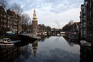
Nieuwe Herengracht
Canal in Amsterdam
Distance: Approx. 250 meters
Latitude and longitude: 52.366894,4.906301
The Nieuwe Herengracht (Dutch pronunciation: [ˌniu.ə ˈɦeːrə(ŋ)ˌɣrɑxt]) is a canal in Centrum district of Amsterdam. The canal is an extension of the Herengracht that runs between the Amstel and the Scharrebiersluis (lock) leading to the Schippersgracht from the Entrepotdok. It is in the Plantage neighborhood in the eastern part of the Grachtengordel (canal belt).

Uilenburgergracht
Canal in Amsterdam
Distance: Approx. 133 meters
Latitude and longitude: 52.370097,4.905893
The Uilenburgergracht is a secondary canal in Amsterdam, the Netherlands. It is located east of the Amsterdam-Centrum district, in the Lastage neighborhood. The Uilenburgergracht defines the southeastern border of Uilenburg Island.
Rapenburgwal
Canal in Amsterdam
Distance: Approx. 270 meters
Latitude and longitude: 52.37152,4.907275
The Rapenburgwal (Dutch pronunciation: [ˈraːpə(m)ˌbʏr(ə)xʋɑl]) is a secondary canal in Amsterdam in the east of the Amsterdam-Centrum district, in the Lastage neighborhood.
Markengracht
Canal in Amsterdam
Distance: Approx. 54 meters
Latitude and longitude: 52.369411,4.907569
The Markengracht was a canal in Amsterdam. For many years it was at the heart of the slums of the poor Jewish neighborhood. It was filled in 1968 as part of a complete rehabilitation of the area combined with construction of the IJtunnel, opened on 30 October 1968.
Weather in this IP's area
broken clouds
14 Celsius
14 Celsius
12 Celsius
16 Celsius
1024 hPa
81 %
1024 hPa
1024 hPa
6000 meters
1.03 m/s
75 %
07:16:53
19:53:35