46.188.60.1 - IP Lookup: Free IP Address Lookup, Postal Code Lookup, IP Location Lookup, IP ASN, Public IP
Country:
Region:
City:
Location:
Time Zone:
Postal Code:
ISP:
ASN:
language:
User-Agent:
Proxy IP:
Blacklist:
IP information under different IP Channel
ip-api
Country
Region
City
ASN
Time Zone
ISP
Blacklist
Proxy
Latitude
Longitude
Postal
Route
db-ip
Country
Region
City
ASN
Time Zone
ISP
Blacklist
Proxy
Latitude
Longitude
Postal
Route
IPinfo
Country
Region
City
ASN
Time Zone
ISP
Blacklist
Proxy
Latitude
Longitude
Postal
Route
IP2Location
46.188.60.1Country
Region
moskva
City
vostochnyy
Time Zone
Europe/Moscow
ISP
Language
User-Agent
Latitude
Longitude
Postal
ipdata
Country
Region
City
ASN
Time Zone
ISP
Blacklist
Proxy
Latitude
Longitude
Postal
Route
Popular places and events near this IP address

Pervomayskaya (Moscow Metro)
Moscow Metro station
Distance: Approx. 4871 meters
Latitude and longitude: 55.7948,37.7993
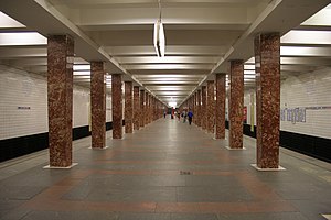
Pervomayskaya (Russian: Первомайская) is a Moscow Metro station in the Izmaylovo District, Eastern Administrative Okrug, Moscow. It is on the Arbatsko-Pokrovskaya Line, between Izmaylovskaya and Shchyolkovskaya stations. Before the current station opened on 21 October 1961, Pervomayskaya referred to the temporary station located in the Izmaylovo depot near the present-day Izmaylovskaya.

Golyanovo District
District in Moscow, Russia
Distance: Approx. 3744 meters
Latitude and longitude: 55.82055556,37.80722222
Golyanovo District (Russian: райо́н Голья́ново) is a district of Eastern Administrative Okrug of the federal city of Moscow, Russia. Population: 157,040 (2010 Census); 159,147 (2002 Census). It is one of the largest districts in Moscow, both in terms of the geographic area and population size.

Moscow Central Bus Terminal
Bus station in Moscow, Russia
Distance: Approx. 4218 meters
Latitude and longitude: 55.81111111,37.8
Moscow Central Bus Terminal is a bus terminal in Moscow for long-range and intercity passenger buses with daily overturn of about 25 thousand passengers serving about 40% of long-range bus routes in Moscow. Situated near Shcholkovskaya Metro station. It is owned by a state Mostransavto company.
Yuzhnoye Izmaylovo
Distance: Approx. 4872 meters
Latitude and longitude: 55.77777778,37.83111111
Yuzhnoye Izmaylovo (Russian: Ю́жное Изма́йлово, Southern Izmaylovo) is an area located in the eastern part of Moscow, Russia, just north of the Shosse Entuziastov (шоссе Энтузиастов) Route and west of the Moscow Ring Highway (МКАД). It borders Izmaylovo District in the south and Izmaylovsky Park in the north and west. In 1960, it became a part of Moscow, after all territories inside the Moscow Ring Highway were incorporated into Moscow proper.

Balashikha Arena
Distance: Approx. 4941 meters
Latitude and longitude: 55.79833333,37.93861111
The Balashikha Arena is a 6,000-seat multi-purpose arena in Balashikha, Russia. Opened in 2007, it replaced Vityaz Ice Palace as the home of HC MVD, a Kontinental Hockey League ice hockey team. The 2017 national rink bandy cup took place in the arena.

Moscow Radio Centre 13
Distance: Approx. 3079 meters
Latitude and longitude: 55.79277778,37.89138889
Moscow Radio Center 13 is a transmission facility near Balashikha, approximately 3.5 km east of the ringbelt motorway of Moscow. Moscow Radio Centre 13 served in the Cold War era as jammer to block transmissions of western shortwave radio programs. Although the radio wave jammer activities ceased in the middle of the 1980s, some occasional continuing of the jammer use occurred on March 14, 1989 to block incoming transmissions to the Lithuanian minority in Moscow area.

Chelyabinskaya Street
Street in Moscow, Russia
Distance: Approx. 4904 meters
Latitude and longitude: 55.77777778,37.83
Chelyabinskaya Street is located in the residential community of Yuzhnoye Izmaylovo in the Eastern Administrative Okrug of Moscow. The street was built in the mid 1970s as a central street for Yuzhnoye Izmaylovo. Named in 1975 for the city of Chelyabinsk, the regional center of Russia, due to its location in the east of Moscow.
Balashikhinsky District
Former administrative and municipal district of Moscow Oblast, Russia
Distance: Approx. 4564 meters
Latitude and longitude: 55.8,37.93333333
Balashikhinsky District (Russian: Балашихинский райо́н) was an administrative and municipal district (raion) of Moscow Oblast, Russia. Its administrative center was the city of Balashikha. Population: 225,381 (2010 Census); 187,988 (2002 Census); 31,964 (1989 Soviet census).

Severnoye Izmaylovo District
District in Moscow, Russia
Distance: Approx. 2965 meters
Latitude and longitude: 55.80888889,37.82138889
Severnoye Izmaylovo District (Russian: район Северное Измайлово) is one of 16 administrative districts (raions) of Eastern Administrative Okrug, and one of the 125 raions of Moscow, Russia. It is bounded on the north by Shchyolkovo Highway, on the south by Sirenevy Boulevard, and on the east by the Moscow Ring Road (MKAD). The area of the district is 4 square kilometers (1.5 sq mi).
Vostochnoye Izmaylovo District
District in federal city of Moscow, Russia
Distance: Approx. 3805 meters
Latitude and longitude: 55.79638889,37.81777778
Vostochnoye Izmaylovo District (Russian: райо́н Восто́чное Изма́йлово) is an administrative district (raion), one of the sixteen in Eastern Administrative Okrug of the federal city of Moscow, Russia. The area is 3.84 square kilometres (1.48 sq mi). As of the 2010 Census, its population was 76,312, up from 75,450 recorded during the 2002 Census.

Vostochny District, Moscow
District in Moscow, Russia
Distance: Approx. 244 meters
Latitude and longitude: 55.81888889,37.86638889
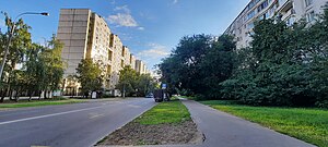
Vostochny District, Moscow (Russian: райо́н Восто́чный) is an administrative district (raion) of Eastern Administrative Okrug, and one of the 125 raions of Moscow, Russia.

Shchyolkovskaya
Moscow Metro station
Distance: Approx. 4336 meters
Latitude and longitude: 55.8094,37.7986
Shchyolkovskaya (Russian: Щёлковская) is a Moscow Metro station on the Arbatsko-Pokrovskaya Line. It is an Eastern terminus of the line. It opened in 1963.
Weather in this IP's area
overcast clouds
2 Celsius
-2 Celsius
2 Celsius
2 Celsius
1011 hPa
80 %
1011 hPa
992 hPa
10000 meters
5.76 m/s
12.96 m/s
315 degree
89 %
