Country:
Region:
City:
Latitude and Longitude:
Time Zone:
Postal Code:
IP information under different IP Channel
ip-api
Country
Region
City
ASN
Time Zone
ISP
Blacklist
Proxy
Latitude
Longitude
Postal
Route
Luminati
Country
ASN
Time Zone
Europe/Berlin
ISP
equada network GmbH
Latitude
Longitude
Postal
IPinfo
Country
Region
City
ASN
Time Zone
ISP
Blacklist
Proxy
Latitude
Longitude
Postal
Route
db-ip
Country
Region
City
ASN
Time Zone
ISP
Blacklist
Proxy
Latitude
Longitude
Postal
Route
ipdata
Country
Region
City
ASN
Time Zone
ISP
Blacklist
Proxy
Latitude
Longitude
Postal
Route
Popular places and events near this IP address

Battle of Dettingen
1743 battle during War of Austrian Succession
Distance: Approx. 3424 meters
Latitude and longitude: 50.04888889,9.01833333
The Battle of Dettingen (German: Schlacht bei Dettingen) took place on 27 June 1743 during the War of the Austrian Succession at Dettingen in the Electorate of Mainz, Holy Roman Empire (now Karlstein am Main in Bavaria). It was fought between a Pragmatic Army, composed of the British, Hanoverian and Austrian troops, and a French army commanded by the duc de Noailles. While the Earl of Stair exercised operational control, the Allied army was nominally commanded by King George II, accompanied by his son the Duke of Cumberland.
Mainflingen
Ortsteil of Mainhausen in Hesse, Germany
Distance: Approx. 3211 meters
Latitude and longitude: 50.03333333,9.03333333
Mainflingen is a village and part (Ortsteil) of the municipality Mainhausen, in the district of Offenbach in Hesse with about 4000 inhabitants. It is known for its time signal transmitter, DCF77, which controls almost all radio clocks in Western Europe.
Karlstein am Main
Municipality in Bavaria, Germany
Distance: Approx. 3424 meters
Latitude and longitude: 50.04888889,9.01833333
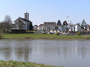
Karlstein am Main (officially Karlstein a. Main) is a municipality in the Aschaffenburg district in the Regierungsbezirk of Lower Franconia (Unterfranken) in Bavaria, Germany. It is the westernmost settlement in Bavaria.
Alzenau
Town in Bavaria, Germany
Distance: Approx. 1489 meters
Latitude and longitude: 50.06666667,9.06666667
Alzenau (German: [ˈaltsənaʊ] ; until 31 December 2006 officially Alzenau i.UFr.) is a town in the north of the Aschaffenburg district in the Regierungsbezirk of Lower Franconia (Unterfranken) in Bavaria, Germany. Until 1 July 1972, Alzenau was the district seat of the now abolished district of the same name and has a population of around 19,000.

Schanzenkopf (Spessart)
Mountain in Germany
Distance: Approx. 2705 meters
Latitude and longitude: 50.07083333,9.09194444
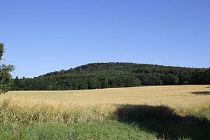
Schanzenkopf (Spessart) is a wooded hill of Bavaria, Germany. It lies in the Mittelgebirge Spessart in the district of Aschaffenburg. Schanzenkopf has a maximum elevation of 343 metres.
Rückersbach
River in Germany
Distance: Approx. 3423 meters
Latitude and longitude: 50.0226,9.0631
Rückersbach is a small river of Bavaria, Germany. It is a right tributary of the Haggraben near Kleinostheim.
Bachquellengraben
River of Bavaria, Germany
Distance: Approx. 1509 meters
Latitude and longitude: 50.0448,9.0493
Bachquellengraben is a small river of Bavaria, Germany. It flows into the Forchbach near Karlstein am Main.
Bruchbach (Haggraben)
River in Germany
Distance: Approx. 3554 meters
Latitude and longitude: 50.0214,9.0639
Bruchbach is a small river of Bavaria, Germany. It is a right tributary of the Haggraben near Kleinostheim.
Forchbach
River in Germany
Distance: Approx. 2943 meters
Latitude and longitude: 50.0377,9.0325
Forchbach is a small river of Bavaria, Germany. It flows into the Main in Karlstein am Main.
Haggraben
River in Germany
Distance: Approx. 2520 meters
Latitude and longitude: 50.0395,9.0378
Haggraben is a small river of Bavaria, Germany. It flows into the Forchbach in Karlstein am Main.
Krebsbach (Kahl)
River in Bavaria, Germany
Distance: Approx. 3862 meters
Latitude and longitude: 50.0874,9.0757
Krebsbach is a small river of Bavaria, Germany. It is a left tributary of the Kahl near Alzenau.

Neuwiesenbach
River in Germany
Distance: Approx. 3549 meters
Latitude and longitude: 50.0849,9.0723
Neuwiesenbach is a small river of Bavaria, Germany. It flows into the Kahl in Alzenau.
Weather in this IP's area
light rain
6 Celsius
3 Celsius
5 Celsius
7 Celsius
1013 hPa
90 %
1013 hPa
996 hPa
10000 meters
4.49 m/s
9.81 m/s
252 degree
100 %
07:40:30
16:37:18


