Country:
 Belgium
Region:
City:
Latitude and Longitude:
Time Zone:
Postal Code:
IP information under different IP Channel
ip-api
Country
Region
City
ASN
Time Zone
ISP
Blacklist
Proxy
Latitude
Longitude
Postal
Route
IPinfo
Country
Region
City
ASN
Time Zone
ISP
Blacklist
Proxy
Latitude
Longitude
Postal
Route
MaxMind
Country
Region
City
ASN
Time Zone
ISP
Blacklist
Proxy
Latitude
Longitude
Postal
Route
Luminati
Country
BERegion
bru
City
brussels
ASN
Time Zone
Europe/Brussels
ISP
Arcadiz Telecom NV
Latitude
Longitude
Postal
db-ip
Country
Region
City
ASN
Time Zone
ISP
Blacklist
Proxy
Latitude
Longitude
Postal
Route
ipdata
Country
Region
City
ASN
Time Zone
ISP
Blacklist
Proxy
Latitude
Longitude
Postal
Route
Popular places and events near this IP address

Aalst, Belgium
Municipality in Flemish Community, Belgium
Distance: Approx. 5728 meters
Latitude and longitude: 50.93833333,4.03916667
Aalst (Dutch pronunciation: [aːlst] ; French: Alost, pronounced [alɔst]; Brabantian: Oilsjt) is a city and municipality in the province of East Flanders in the Flemish Region of Belgium. It is located on the Dender River, about 31 kilometres (19 mi) northwest of Brussels. The municipality comprises the city of Aalst itself and the villages of Baardegem, Erembodegem, Gijzegem, Herdersem, Hofstade, Meldert, Moorsel and Nieuwerkerken; it is the tenth largest city by population with 90.068 inhabitants.
Denderleeuw
Municipality in Flemish Community, Belgium
Distance: Approx. 3945 meters
Latitude and longitude: 50.88333333,4.06666667
Denderleeuw (Dutch pronunciation: [ˌdɛndərˈleːu] ) is a municipality located in the Belgian province of East Flanders in the Denderstreek. The municipality comprises the towns of Denderleeuw proper, Iddergem and Welle. In 2021, Denderleeuw had a total population of 20.730.

Affligem
Municipality in Flemish Community, Belgium
Distance: Approx. 1053 meters
Latitude and longitude: 50.9,4.1
Affligem (Dutch pronunciation: [ˈɑfliɣɛm] ; anciently written Afflighem) is a municipality located some 20 km (12 mi) west-north-west of Brussels in the Belgian province of Flemish Brabant, not far from the city of Aalst and the important railway junction of Denderleeuw. Affligem is situated in the Pajottenland. The municipality comprises the villages of Essene, Hekelgem and Teralfene (note that there is no village called Affligem proper).

Liedekerke
Municipality in Flemish Community, Belgium
Distance: Approx. 4940 meters
Latitude and longitude: 50.86666667,4.08333333
Liedekerke (Dutch pronunciation: [ˈlidəkɛrkə]) is a municipality located in the Belgian province of Flemish Brabant. On January 1, 2006, Liedekerke had a total population of 11,920. It is also situated in the Pajottenland.The total area is 10.08 km2 which results in a population density of 1,183 inhabitants per km2.
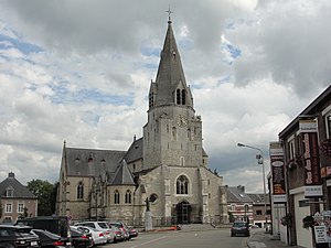
Affligem Abbey
Abbey in Affligem, Belgium
Distance: Approx. 1817 meters
Latitude and longitude: 50.9242,4.114
Affligem Abbey (Dutch: Abdij Affligem, French: Abbaye d'Affligem) is a Benedictine abbey in the historic village of Hekelgem, now in the municipality of Affligem, Flemish Brabant, Belgium, 19 km (12 mi) to the north-west of Brussels. Dedicated in 1086, it was the most important monastery in the Duchy of Brabant and therefore often called Primaria Brabantiae.

Teralfene
Municipality in Flemish Community, Belgium
Distance: Approx. 1053 meters
Latitude and longitude: 50.9,4.1
Teralfene is a village in the municipality of Affligem, Belgium. It has an area of 244 ha (602.94 acres). The other communities in Affligem are Hekelgem and Essene.

Van Roystadion
Football stadium in Denderleeuw, Belgium
Distance: Approx. 3701 meters
Latitude and longitude: 50.883683,4.071185
Van Roystadion is a stadium in Denderleeuw, Belgium. It is mainly used for football and is the home stadium of Dender EH. Built in 1997, it has a capacity of 6,429. In 2008, the FCV Dender EH-management decided to build a new stadium, because the old one didn't fit to League One conditions.

Moorsel
Deelgemeente in East Flanders, Belgium
Distance: Approx. 4345 meters
Latitude and longitude: 50.9475,4.09916667
Moorsel is a village in the Denderstreek in the province East Flanders in Belgium, a deelgemeente of the city of Aalst. The village belongs to a league of neighbouring villages, which call themselves the Faluintjesgemeenten. Moorsel is the largest of the four villages with approximately 5,175 inhabitants as of 2021.
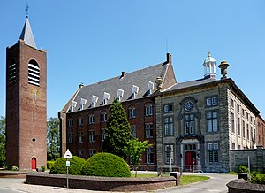
St Joseph College, Aalst
Secondary school in Aalst, Belgium
Distance: Approx. 5532 meters
Latitude and longitude: 50.937188,4.041308
St Joseph's College (Dutch, Sint-Jozefscollege) is a Roman Catholic subsidized free school for general secondary education founded by the Society of Jesus in Aalst. The school building is a protected monument.
Okapi Forum
Multi-purpose arena in Aalst, Belgium
Distance: Approx. 4989 meters
Latitude and longitude: 50.9398,4.0547
Okapi Forum is a multi-purpose arena in Aalst, Belgium. Okapi Forum holds room for 2,800 people for basketball games. It hosts the home games of the BNXT League club Okapi Aalst, as well as performances of music artists.

Denderleeuw railway station
Railway station in East Flanders, Belgium
Distance: Approx. 3046 meters
Latitude and longitude: 50.89166667,4.07194444
Denderleeuw railway station (Dutch: Station Denderleeuw; French: Gare de Denderleeuw) is a railway station in Denderleeuw, East Flanders, Belgium. The station opened on 7 April 1855 and is located on railway lines 50, 89 and 90. The train services are operated by the National Railway Company of Belgium (NMBS/SNCB).

Groot Park
City Park of the city of Aalst.
Distance: Approx. 4826 meters
Latitude and longitude: 50.93032,4.046294
The Groot park or Park schepen de Wolf or city park of Aalst (stadspark) is a park in the Belgian city of Aalst. It can be regarded as an artificial nature domain with a recreational-educational function. The park covers an area of approximately 15 hectares (37 acres).
Weather in this IP's area
overcast clouds
13 Celsius
13 Celsius
13 Celsius
14 Celsius
1007 hPa
93 %
1007 hPa
999 hPa
10000 meters
9.02 m/s
15.29 m/s
229 degree
99 %
07:44:17
19:21:50