46.182.16.127 - IP Lookup: Free IP Address Lookup, Postal Code Lookup, IP Location Lookup, IP ASN, Public IP
Country:
 Germany
Region:
City:
Location:
Time Zone:
Postal Code:
ISP:
ASN:
language:
User-Agent:
Proxy IP:
Blacklist:
IP information under different IP Channel
ip-api
Country
Region
City
ASN
Time Zone
ISP
Blacklist
Proxy
Latitude
Longitude
Postal
Route
db-ip
Country
Region
City
ASN
Time Zone
ISP
Blacklist
Proxy
Latitude
Longitude
Postal
Route
IPinfo
Country
Region
City
ASN
Time Zone
ISP
Blacklist
Proxy
Latitude
Longitude
Postal
Route
IP2Location
46.182.16.127Country
deRegion
thuringen
City
bethenhausen
Time Zone
Europe/Berlin
ISP
Language
User-Agent
Latitude
Longitude
Postal
ipdata
Country
Region
City
ASN
Time Zone
ISP
Blacklist
Proxy
Latitude
Longitude
Postal
Route
Popular places and events near this IP address

Bröckau
Ortsteil of Schnaudertal in Saxony-Anhalt, Germany
Distance: Approx. 3894 meters
Latitude and longitude: 50.96666667,12.21666667
Bröckau is a village and a former municipality in the Burgenlandkreis district, in Saxony-Anhalt, Germany. Since 1 January 2010, it is part of the municipality Schnaudertal.
Heuckewalde
Ortsteil of Gutenborn in Saxony-Anhalt, Germany
Distance: Approx. 4389 meters
Latitude and longitude: 50.96666667,12.16666667
Heuckewalde is a village and a former municipality in the Burgenlandkreis district, in Saxony-Anhalt, Germany. Since 1 January 2010, it has been part of the Gutenborn municipality.
Lumpzig
Ortsteil of Schmölln in Thuringia, Germany
Distance: Approx. 4471 meters
Latitude and longitude: 50.94527778,12.26083333
Lumpzig is a village and a former municipality in the district Altenburger Land, in Thuringia, Germany. Since 1 January 2019, it is part of the town of Schmölln.

Hirschfeld, Thuringia
Municipality in Thuringia, Germany
Distance: Approx. 1204 meters
Latitude and longitude: 50.94138889,12.18861111
Hirschfeld is a municipality in the district of Greiz, in Thuringia, Germany. The town is member of the municipal association Am Brahmetal.

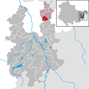
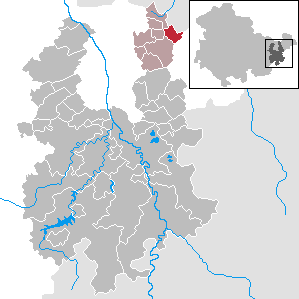
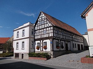
Bethenhausen
Municipality in Thuringia, Germany
Distance: Approx. 528 meters
Latitude and longitude: 50.92888889,12.19722222
Bethenhausen is a municipality in the district of Greiz, in Thuringia, Germany. The town is member of the municipal association Am Brahmetal.

Brahmenau
Municipality in Thuringia, Germany
Distance: Approx. 2983 meters
Latitude and longitude: 50.91666667,12.16666667
Brahmenau is a municipality in the district of Greiz, in Thuringia, Germany.

Großenstein
Municipality in Thuringia, Germany
Distance: Approx. 3707 meters
Latitude and longitude: 50.9,12.2
Großenstein is a municipality in the district of Greiz, in Thuringia, Germany. The town is member of the municipal association Am Brahmetal.
Korbußen
Municipality in Thuringia, Germany
Distance: Approx. 5087 meters
Latitude and longitude: 50.89138889,12.17111111
Korbußen is a municipality in the district of Greiz, in Thuringia, Germany. The town is member of the municipal association Am Brahmetal.

Pölzig
Municipality in Thuringia, Germany
Distance: Approx. 2143 meters
Latitude and longitude: 50.9525,12.19777778
Pölzig is a municipality in the district of Greiz, in Thuringia, Germany. It is member of the municipal association Am Brahmetal.
Reichstädt
Municipality in Thuringia, Germany
Distance: Approx. 2624 meters
Latitude and longitude: 50.925,12.235
Reichstädt is a municipality in the district of Greiz, in Thuringia, Germany. The town is member of the municipal association Am Brahmetal.
Am Brahmetal
Distance: Approx. 3707 meters
Latitude and longitude: 50.9,12.2
Am Brahmetal is a Verwaltungsgemeinschaft ("collective municipality") in the district of Greiz, in Thuringia, Germany. Since 1991 the seat of the Verwaltungsgemeinschaft is in Großenstein. One year later the name of the Verwaltungsgemeinschaft changed from Oberes Sprottetal to Am Brahmetal.

Schnaudertal
Municipality in Saxony-Anhalt, Germany
Distance: Approx. 3714 meters
Latitude and longitude: 50.96666667,12.2
Schnaudertal is a municipality in the Burgenlandkreis district, in Saxony-Anhalt, Germany. It was formed on 1 January 2010 by the merger of the former municipalities Bröckau and Wittgendorf.
Weather in this IP's area
light snow
-2 Celsius
-2 Celsius
-3 Celsius
-1 Celsius
1017 hPa
92 %
1017 hPa
986 hPa
10000 meters
0.45 m/s
1.79 m/s
281 degree
100 %