46.182.150.9 - IP Lookup: Free IP Address Lookup, Postal Code Lookup, IP Location Lookup, IP ASN, Public IP
Country:
Region:
City:
Location:
Time Zone:
Postal Code:
IP information under different IP Channel
ip-api
Country
Region
City
ASN
Time Zone
ISP
Blacklist
Proxy
Latitude
Longitude
Postal
Route
Luminati
Country
Region
he
City
offenbach
ASN
Time Zone
Europe/Berlin
ISP
DATEV eG
Latitude
Longitude
Postal
IPinfo
Country
Region
City
ASN
Time Zone
ISP
Blacklist
Proxy
Latitude
Longitude
Postal
Route
IP2Location
46.182.150.9Country
Region
bayern
City
niedling
Time Zone
Europe/Berlin
ISP
Language
User-Agent
Latitude
Longitude
Postal
db-ip
Country
Region
City
ASN
Time Zone
ISP
Blacklist
Proxy
Latitude
Longitude
Postal
Route
ipdata
Country
Region
City
ASN
Time Zone
ISP
Blacklist
Proxy
Latitude
Longitude
Postal
Route
Popular places and events near this IP address
Traunstein
Town in Bavaria, Germany
Distance: Approx. 8466 meters
Latitude and longitude: 47.86666667,12.63333333
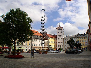
Traunstein (Central Bavarian: Traunstoa) is a town in the south-eastern part of Bavaria, Germany, and is the administrative center of a much larger district of the same name. The town serves as a local government, retail, health services, transport and educational center for the wider district. The historic market square, Bavarian hospitality, local breweries, outdoor sports facilities, Easter Monday horse parade, and connections with Pope Emeritus Benedict XVI, contribute to the town's profile as a tourist destination.
Traunreut
Town in Bavaria, Germany
Distance: Approx. 4420 meters
Latitude and longitude: 47.96666667,12.58333333
Traunreut (German pronunciation: [tʁaʊ̯nˈʁɔɪ̯t] ; Central Bavarian: Traunreit) is a town in southeastern Bavaria, Germany in the Traunstein district. It is located at 47°58′N 12°35′E. Traunreut lies in the heart of the Chiemgau region between Munich and Salzburg, approximately 10 km east of the Chiemsee, 25 km north of the Alps, and 35 km west of Salzburg. Its population is approximately 21,000.

Palling
Municipality in Bavaria, Germany
Distance: Approx. 6382 meters
Latitude and longitude: 48,12.63333333
Palling is a municipality in the district of Traunstein in Bavaria, Germany.

Waging am See
Municipality in Bavaria, Germany
Distance: Approx. 7732 meters
Latitude and longitude: 47.93333333,12.73333333
Waging am See (officially: Waging a. See) is a municipality in the district of Traunstein in Bavaria, Germany.
Nußdorf (Chiemgau)
Municipality in Bavaria, Germany
Distance: Approx. 7491 meters
Latitude and longitude: 47.88333333,12.58333333
Nußdorf (German pronunciation: [ˈnʊsdɔʁf] ) is a municipality in the district of Traunstein in Bavaria in Germany.

Taching am See
Municipality in Bavaria, Germany
Distance: Approx. 6949 meters
Latitude and longitude: 47.96666667,12.71666667
Taching am See is a municipality in the district of Traunstein in Bavaria, Germany. The municipality lies to the west and northwest of the Tachinger See (Lake Taching). Among the small villages in rural Taching am See are: Assing, Buchberg, Grendach, Gröben, Haunerting, Hörgassing, Hucking, Mauerham, Moosmühle, Obertaching, Planthal, Salling, Schönhofen and Tettenberg.

Wonneberg
Municipality in Bavaria, Germany
Distance: Approx. 7043 meters
Latitude and longitude: 47.91666667,12.71666667
Wonneberg is a municipality in the district of Traunstein in Bavaria, Germany.
Heidenhain
German machine tool numerical control manufacturer
Distance: Approx. 3581 meters
Latitude and longitude: 47.964,12.5946
Dr. Johannes Heidenhain GmbH is a privately owned enterprise located in Traunreut, Germany. Heidenhain manufactures numerical controls for machine tools, as well as mechatronic measuring devices for length and angle.

Schlossberg von Tettelham
Mountain in Germany
Distance: Approx. 3650 meters
Latitude and longitude: 47.94805556,12.67888889
Schlossberg von Tettelham is a mountain of Bavaria, Germany.
Hofbräuhaus Traunstein
Beer brewery in Bavaria, Germany
Distance: Approx. 8316 meters
Latitude and longitude: 47.8689686,12.6485124
Hofbräuhaus Traunstein is a beer brewery in Traunstein, southeastern Bavaria, Germany.

Stein Castle (Bavaria)
Distance: Approx. 7957 meters
Latitude and longitude: 47.986625,12.546381
Stein Castle (German: Schloss Stein) in Stein an der Traun is the most important cave castle in Germany. The castle comprises three elements: the upper house on the almost 50 metre high steeply sloping nagelfluh rock face; the cave castle beneath it, which hides a passage to the Traun valley in the rock; the lower house in Stein itself.

Traunstein station
Railway station in Traunstein, Germany
Distance: Approx. 8168 meters
Latitude and longitude: 47.869524,12.638569
Traunstein station is the only station of the large district town of Traunstein in the German state of Bavaria. It has four main line platform tracks and two bay platform tracks and is classified by Deutsche Bahn as a category 4 station. The station is a rail junction and is located on the Rosenheim–Salzburg, Traunstein–Ruhpolding, Traunstein–Waging and Traunstein–Garching lines.
Weather in this IP's area
light snow
-2 Celsius
-5 Celsius
-2 Celsius
-2 Celsius
1035 hPa
80 %
1035 hPa
961 hPa
10000 meters
2.68 m/s
5.36 m/s
219 degree
99 %


