46.182.149.220 - IP Lookup: Free IP Address Lookup, Postal Code Lookup, IP Location Lookup, IP ASN, Public IP
Country:
Region:
City:
Location:
Time Zone:
Postal Code:
IP information under different IP Channel
ip-api
Country
Region
City
ASN
Time Zone
ISP
Blacklist
Proxy
Latitude
Longitude
Postal
Route
Luminati
Country
Region
nw
City
wermelskirchen
ASN
Time Zone
Europe/Berlin
ISP
DATEV eG
Latitude
Longitude
Postal
IPinfo
Country
Region
City
ASN
Time Zone
ISP
Blacklist
Proxy
Latitude
Longitude
Postal
Route
IP2Location
46.182.149.220Country
Region
bayern
City
kuhn
Time Zone
Europe/Berlin
ISP
Language
User-Agent
Latitude
Longitude
Postal
db-ip
Country
Region
City
ASN
Time Zone
ISP
Blacklist
Proxy
Latitude
Longitude
Postal
Route
ipdata
Country
Region
City
ASN
Time Zone
ISP
Blacklist
Proxy
Latitude
Longitude
Postal
Route
Popular places and events near this IP address
Waldkirchen
Town in Bavaria, Germany
Distance: Approx. 4230 meters
Latitude and longitude: 48.73047778,13.60113889
Waldkirchen is the biggest town in the district of Freyung-Grafenau in Germany.

Hauzenberg
Town in Bavaria, Germany
Distance: Approx. 9088 meters
Latitude and longitude: 48.65,13.63333333
Hauzenberg (German pronunciation: [ˈhaʊ̯t͡sn̩ˌbɛʁk] ) is a municipality in the district of Passau, in Bavaria, Germany. It is situated 15 kilometres (9 miles) northeast of Passau. In November 1936, Gauleiter Fritz Wächtler dedicated the Hauzenberg district house.

Freyung, Bavaria
Town in Bavaria, Germany
Distance: Approx. 9886 meters
Latitude and longitude: 48.8,13.55
Freyung is a town in Bavaria and capital of the Freyung-Grafenau district. It is situated in the Bavarian Forest mountain range, near the border with Austria and the Czech Republic.

Fürsteneck
Municipality in Bavaria, Germany
Distance: Approx. 6261 meters
Latitude and longitude: 48.71666667,13.46666667
Fürsteneck is a municipality in the district of Freyung-Grafenau in Bavaria in Germany.

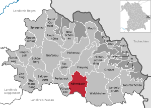
Röhrnbach
Municipality in Bavaria, Germany
Distance: Approx. 2802 meters
Latitude and longitude: 48.73333333,13.53333333
Röhrnbach is a municipality in the district of Freyung-Grafenau in Bavaria in Germany.

Büchlberg
Municipality in Bavaria, Germany
Distance: Approx. 6237 meters
Latitude and longitude: 48.66666667,13.5
Büchlberg (Central Bavarian: Bichlbeag) is a municipality in the district of Passau in Bavaria in Germany.

Witzmannsberg
Municipality in Bavaria, Germany
Distance: Approx. 9922 meters
Latitude and longitude: 48.71666667,13.41666667
Witzmannsberg is a municipality in the district of Passau in Bavaria in Germany.

Hutthurm
Municipality in Bavaria, Germany
Distance: Approx. 7048 meters
Latitude and longitude: 48.66666667,13.48333333
Hutthurm (Central Bavarian: Huading) is a municipality in the district of Passau in Bavaria in Germany.
Wollaberg
Ortsteil of Jandelsbrunn in Bavaria, Germany
Distance: Approx. 8918 meters
Latitude and longitude: 48.72225278,13.67176111
Wollaberg is a small town in the district of Freyung-Grafenau in Bavaria in Germany.
Oberfrauenwald
Mountain in Germany
Distance: Approx. 8336 meters
Latitude and longitude: 48.685,13.65777778
Oberfrauenwald is a 947.7 m (3,109 ft) high wooded mountain in the southern Bavarian Forest in Bavaria, Germany. It is positioned between the cities of Waldkirchen and Hauzenberg. The district borders between Passau and Freyung-Grafenau run over the mountain's peaks.
Steinberg (Lower Bavaria)
Mountain in Germany
Distance: Approx. 4172 meters
Latitude and longitude: 48.68222222,13.5875
Steinberg is a mountain of Bavaria, Germany.

Wolfsteiner Ohe
River in Germany
Distance: Approx. 7168 meters
Latitude and longitude: 48.7183,13.4545
Wolfsteiner Ohe is a river of Bavaria, Germany. It is formed at the confluence of the Saußbach and the Reschbach west of Freyung. It flows into the Ilz near Fürsteneck.
Weather in this IP's area
broken clouds
-2 Celsius
-2 Celsius
-4 Celsius
-1 Celsius
1039 hPa
96 %
1039 hPa
982 hPa
10000 meters
0.17 m/s
0.44 m/s
98 degree
58 %

