46.182.146.197 - IP Lookup: Free IP Address Lookup, Postal Code Lookup, IP Location Lookup, IP ASN, Public IP
Country:
Region:
City:
Location:
Time Zone:
Postal Code:
IP information under different IP Channel
ip-api
Country
Region
City
ASN
Time Zone
ISP
Blacklist
Proxy
Latitude
Longitude
Postal
Route
Luminati
Country
Region
he
City
offenbach
ASN
Time Zone
Europe/Berlin
ISP
DATEV eG
Latitude
Longitude
Postal
IPinfo
Country
Region
City
ASN
Time Zone
ISP
Blacklist
Proxy
Latitude
Longitude
Postal
Route
IP2Location
46.182.146.197Country
Region
saarland
City
perl
Time Zone
Europe/Berlin
ISP
Language
User-Agent
Latitude
Longitude
Postal
db-ip
Country
Region
City
ASN
Time Zone
ISP
Blacklist
Proxy
Latitude
Longitude
Postal
Route
ipdata
Country
Region
City
ASN
Time Zone
ISP
Blacklist
Proxy
Latitude
Longitude
Postal
Route
Popular places and events near this IP address

Schengen, Luxembourg
Commune in Remich, Luxembourg
Distance: Approx. 1641 meters
Latitude and longitude: 49.46944444,6.35888889
Schengen (Luxembourgish: [ˈʃæŋən] , French: [ʃɛŋɡɛn] , German: [ˈʃɛŋən]) is a small wine-making village and commune in far south-eastern Luxembourg, on the western bank of the river Moselle. The commune border includes the tripoint where the borders of Germany, France, and Luxembourg meet. After the mergers with Burmerange and Wellenstein in 2011, the commune has a population of 4,224 with an area of 31.42 square kilometres (12.13 sq mi).

Remerschen
Distance: Approx. 2608 meters
Latitude and longitude: 49.48333333,6.35
Remerschen (Luxembourgish: Rëmerschen) is a former commune and small wine-growing town in south-eastern Luxembourg, belonging to the commune of Schengen, near the point where the borders of Germany, France and Luxembourg come together. As of 2024, the town of Remerschen, which lies in the centre of the commune, has a population of 761. To use the name recognition of the town of Schengen, the council of the commune of Remerschen decided on 18 January 2006 to rename the commune to Schengen.

Markusbierg Tunnel
Distance: Approx. 2525 meters
Latitude and longitude: 49.4789,6.3482
The Markusbierg tunnels are a pair of parallel tunnels, which form the most easterly section of the A13 motorway through Luxembourg, near the town of Schengen. The tunnels are 1575 metres in length, and descend easterly, towards the German border at a 5% gradient. The eastern end of the tunnel runs directly to a viaduct crossing the river Moselle, which forms the border with Germany.
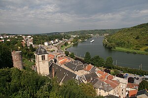
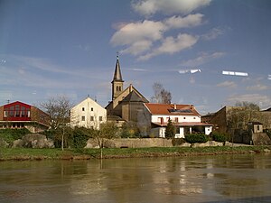
Perl, Saarland
Municipality in Saarland, Germany
Distance: Approx. 1198 meters
Latitude and longitude: 49.46666667,6.36666667
Perl (German pronunciation: [pɛʁl] ) is a municipality in Merzig-Wadern, Saarland, Germany. In 2020 its population was 8,824.

Apach
Commune in Grand Est, France
Distance: Approx. 1430 meters
Latitude and longitude: 49.4594,6.3756
Apach (French pronunciation: [apak]; German: Apach; Luxembourgish: Opech [ˈoːpəɕ]) is a commune in the Moselle department in Grand Est in northeastern France. Apach is 2 km (1.2 mi) from Sierck-les-Bains, 25 km (16 mi) from Thionville, and 50 km (31 mi) from Metz. It is on the right bank of the river Moselle, on the border of Germany and Luxembourg, the municipalities just across the border being Perl in Germany and Schengen in Luxembourg.

Wintrange
Town in southeastern Luxembourg
Distance: Approx. 3879 meters
Latitude and longitude: 49.5,6.35
Wintrange (Luxembourgish: Wëntreng, German: Wintringen) is a small town in the commune of Schengen, in southeastern Luxembourg. As of 2024, the town has a population of 483.
Kirsch-lès-Sierck
Commune in Grand Est, France
Distance: Approx. 3401 meters
Latitude and longitude: 49.4439,6.4008
Kirsch-lès-Sierck (French pronunciation: [kiʁʃ lɛ siʁk], lit. 'Kirsch near Sierck'; German: Kirsch bei Sierck) is a commune in the Moselle department in Grand Est in north-eastern France.
Contz-les-Bains
Commune in Grand Est, France
Distance: Approx. 3242 meters
Latitude and longitude: 49.4528,6.3472
Contz-les-Bains (French pronunciation: [kɔ̃ts le bɛ̃]; Lorraine Franconian: Nidderkonz; German: Niederkontz) is a commune in the Moselle department in Grand Est in north-eastern France. The commune is located in the Pays de Sierck at the confluence of the Sauer (known in French as the Sûre) and the Moselle, which form the borders with Luxembourg and Germany. Just over the border in Germany is the town of Perl in Saarland, and the neighboring town in Luxembourg is Schengen.
Merschweiller
Commune in Grand Est, France
Distance: Approx. 2929 meters
Latitude and longitude: 49.4628,6.4194
Merschweiller (German: Merschweiler) is a commune in the Moselle department in Grand Est in north-eastern France.
Rustroff
Commune in Grand Est, France
Distance: Approx. 3151 meters
Latitude and longitude: 49.4439,6.3731
Rustroff (French pronunciation: [ʁystʁɔf]; German: Rüsdorf) is a commune in the Moselle department in Grand Est in north-eastern France.

Sierck-les-Bains
Commune in Grand Est, France
Distance: Approx. 3512 meters
Latitude and longitude: 49.4431,6.3608
Sierck-les-Bains (French pronunciation: [siʁk le bɛ̃] ; German: Bad Sierck; Lorraine Franconian: Siirk/Siirck) is a commune in the Moselle department in Grand Est in north-eastern France.
Schengen Castle
Castle in Luxembourg
Distance: Approx. 1141 meters
Latitude and longitude: 49.47111111,6.36555556
Schengen Castle (Luxembourgish: Schlass Schengen; French: Château de Schengen; German: Schloss Schengen) is located in the village of Schengen in the south-east of Luxembourg close to the borders with France and Germany. Dating from 1390 but almost completely rebuilt in the 19th century, it was a hotel and conference centre until it was sold to Regus in 2016.
Weather in this IP's area
overcast clouds
3 Celsius
3 Celsius
2 Celsius
3 Celsius
1038 hPa
68 %
1038 hPa
1006 hPa
10000 meters
0.45 m/s
5.81 m/s
87 %


