46.182.139.52 - IP Lookup: Free IP Address Lookup, Postal Code Lookup, IP Location Lookup, IP ASN, Public IP
Country:
Region:
City:
Location:
Time Zone:
Postal Code:
IP information under different IP Channel
ip-api
Country
Region
City
ASN
Time Zone
ISP
Blacklist
Proxy
Latitude
Longitude
Postal
Route
Luminati
Country
Region
bw
City
nattheim
ASN
Time Zone
Europe/Berlin
ISP
NetCom BW GmbH
Latitude
Longitude
Postal
IPinfo
Country
Region
City
ASN
Time Zone
ISP
Blacklist
Proxy
Latitude
Longitude
Postal
Route
IP2Location
46.182.139.52Country
Region
baden-wurttemberg
City
ulm
Time Zone
Europe/Berlin
ISP
Language
User-Agent
Latitude
Longitude
Postal
db-ip
Country
Region
City
ASN
Time Zone
ISP
Blacklist
Proxy
Latitude
Longitude
Postal
Route
ipdata
Country
Region
City
ASN
Time Zone
ISP
Blacklist
Proxy
Latitude
Longitude
Postal
Route
Popular places and events near this IP address

Ulm
City in Baden-Württemberg, Germany
Distance: Approx. 636 meters
Latitude and longitude: 48.4,9.98333333
Ulm (German pronunciation: [ʊlm] ) is the sixth-largest city of the southwestern German state of Baden-Württemberg, and with around 129,000 inhabitants, it is Germany's 60th-largest city. Ulm is located on the eastern edges of the Swabian Jura mountain range, on the upper course of the River Danube, at the confluence with the small Blau Stream, coming from the Blautopf in the west. The mouth of the Iller also falls within Ulm's city limits.

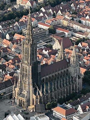
Ulm Minster
Lutheran church in Ulm, Germany that is the tallest church in the world
Distance: Approx. 71 meters
Latitude and longitude: 48.39861111,9.9925
Ulm Minster (German: Ulmer Münster) is a Lutheran church located in Ulm, State of Baden-Württemberg (Germany). It is the tallest church in the world. The church is the fifth-tallest structure built before the 20th century, with a steeple measuring 161.53 metres.

Ulm-Jungingen
Stadtteil of Ulm in Baden-Württemberg, Germany
Distance: Approx. 636 meters
Latitude and longitude: 48.4,9.98333333
Ulm-Jungingen is a borough of Ulm in the German Bundesland of Baden-Württemberg with a population of 3,706 (2019).

Ulm Hauptbahnhof
Railway station in Ulm, Germany
Distance: Approx. 636 meters
Latitude and longitude: 48.4,9.98333333
Ulm Hauptbahnhof is the main station in the city of Ulm, which lies on the Danube, on the border of the German states of Baden-Württemberg and Bavaria in the Danube-Iller region (Region Donau-Iller). Ulm Hauptbahnhof has twelve platforms, of which five are terminating platforms, and forms a major railway junction. Other stations in the city are Ulm-Söflingen to the west and Ulm Ost (east) to the east and Ulm-Donautal (Danube valley) in the industrial area.

EV6 The Rivers Route
Cycling route in Europe
Distance: Approx. 421 meters
Latitude and longitude: 48.4008,9.9872
EuroVelo 6 (EV6), named the "Rivers Route", is a EuroVelo long-distance cycling route that runs along 3,653 km (2,270 mi) some of Europe's major rivers, including much of the Loire, some of the Saône, a short section of the upper Rhine and almost the entire length of Europe’s second longest river, the Danube — from the Atlantic coast of France to the city of Constanța on the Black Sea. The EV6 traverses ten countries, from the mouth of the Loire eastward along that river to the Saône, across the border to Switzerland, along the Rhine to Lake Constance, north into Germany, down the Danube and through Austria, Slovakia, Hungary, Serbia, Croatia, Bulgaria, and Romania to the Danube Delta, before terminating at Constanța on the Black Sea. The EV6 includes the Danube Cycleway (de:Donauradweg), the most popular holiday cycle route in Europe.
Söflingen Abbey
Distance: Approx. 636 meters
Latitude and longitude: 48.4,9.98333333
Söflingen Abbey was a nunnery of the Order of Poor Ladies, also known as the Poor Clares, the Poor Clare Sisters, the Clarisse, the Minoresses, or the Second Order of St. Francis. It was situated in the village of Söflingen, now part of Ulm in Baden-Württemberg, Germany.
Stadthaus Ulm
Distance: Approx. 68 meters
Latitude and longitude: 48.39805556,9.99083333
The Stadthaus Ulm is in the centre of Ulm (Germany), located on the Münsterplatz (Minster Square). Primarily, the building is used to present exhibitions of photography and modern and contemporary art. A lecture hall is used for a variety of events, activities, and workshops, including a festival of modern music.
Trams in Ulm
Tram system
Distance: Approx. 636 meters
Latitude and longitude: 48.4,9.98333333
The Ulm tramway network (German: Straßenbahnnetz Ulm) is a network of tramways forming part of the public transport system in Ulm, a city in the federal state of Baden-Württemberg, Germany. Opened in 1897, the network is currently operated by Stadtwerke Ulm/Neu-Ulm GmbH (SWU), and integrated in the Donau-Iller-Nahverkehrsverbund (DING).

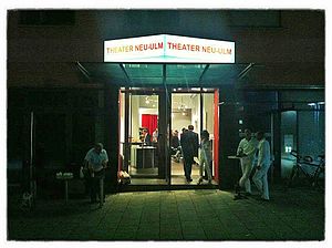
Theater Neu-Ulm
Distance: Approx. 581 meters
Latitude and longitude: 48.39388889,9.99555556
Theater Neu-Ulm is a theatre in Neu-Ulm, Bavaria, Germany.

Theater Ulm
Theatre in Ulm, Germany
Distance: Approx. 494 meters
Latitude and longitude: 48.40138889,9.98666667
Theater Ulm is the municipal theater in the Baden-Württemberg city of Ulm in Germany. Founded in 1641, it is the oldest municipal theater in Germany. Today, it operates distinct ensembles for opera/operetta, acting, and ballet.

Museum Ulm
Museum in Ulm, Germany
Distance: Approx. 282 meters
Latitude and longitude: 48.39694444,9.99472222
The Museum Ulm (Museum der Stadt Ulm), founded in 1924, is a museum for art, archeology, urban and cultural history in Ulm, Germany. Exhibits range from prehistoric and early archaeological finds of the Ulm region (including the lion-man statuette) to Late (International) Gothic and Renaissance paintings and sculptures made in Ulm and Upper Swabia. Collections of 16th- to 19th-century artisan works by Ulm's handicraft guilds are also presented.
Kepler-Gymnasium Ulm
School
Distance: Approx. 510 meters
Latitude and longitude: 48.4029,9.9929
The Kepler-Gymnasium is one of seven gymnasiums in Ulm. A special feature of the Kepler-Gymnasium is its art program, which can be attended from the 5th grade.
Weather in this IP's area
scattered clouds
-3 Celsius
-6 Celsius
-4 Celsius
-1 Celsius
1038 hPa
97 %
1038 hPa
977 hPa
10000 meters
2.51 m/s
6.19 m/s
52 degree
28 %


