46.182.137.67 - IP Lookup: Free IP Address Lookup, Postal Code Lookup, IP Location Lookup, IP ASN, Public IP
Country:
Region:
City:
Location:
Time Zone:
Postal Code:
IP information under different IP Channel
ip-api
Country
Region
City
ASN
Time Zone
ISP
Blacklist
Proxy
Latitude
Longitude
Postal
Route
Luminati
Country
Region
bw
City
nattheim
ASN
Time Zone
Europe/Berlin
ISP
NetCom BW GmbH
Latitude
Longitude
Postal
IPinfo
Country
Region
City
ASN
Time Zone
ISP
Blacklist
Proxy
Latitude
Longitude
Postal
Route
IP2Location
46.182.137.67Country
Region
baden-wurttemberg
City
vellberg
Time Zone
Europe/Berlin
ISP
Language
User-Agent
Latitude
Longitude
Postal
db-ip
Country
Region
City
ASN
Time Zone
ISP
Blacklist
Proxy
Latitude
Longitude
Postal
Route
ipdata
Country
Region
City
ASN
Time Zone
ISP
Blacklist
Proxy
Latitude
Longitude
Postal
Route
Popular places and events near this IP address

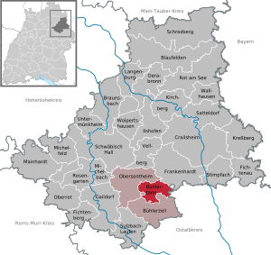
Vellberg
Town in Baden-Württemberg, Germany
Distance: Approx. 430 meters
Latitude and longitude: 49.08777778,9.88166667
Vellberg is a town in the district of Schwäbisch Hall, in Baden-Württemberg, Germany. It is located 10 km east of Schwäbisch Hall, and 15 km southwest of Crailsheim.

Bühlertann
Municipality in Baden-Württemberg, Germany
Distance: Approx. 5268 meters
Latitude and longitude: 49.04111111,9.90861111
Bühlertann is a municipality in the district of Schwäbisch Hall in Baden-Württemberg in Germany.

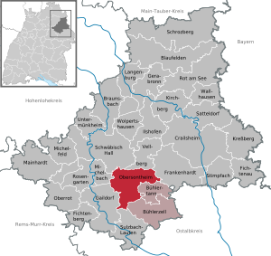
Obersontheim
Municipality in Baden-Württemberg, Germany
Distance: Approx. 3218 meters
Latitude and longitude: 49.05777778,9.89666667
Obersontheim is a municipality in the district of Schwäbisch Hall in Baden-Württemberg in Germany. Today the town includes a number of villages, including Untersontheim, Ummenhofen and Hausen.

Aalenbach
River in Germany
Distance: Approx. 729 meters
Latitude and longitude: 49.09083333,9.87833333
The Aalenbach is a river located in Baden-Württemberg, Germany. It is a tributary of the Bühler and flows into it near Vellberg.

Hirtenbach (Bühler)
River in Germany
Distance: Approx. 2144 meters
Latitude and longitude: 49.102,9.8675
The Hirtenbach is a small river of Baden-Württemberg, Germany. It flows into the Bühler near Vellberg.

Lanzenbach (Bühler)
River in Germany
Distance: Approx. 1252 meters
Latitude and longitude: 49.0776,9.8929
The Lanzenbach is a small river of Baden-Württemberg, Germany. It is a right tributary of the Bühler at Eschenau, a district of Vellberg.

Nesselbach (Bühler)
River in Germany
Distance: Approx. 4237 meters
Latitude and longitude: 49.0503,9.9052
The Nesselbach is a river of Baden-Württemberg, Germany. It is a right tributary of the Bühler, joining it near Obersontheim.
Otterbach (Bühler)
River in Baden-Württemberg, Germany
Distance: Approx. 4590 meters
Latitude and longitude: 49.1231,9.8578
The Otterbach is a river of Baden-Württemberg, Germany. It is a tributary of the Bühler near Vellberg.

Schmerach
River in Germany
Distance: Approx. 5220 meters
Latitude and longitude: 49.1297,9.8612
The Schmerach is a river of Baden-Württemberg, Germany. It flows into the Bühler in Oberscheffach.

Schwarzenlachenbach
River in Germany
Distance: Approx. 2385 meters
Latitude and longitude: 49.1039,9.8659
Schwarzenlachenbach is a small river of Baden-Württemberg, Germany. A tributary of the Bühler, the Schwarzenlachenbach joins it near Vellberg.

Steinbach (Bühler, Vellberg)
River in Baden-Württemberg, Germany
Distance: Approx. 914 meters
Latitude and longitude: 49.0788,9.8884
The Steinbach is a river of Baden-Württemberg, Germany. It is a left tributary of the Bühler near Vellberg.

Riedbach (Bühler)
River in Germany
Distance: Approx. 2355 meters
Latitude and longitude: 49.0652,9.893
Riedbach is a small river of Baden-Württemberg, Germany. It is a left tributary of the Bühler, joining it near Obersontheim.
Weather in this IP's area
few clouds
-2 Celsius
-6 Celsius
-3 Celsius
-2 Celsius
1038 hPa
93 %
1038 hPa
983 hPa
10000 meters
2.57 m/s
90 degree
12 %