46.182.136.60 - IP Lookup: Free IP Address Lookup, Postal Code Lookup, IP Location Lookup, IP ASN, Public IP
Country:
Region:
City:
Location:
Time Zone:
Postal Code:
IP information under different IP Channel
ip-api
Country
Region
City
ASN
Time Zone
ISP
Blacklist
Proxy
Latitude
Longitude
Postal
Route
Luminati
Country
Region
bw
City
nattheim
ASN
Time Zone
Europe/Berlin
ISP
NetCom BW GmbH
Latitude
Longitude
Postal
IPinfo
Country
Region
City
ASN
Time Zone
ISP
Blacklist
Proxy
Latitude
Longitude
Postal
Route
IP2Location
46.182.136.60Country
Region
bayern
City
lauingen
Time Zone
Europe/Berlin
ISP
Language
User-Agent
Latitude
Longitude
Postal
db-ip
Country
Region
City
ASN
Time Zone
ISP
Blacklist
Proxy
Latitude
Longitude
Postal
Route
ipdata
Country
Region
City
ASN
Time Zone
ISP
Blacklist
Proxy
Latitude
Longitude
Postal
Route
Popular places and events near this IP address
Dillingen (district)
District in Bavaria, Germany
Distance: Approx. 1461 meters
Latitude and longitude: 48.58,10.42
Dillingen is a Landkreis (district) in Swabia, Bavaria, Germany. It is bounded by (from the north and clockwise) the districts of Donau-Ries, Augsburg and Günzburg, and by the state of Baden-Württemberg (district of Heidenheim).
Dillingen an der Donau
Town in Bavaria, Germany
Distance: Approx. 2932 meters
Latitude and longitude: 48.56666667,10.46666667
Dillingen or Dillingen an der Donau (Dillingen at the Danube) is a town in Swabia, Bavaria, Germany. It is the administrative center of the district of Dillingen. Besides the town of Dillingen proper, the municipality encompasses the villages of Donaualtheim, Fristingen, Hausen, Kicklingen, Schretzheim and Steinheim.

Gundelfingen an der Donau
Town in Bavaria, Germany
Distance: Approx. 4856 meters
Latitude and longitude: 48.55,10.36666667
Gundelfingen an der Donau (Swabian: Gundelfinga) is a town in the Bavarian district Dillingen in Swabia. Gundelfingen is located at the river Danube (Donau), between Stuttgart, Munich and Augsburg (latitude 48° 33" 15' and longitude: 10° 22" 9'). It has some 8,000 inhabitants and still resembles the town of the Middle Ages.

Brenz (river)
River in Germany
Distance: Approx. 933 meters
Latitude and longitude: 48.56055556,10.42027778
The Brenz (German pronunciation: [bʁɛnt͡s] ) is a river in Baden-Württemberg and Bavaria, Germany. It is a left tributary of the Danube. Its source is at a spring in the town of Königsbronn and it flows for 52 kilometers before meeting the Danube at Lauingen, a few kilometers west of Dillingen.
Echenbrunn Abbey
Monastery in Bavaria, Germany
Distance: Approx. 2957 meters
Latitude and longitude: 48.559167,10.388889
Echenbrunn Abbey (German: Kloster Echenbrunn) was a Benedictine monastery located at Echenbrunn, now part of Gundelfingen an der Donau in Bavaria, Germany. Dedicated to Saints Peter and Paul, the monastery was founded in 1122 by Gumbert von Flochberg, a local noble. It was dissolved in 1556 by order of Otto Henry, Elector Palatine.

Lauingen
Town in Bavaria, Germany
Distance: Approx. 488 meters
Latitude and longitude: 48.56666667,10.43333333
Lauingen (Swabian: Lauinga) is a town in the district of Dillingen in Bavaria, Germany. It is located on the left bank of the Danube, 5 km west of Dillingen, and 37 km northeast of Ulm. In June 1800, the armies of the French First Republic, under command of Jean Victor Moreau, fought Habsburg regulars and Württemberg contingents, under the general command of Pál Kray.
Haunsheim
Municipality in Bavaria, Germany
Distance: Approx. 5710 meters
Latitude and longitude: 48.6,10.36666667
Haunsheim is a municipality in the district of Dillingen in Bavaria in Germany. The town is a member of the municipal association Gundelfingen an der Donau.

Wittislingen
Municipality in Bavaria, Germany
Distance: Approx. 5503 meters
Latitude and longitude: 48.61666667,10.41666667
Wittislingen is a municipality in the district of Dillingen in Bavaria in Germany.

Gundremmingen Nuclear Power Plant
Nuclear power plant in Germany
Distance: Approx. 6172 meters
Latitude and longitude: 48.51472222,10.40222222
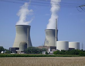
The Gundremmingen Nuclear Power Plant was a nuclear power station in Germany. It was located in Gundremmingen, district of Günzburg, Bavaria. It was operated by Kernkraftwerk Gundremmingen GmbH, a joint operation of RWE Power AG (75%) and PreussenElektra (25%).

University of Dillingen
Distance: Approx. 4892 meters
Latitude and longitude: 48.57762778,10.4916
The University of Dillingen, at Dillingen an der Donau in southern Germany, existed from 1551 to 1803. It was located in Swabia, then a district of Bavaria.
Lauingen Energy Park
Photovoltaic power station in Germany
Distance: Approx. 3430 meters
Latitude and longitude: 48.53694444,10.42416667
The Lauingen Energy Park is a 25.7–megawatt (MW) photovoltaic power station, located in Bavarian Swabia, Germany. It covers an area of 63 hectares (155.7 acres) and was commissioned in June 2010. The project was built in three phases: The 10.0 MW Helmeringen 1 (already commissioned in 2009) The 9.4 MW Helmeringen 2 The 6.3 MW Helmeringen 3 (built and commissioned in 2010) The largest solar power station in Swabia was built by the German company Gehrlicher Solar and features the following key figures: 288,132 thin-film modules using cadmium telluride photovoltaics (CdTe PV) manufactured by U.S. company First Solar 17,952 conventional solar panels based using crystalline silicon photovoltaics manufactured by Chinese company Yingli 18 SMA solar inverters 3 Siemens central inverters a total of 664 km solar cable trays a projected generation of almost 27 million kilowatt-hours (kWh) an avoided 14,353 tons of CO2 per year powers about 7,500 average households with clean energy, where average means a three-person household with an annual electricity consumption of 3,500 kWh.

Basilica of Sts. Peter and Paul, Dillingen
Church in Bavaria, Germany
Distance: Approx. 5076 meters
Latitude and longitude: 48.5781,10.494
The Basilica of Sts. Peter and Paul (German: Basilika SS. Peter und Paul ) also called Dillingen Basilica is a Catholic church located in Dillingen, Germany, which serves as basilica and co-cathedral of the diocese of Augsburg. The three-nave church was built in the years 1619-1628 by court architect Hans Alberthal on the foundations of the earlier churches dating from the thirteenth and fifteenth centuries.
Weather in this IP's area
scattered clouds
-2 Celsius
-6 Celsius
-4 Celsius
0 Celsius
1038 hPa
96 %
1038 hPa
983 hPa
10000 meters
2.17 m/s
4.18 m/s
74 degree
35 %


