46.18.150.90 - IP Lookup: Free IP Address Lookup, Postal Code Lookup, IP Location Lookup, IP ASN, Public IP
Country:
Region:
City:
Location:
Time Zone:
Postal Code:
IP information under different IP Channel
ip-api
Country
Region
City
ASN
Time Zone
ISP
Blacklist
Proxy
Latitude
Longitude
Postal
Route
Luminati
Country
Region
pv
City
staralubovna
ASN
Time Zone
Europe/Bratislava
ISP
DSI DATA, a. s.
Latitude
Longitude
Postal
IPinfo
Country
Region
City
ASN
Time Zone
ISP
Blacklist
Proxy
Latitude
Longitude
Postal
Route
IP2Location
46.18.150.90Country
Region
presovsky kraj
City
podolinec
Time Zone
Europe/Bratislava
ISP
Language
User-Agent
Latitude
Longitude
Postal
db-ip
Country
Region
City
ASN
Time Zone
ISP
Blacklist
Proxy
Latitude
Longitude
Postal
Route
ipdata
Country
Region
City
ASN
Time Zone
ISP
Blacklist
Proxy
Latitude
Longitude
Postal
Route
Popular places and events near this IP address
Bušovce
Municipality in Slovakia
Distance: Approx. 6045 meters
Latitude and longitude: 49.21666667,20.48333333
Bušovce (German: Bauschendorf, Hungarian: Busóc, Rusyn: Бушовце) is a village and municipality in Kežmarok District in the Prešov Region of northern central Slovakia.
Ľubica
Municipality in Slovakia
Distance: Approx. 6804 meters
Latitude and longitude: 49.23722222,20.44833333
Ľubica (Hungarian: Leibic, German: Leibitz, Rusyn: Любіца) is a large village and municipality in Kežmarok District in the Prešov Region of north Slovakia. It is now a mostly housing development district with many panel block houses.
Vojňany
Municipality in Slovakia
Distance: Approx. 6922 meters
Latitude and longitude: 49.25,20.44166667
Vojňany (Hungarian: Krig, German: Kreig, Rusyn: Войняні) is a village and municipality in the Kežmarok District, Prešov Region of north Slovakia.

Toporec
Distance: Approx. 2762 meters
Latitude and longitude: 49.26666667,20.5
Toporec (Hungarian: Toporc, German: Topporz, Rusyn: Топорец) is a village and municipality in Kežmarok District in the Prešov Region of north Slovakia.

Podolínec
Town in Slovakia
Distance: Approx. 410 meters
Latitude and longitude: 49.25722222,20.53083333
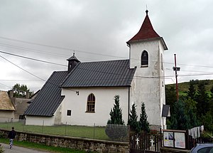
Podolínec (Polish: Podoliniec, Rusyn: Подолинець, German: Pudlein, Hungarian: Podolin) is a town in the Stará Ľubovňa District of the Prešov Region in northern Slovakia, in the historic region of Spiš.

Forbasy
Village and municipality in Slovakia
Distance: Approx. 7447 meters
Latitude and longitude: 49.3,20.61666667
Forbasy (Hungarian: Poprádfalu, Rusyn: Форбасы) is a village and municipality in Stará Ľubovňa District in the Prešov Region of northern Slovakia.

Kolačkov
Municipality of Slovakia
Distance: Approx. 7126 meters
Latitude and longitude: 49.26666667,20.63333333
Kolačkov (Hungarian: Kalács, Rusyn: Колачков) is a village and municipality in Stará Ľubovňa District in the Prešov Region of northern Slovakia.

Nižné Ružbachy
Village
Distance: Approx. 4398 meters
Latitude and longitude: 49.28333333,20.58333333
Nižné Ružbachy (Hungarian: Alsózúgó, German: Unterrauschenbach, Polish: Drużbaki Niżne, Rusyn: Нижнї Ружбахы) is a village and municipality in Stará Ľubovňa District in the Prešov Region of northern Slovakia.

Lacková
Distance: Approx. 6967 meters
Latitude and longitude: 49.30833333,20.59444444
Lacková (Hungarian: Lackvágása, Rusyn: Лацкова) is a village and municipality in Stará Ľubovňa District in the Prešov Region of northern Slovakia.

Lomnička (Stará Ľubovňa District)
Distance: Approx. 2430 meters
Latitude and longitude: 49.25,20.56666667
Lomnička (German: Kleinlomnitz; Hungarian: Kislomnic; Rusyn: Ломнічка) is a village and municipality in Stará Ľubovňa District in the Prešov Region of northern Slovakia. Till 1945 the name was KleinLomnitz for 'Small'Lomnitz.

Vyšné Ružbachy
Village in Slovakia
Distance: Approx. 5109 meters
Latitude and longitude: 49.3,20.56666667
Vyšné Ružbachy (German: Oberrauschenbach; Hungarian: Felsőzúgó, Rusyn: Вышнї Ружбахы) is a spa village and municipality in Stará Ľubovňa District in the Prešov Region of northern Slovakia.
Podhorany, Kežmarok District
Municipality in Slovakia
Distance: Approx. 4603 meters
Latitude and longitude: 49.23972222,20.47972222
Podhorany [pɔdɦɔrani] (German: Maltern, Hungarian: Maldur, Rusyn: Подгорані) (German pronunciation: [maltɛʁn] Hungarian pronunciation: [mɒldur]) is a village and municipality in KežmarokDistrict in the Prešov Region of north Slovakia.
Weather in this IP's area
overcast clouds
-2 Celsius
-6 Celsius
-2 Celsius
-2 Celsius
1040 hPa
89 %
1040 hPa
944 hPa
5311 meters
3.11 m/s
5.17 m/s
351 degree
100 %


