Country:
 Slovakia
Region:
City:
Latitude and Longitude:
Time Zone:
Postal Code:
IP information under different IP Channel
ip-api
Country
Region
City
ASN
Time Zone
ISP
Blacklist
Proxy
Latitude
Longitude
Postal
Route
IPinfo
Country
Region
City
ASN
Time Zone
ISP
Blacklist
Proxy
Latitude
Longitude
Postal
Route
MaxMind
Country
Region
City
ASN
Time Zone
ISP
Blacklist
Proxy
Latitude
Longitude
Postal
Route
Luminati
Country
SKRegion
pv
City
staralubovna
ASN
Time Zone
Europe/Bratislava
ISP
DSI DATA, a. s.
Latitude
Longitude
Postal
db-ip
Country
Region
City
ASN
Time Zone
ISP
Blacklist
Proxy
Latitude
Longitude
Postal
Route
ipdata
Country
Region
City
ASN
Time Zone
ISP
Blacklist
Proxy
Latitude
Longitude
Postal
Route
Popular places and events near this IP address

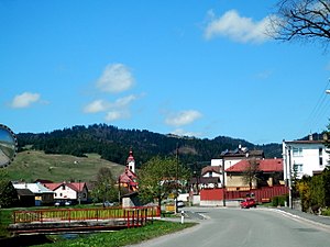
Stará Ľubovňa
City in Slovakia
Distance: Approx. 1427 meters
Latitude and longitude: 49.30944444,20.67888889
Stará Ľubovňa (German: Altlublau, Hungarian: Ólubló, Rusyn: Стара Любовня, Latin: Lublovia, Polish: Lubowla, Ukrainian: Стара Любовня) is a town with approximately 16,000 inhabitants in northeastern Slovakia. The town consists of the districts Podsadek and Stará Ľubovňa.
Stará Ľubovňa District
District in Prešov Region, Slovakia
Distance: Approx. 308 meters
Latitude and longitude: 49.30222222,20.69055556
Stará Ľubovňa District (okres Stará Ľubovňa) is a district in the Prešov Region of eastern Slovakia. Until 1918, the district was almost entirely part of the county of Kingdom of Hungary of Spiš, apart from a small area in the east which formed part of the county of Šariš.

Forbasy
Village and municipality in Slovakia
Distance: Approx. 5418 meters
Latitude and longitude: 49.3,20.61666667
Forbasy (Hungarian: Poprádfalu, Rusyn: Форбасы) is a village and municipality in Stará Ľubovňa District in the Prešov Region of northern Slovakia.
Hniezdne
Distance: Approx. 4208 meters
Latitude and longitude: 49.3,20.63333333
Hniezdne (German: Kniesen; Hungarian: Gnézda, Rusyn: Гнїздне) is a village and municipality in Stará Ľubovňa District in the Prešov Region of northern Slovakia.

Chmeľnica
Village in Slovakia
Distance: Approx. 3052 meters
Latitude and longitude: 49.3,20.73333333
Chmeľnica (German: Hopgarten; Hungarian: Komlóskert; Rusyn: Хмельніця; Polish: Chmielnica) is a village and municipality in Stará Ľubovňa District in the Prešov Region of northern Slovakia. The village is traditionally inhabited by Carpathian Germans.
Jakubany
Village and municipality in Slovakia
Distance: Approx. 5546 meters
Latitude and longitude: 49.25,20.7
Jakubany (Rusyn: Якубяны, romanized: Jakubjanŷ, Ukrainian: Якуб'яни, romanized: Yakubyany; Hungarian: Szepesjakabfalva) is a village and municipality in Stará Ľubovňa District in the Prešov Region of northern Slovakia.

Jarabina
Village and municipality in Slovakia
Distance: Approx. 4169 meters
Latitude and longitude: 49.33333333,20.66666667
Jarabina, also known as Orjabyna (Rusyn: Орябина; Hungarian: Berkenyéd; German: Girm; Polish: Jarzębina) is a village and municipality in Stará Ľubovňa District in the Prešov Region of northern Slovakia. U.S. Marine Michael Strank, Flag Raiser at Iwo Jima, was born here.
Kamienka, Stará Ľubovňa District
Municipality in Slovakia
Distance: Approx. 6662 meters
Latitude and longitude: 49.33166667,20.61388889
Kamienka (Rusyn: Камюнка, romanized: Kamiunka; Ukrainian: Камйонка, romanized: Kamionka; Hungarian: Kövesfalva, German: Stein) is a village and municipality in Stará Ľubovňa District in the Prešov Region of northern Slovakia. The village is traditionally inhabited by Rusyns, as one of their westernmost settlements.
Kolačkov
Municipality of Slovakia
Distance: Approx. 5575 meters
Latitude and longitude: 49.26666667,20.63333333
Kolačkov (Hungarian: Kalács, Rusyn: Колачков) is a village and municipality in Stará Ľubovňa District in the Prešov Region of northern Slovakia.
Kremná
Village and municipality in Slovakia
Distance: Approx. 5657 meters
Latitude and longitude: 49.35,20.7
Kremná (Hungarian: Lublókorompa, Rusyn: Кремна) is a village and municipality in Stará Ľubovňa District in the Prešov Region of northern Slovakia.

Nová Ľubovňa
Municipality in Slovakia
Distance: Approx. 3241 meters
Latitude and longitude: 49.27111111,20.68138889
Nová Ľubovňa (Hungarian: Újlubló, German: Neulublau, Rusyn: Нова Любовня) is a village and municipality in Stará Ľubovňa District in the Prešov Region of northern Slovakia.
Matysová
Distance: Approx. 5794 meters
Latitude and longitude: 49.31666667,20.76666667
Matysová (Rusyn: Матисова, romanized: Matysova; Hungarian: Máté) is a village and municipality in Stará Ľubovňa District in the Prešov Region of northern Slovakia.
Weather in this IP's area
clear sky
10 Celsius
9 Celsius
8 Celsius
11 Celsius
1025 hPa
43 %
1025 hPa
961 hPa
10000 meters
2.45 m/s
3.69 m/s
178 degree
07:04:34
17:39:24