46.18.147.92 - IP Lookup: Free IP Address Lookup, Postal Code Lookup, IP Location Lookup, IP ASN, Public IP
Country:
Region:
City:
Location:
Time Zone:
Postal Code:
IP information under different IP Channel
ip-api
Country
Region
City
ASN
Time Zone
ISP
Blacklist
Proxy
Latitude
Longitude
Postal
Route
Luminati
Country
Region
pv
City
staralubovna
ASN
Time Zone
Europe/Bratislava
ISP
DSI DATA, a. s.
Latitude
Longitude
Postal
IPinfo
Country
Region
City
ASN
Time Zone
ISP
Blacklist
Proxy
Latitude
Longitude
Postal
Route
IP2Location
46.18.147.92Country
Region
zilinsky kraj
City
tvrdosin
Time Zone
Europe/Bratislava
ISP
Language
User-Agent
Latitude
Longitude
Postal
db-ip
Country
Region
City
ASN
Time Zone
ISP
Blacklist
Proxy
Latitude
Longitude
Postal
Route
ipdata
Country
Region
City
ASN
Time Zone
ISP
Blacklist
Proxy
Latitude
Longitude
Postal
Route
Popular places and events near this IP address

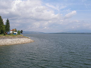
Orava (reservoir)
Reservoir in Slovakia, Poland
Distance: Approx. 7023 meters
Latitude and longitude: 49.39972222,19.54555556
Orava (Slovak: Oravská priehrada) is a reservoir in northernmost Slovakia, forming the largest lake in Slovakia (35.2 km2).

Tvrdošín
Town in Slovakia
Distance: Approx. 315 meters
Latitude and longitude: 49.33427778,19.55480556
Tvrdošín (German: Turdoschin or Thurdossin; Hungarian: Turdossin; Polish: Twardoszyn) is a town in central Slovakia.
Tvrdošín District
District in Žilina Region, Slovakia
Distance: Approx. 384 meters
Latitude and longitude: 49.33361111,19.555
Tvrdošín District (okres Tvrdošín) is a district in the Žilina Region of central Slovakia. The district was first established in 1996; in 1923 it had been a part of Trstená District.

Trstená
Town in Slovakia
Distance: Approx. 4816 meters
Latitude and longitude: 49.36166667,19.61055556
Trstená (Hungarian: Trsztena or Árvanádasd; Polish: Trzciana; German: Bingenstadt) is a town in Tvrdošín District, Žilina Region, central Slovakia.

Brezovica, Tvrdošín District
Distance: Approx. 6969 meters
Latitude and longitude: 49.3408,19.6519
Brezovica (Polish: Brzozowica) is a village and municipality in Tvrdošín District in the Žilina Region of northern Slovakia.
Nižná, Tvrdošín District
Village in Slovakia
Distance: Approx. 3522 meters
Latitude and longitude: 49.31027778,19.53
Nižná (Hungarian: Nizsna) is a village and municipality in Tvrdošín District in the Žilina Region of northern Slovakia.

Oravský Biely Potok
Village and municipality in Slovakia
Distance: Approx. 5990 meters
Latitude and longitude: 49.28333333,19.55
Oravský Biely Potok (Hungarian: Árvafejérpatak) is a village and municipality in Tvrdošín District in the Žilina Region of northern Slovakia.

Štefanov nad Oravou
Distance: Approx. 3743 meters
Latitude and longitude: 49.36388889,19.525
Štefanov nad Oravou (Hungarian: Stepanó) is a village and municipality in Tvrdošín District in the Žilina Region of northern Slovakia.

Zábiedovo
Village and municipality in Slovakia
Distance: Approx. 4949 meters
Latitude and longitude: 49.31666667,19.61666667
Zábiedovo (Hungarian: Zábidó) is a village and municipality in Tvrdošín District in the Žilina Region of northern Slovakia.
Podbiel
Village in Slovakia
Distance: Approx. 5737 meters
Latitude and longitude: 49.31666667,19.48333333
Podbiel (Hungarian: Podbjel) is a village and municipality in Tvrdošín District in the Žilina Region of northern Slovakia. It contains a beautiful set of traditional wooden cottages, which have been declared a folk architecture preservation area.

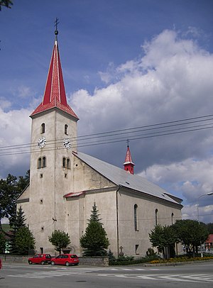
Most Holy Trinity Church, Tvrdošín
Distance: Approx. 434 meters
Latitude and longitude: 49.33317778,19.55480556
The Roman Catholic Church of the Most Holy Trinity in Tvrdošín, region Orava, Slovakia. Original wooden church was built in first half of 17th century. The church was burned down few times.

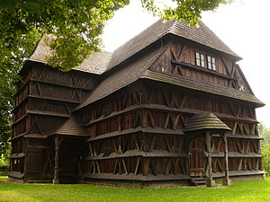
Wooden churches of the Slovak Carpathians
UNESCO World Heritage Site in Slovakia
Distance: Approx. 196 meters
Latitude and longitude: 49.33611111,19.55833333
Carpathian Wooden Churches is the name of a UNESCO World Heritage Site that consists of nine wooden religious buildings constructed between the 16th and 18th centuries in eight different locations in Slovakia. They include two Roman Catholic (Hervartov, Tvrdošín), three Protestant (so-called Articular churches in Hronsek, Leštiny, Kežmarok) and three Greek Catholic churches (Bodružal, Ruská Bystrá, Ladomirová) plus one belfry in Hronsek. In addition to these churches there are about 50 more wooden churches in the territory of present-day Slovakia mainly in the northern and eastern part of the Prešov Region (see e.g.
Weather in this IP's area
overcast clouds
-2 Celsius
-4 Celsius
-2 Celsius
1 Celsius
1040 hPa
59 %
1040 hPa
935 hPa
10000 meters
1.54 m/s
1.84 m/s
66 degree
99 %

