46.175.108.28 - IP Lookup: Free IP Address Lookup, Postal Code Lookup, IP Location Lookup, IP ASN, Public IP
Country:
Region:
City:
Location:
Time Zone:
Postal Code:
IP information under different IP Channel
ip-api
Country
Region
City
ASN
Time Zone
ISP
Blacklist
Proxy
Latitude
Longitude
Postal
Route
Luminati
Country
Region
24
City
wegierskagorka
ASN
Time Zone
Europe/Warsaw
ISP
ARKOM Mucharski Adam
Latitude
Longitude
Postal
IPinfo
Country
Region
City
ASN
Time Zone
ISP
Blacklist
Proxy
Latitude
Longitude
Postal
Route
IP2Location
46.175.108.28Country
Region
slaskie
City
milowka
Time Zone
Europe/Warsaw
ISP
Language
User-Agent
Latitude
Longitude
Postal
db-ip
Country
Region
City
ASN
Time Zone
ISP
Blacklist
Proxy
Latitude
Longitude
Postal
Route
ipdata
Country
Region
City
ASN
Time Zone
ISP
Blacklist
Proxy
Latitude
Longitude
Postal
Route
Popular places and events near this IP address

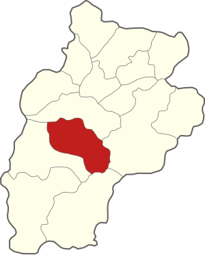
Gmina Milówka
Gmina in Silesian Voivodeship, Poland
Distance: Approx. 888 meters
Latitude and longitude: 49.56305556,19.08722222
Gmina Milówka is a rural gmina (administrative district) in Żywiec County, Silesian Voivodeship, in southern Poland. Its seat is the village of Milówka, which lies approximately 17 kilometres (11 mi) south-west of Żywiec and 77 km (48 mi) south of the regional capital Katowice. The gmina covers an area of 98.33 square kilometres (38.0 sq mi), and as of 2019 its total population is 10,052.

Gmina Rajcza
Gmina in Silesian Voivodeship, Poland
Distance: Approx. 5529 meters
Latitude and longitude: 49.50694444,19.1075
Gmina Rajcza is a rural gmina (administrative district) in Żywiec County, Silesian Voivodeship, in southern Poland, on the Slovak border. Its seat is the village of Rajcza, which lies approximately 22 kilometres (14 mi) south of Żywiec and 83 km (52 mi) south of the regional capital Katowice. The gmina covers an area of 131.17 square kilometres (50.6 sq mi), and as of 2019 its total population is 8,835.

Gmina Węgierska Górka
Gmina in Silesian Voivodeship, Poland
Distance: Approx. 5841 meters
Latitude and longitude: 49.6,19.13333333
Gmina Węgierska Górka is a rural gmina (administrative district) in Żywiec County, Silesian Voivodeship, in southern Poland. Its seat is the village of Węgierska Górka, which lies approximately 12 kilometres (7 mi) south-west of Żywiec and 73 km (45 mi) south of the regional capital Katowice. The gmina covers an area of 77.06 square kilometres (29.8 sq mi), and as of 2019 its total population is 15,073.

Milówka, Silesian Voivodeship
Village in Silesian Voivodeship, Poland
Distance: Approx. 883 meters
Latitude and longitude: 49.56305556,19.0875
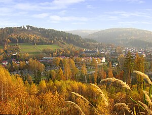
Milówka [miˈlufka] is a village in Żywiec County, Silesian Voivodeship, in southern Poland (historic and geografical province of Lesser Poland). It is the seat of the gmina (administrative district) called Gmina Milówka. It lies It is situated in the Żywiec Beskids mountain range, approximately 18 kilometres (11 mi) south-west of Żywiec and 78 km (48 mi) south of the regional capital Katowice.

Kamesznica
Village in Silesian Voivodeship, Poland
Distance: Approx. 5170 meters
Latitude and longitude: 49.56472222,19.02055556
Kamesznica [kamɛʂˈnit͡sa] is a village in the administrative district of Gmina Milówka, within Żywiec County, Silesian Voivodeship, in southern Poland. It lies approximately 5 kilometres (3 mi) west of Milówka, 20 km (12 mi) south-west of Żywiec, and 77 km (48 mi) south of the regional capital Katowice.
Nieledwia
Village in Silesian Voivodeship, Poland
Distance: Approx. 1929 meters
Latitude and longitude: 49.54444444,19.07
Nieledwia [ɲɛˈlɛdvja] is a village in the administrative district of Gmina Milówka, within Żywiec County, Silesian Voivodeship, in southern Poland. It lies approximately 3 kilometres (2 mi) south-west of Milówka, 19 km (12 mi) south-west of Żywiec, and 79 km (49 mi) south of the regional capital Katowice.

Szare
Village in Silesian Voivodeship, Poland
Distance: Approx. 4186 meters
Latitude and longitude: 49.55,19.03333333
Szare [ˈʂarɛ] is a village in the administrative district of Gmina Milówka, within Żywiec County, Silesian Voivodeship, in southern Poland. It lies approximately 5 kilometres (3 mi) west of Milówka, 20 km (12 mi) south-west of Żywiec, and 78 km (48 mi) south of the regional capital Katowice. Until 1948 Laliki (then known as Szare Gronie) was part of the village.

Sól-Kiczora
Village in Silesian Voivodeship, Poland
Distance: Approx. 5729 meters
Latitude and longitude: 49.52083333,19.03194444
Sól-Kiczora [kiˈt͡ʂɔra] (previously Kiczora) is a village in the administrative district of Gmina Rajcza, within Żywiec County, Silesian Voivodeship, in southern Poland, close to the border with Slovakia. It lies approximately 6 kilometres (4 mi) west of Rajcza, 23 km (14 mi) south-west of Żywiec, and 81 km (50 mi) south of the regional capital Katowice. Until 1 January 2014 Sól-Kiczora constituted integral part of the village Sól.

Rajcza
Village in Silesian Voivodeship, Poland
Distance: Approx. 5529 meters
Latitude and longitude: 49.50694444,19.1075
Rajcza [ˈrai̯t͡ʂa] is a village in Żywiec County, Silesian Voivodeship, in the historic province of Lesser Poland, close to the border with Slovakia. It is the seat of the gmina (administrative district) called Gmina Rajcza. It lies approximately 22 kilometres (14 mi) south of Żywiec and 83 km (52 mi) south of the regional capital Katowice.

Cisiec
Village in Silesian Voivodeship, Poland
Distance: Approx. 3181 meters
Latitude and longitude: 49.58333333,19.1
Cisiec [ˈt͡ɕiɕɛt͡s] is a village in the administrative district of Gmina Węgierska Górka, within Żywiec County, Silesian Voivodeship, in southern Poland. It lies approximately 4 kilometres (2 mi) south-west of Węgierska Górka, 15 km (9 mi) south-west of Żywiec, and 75 km (47 mi) south of the regional capital Katowice.

Żabnica, Silesian Voivodeship
Village in Silesian Voivodeship, Poland
Distance: Approx. 5508 meters
Latitude and longitude: 49.58055556,19.15638889
Żabnica [ʐabˈnit͡sa] is a village in the administrative district of Gmina Węgierska Górka, within Żywiec County, Silesian Voivodeship, in southern Poland. It lies approximately 3 kilometres (2 mi) south-east of Węgierska Górka, 13 km (8 mi) south of Żywiec, and 76 km (47 mi) south of the regional capital Katowice.

National road 69 (Poland)
Former national road in Poland connecting Bielsko-Biała to Poland–Slovakia border in Zwardoń
Distance: Approx. 5348 meters
Latitude and longitude: 49.5429,19.0192
National road 69 (Polish: Droga krajowa nr 69, abbreviated as DK69) was a route belonging to the Polish national road network. The highway connected Bielsko-Biała with Poland–Slovakia border in Zwardoń. From 1986 to 2000 the route was signed as: national road 94 from Bielsko-Biała to Żywiec national road 944 from Żywiec via Milówka and Zwardoń to country border.
Weather in this IP's area
overcast clouds
6 Celsius
5 Celsius
5 Celsius
7 Celsius
1002 hPa
97 %
1002 hPa
949 hPa
5719 meters
2.35 m/s
4.74 m/s
151 degree
92 %